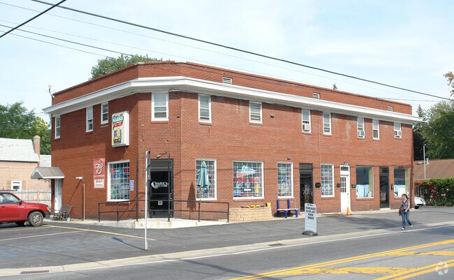
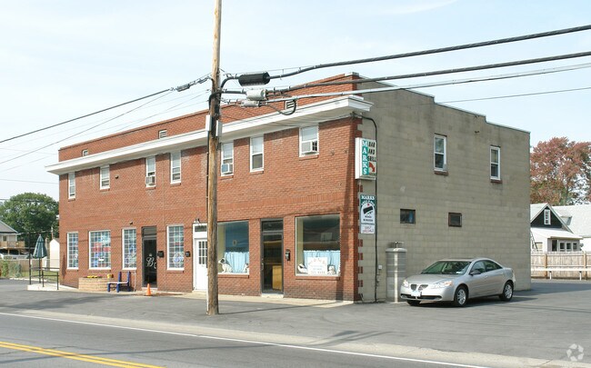
Property Record
1053 Curry Rd, Schenectady, NY 12306
NEARBY LISTINGS FOR SALE OR LEASE
Property Detail
1053 Curry Rd
058-008-0001-016-000-0000
APTS,BAR,RENTAL FAGAN #10-73 3.-274-24
Bartavern
Schenectady
X
New York
36093C0161D
16.000
2025
0.16 AC
2024
Greater Schenectady
032700
Albany/Schenectady/Troy
4,896 SF
Albany-Schenectady-Troy, NY
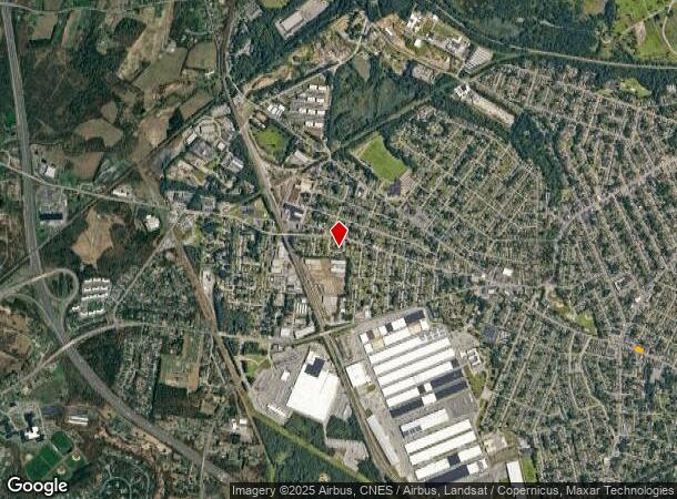
DEMOGRAPHICS near 1053 Curry Rd
1 Mile
3 Mile
5 Mile
2024 Total Population
15,469
79,899
139,638
2029 Population
16,304
83,847
146,174
Pop Growth 2024-2029
+ 5.40%
+ 4.94%
+ 4.68%
Average Age
40
39
40
2024 Total Households
6,605
33,246
57,911
HH Growth 2024-2029
+ 5.75%
+ 5.20%
+ 4.97%
Median Household Inc
$70,373
$59,456
$71,132
Avg Household Size
2.30
2.30
2.30
2024 Avg HH Vehicles
2.00
1.00
2.00
Median Home Value
$159,470
$163,208
$183,202
Median Year Built
1948
1949
1954
Nearby Places
Map Layers
Map Styles
 Street
 Aerial
- Restaurants
- Banks
- Shops
- Fitness
- Groceries
PUBLIC TRANSPORTATION
COMMUTER RAIL
Schenectady (Adirondack - VIA Rail, Empire Service - VIA Rail, Ethan Allen Express - VIA Rail, Lake Shore Limited - VIA Rail, Maple Leaf - VIA Rail, Toronto - New York - VIA Rail)
DRIVE
WALK
Distance
Schenectady (Adirondack - VIA Rail, Empire Service - VIA Rail, Ethan Allen Express - VIA Rail, Lake Shore Limited - VIA Rail, Maple Leaf - VIA Rail, Toronto - New York - VIA Rail)
8 min
4.1 mi
AIRPORT
Albany International
DRIVE
WALK
Distance
Albany International
25 min
12.8 mi
Freight Ports
Albany, NY Port
DRIVE
WALK
Distance
Albany, NY Port
31 min
19.2 mi
Nearby Properties
Address
Land Use
TOTAL SIZE
Lot Size
Zoning
Address
Land Use
TOTAL SIZE
Lot Size
Zoning
2,068,862 SF
204.52 AC
I-2
Address
Land Use
TOTAL SIZE
Lot Size
Zoning
0.01 AC
06 - INDUS
Address
Land Use
TOTAL SIZE
Lot Size
Zoning
1,003,413 SF
177.60 AC
B-1, I-1
Address
Land Use
TOTAL SIZE
Lot Size
Zoning
382,858 SF
70.33 AC
R-1
Address
Land Use
TOTAL SIZE
Lot Size
Zoning
59,240 SF
0.72 AC
05 - COMME
Address
Land Use
TOTAL SIZE
Lot Size
Zoning
284,171 SF
16.40 AC
03 - MULTI
Address
Land Use
TOTAL SIZE
Lot Size
Zoning
183,759 SF
1.40 AC
05 - COMME
Address
Land Use
TOTAL SIZE
Lot Size
Zoning
4,896 SF
12.80 AC
A-1
Address
Land Use
TOTAL SIZE
Lot Size
Zoning
128,744 SF
119 AC
A-1
Address
Land Use
TOTAL SIZE
Lot Size
Zoning
9.38 AC
I-2
Address
Land Use
TOTAL SIZE
Lot Size
Zoning
152,503 SF
8.21 AC
I-1
Address
Land Use
TOTAL SIZE
Lot Size
Zoning
136,722 SF
2.01 AC
05 - COMME
Address
Land Use
TOTAL SIZE
Lot Size
Zoning
21,791 SF
4.93 AC
B-1, B-2
Address
Land Use
TOTAL SIZE
Lot Size
Zoning
141,145 SF
1.11 AC
05 - COMME
Address
Land Use
TOTAL SIZE
Lot Size
Zoning
21,791 SF
4.86 AC
B-1, B-2
Address
Land Use
TOTAL SIZE
Lot Size
Zoning
12,289 SF
17.08 AC
R-3
Address
Land Use
TOTAL SIZE
Lot Size
Zoning
113,670 SF
1.35 AC
05 - COMME
Address
Land Use
TOTAL SIZE
Lot Size
Zoning
202,050 SF
20.75 AC
B-2
Address
Land Use
TOTAL SIZE
Lot Size
Zoning
116,392 SF
1.84 AC
05 - COMME
Address
Land Use
TOTAL SIZE
Lot Size
Zoning
99.20 AC
Address
Land Use
TOTAL SIZE
Lot Size
Zoning
229,890 SF
85.08 AC
I-1
Address
Land Use
TOTAL SIZE
Lot Size
Zoning
127,632 SF
3.50 AC
B-1
Address
Land Use
TOTAL SIZE
Lot Size
Zoning
161,606 SF
1.14 AC
05 - COMME
Address
Land Use
TOTAL SIZE
Lot Size
Zoning
59,030 SF
1.27 AC
05 - COMME
Address
Land Use
TOTAL SIZE
Lot Size
Zoning
115,660 SF
12.37 AC
B-1
Address
Land Use
TOTAL SIZE
Lot Size
Zoning
230,000 SF
12.99 AC
I-1
Address
Land Use
TOTAL SIZE
Lot Size
Zoning
78,240 SF
10.55 AC
B-2
Address
Land Use
TOTAL SIZE
Lot Size
Zoning
10,212 SF
7.09 AC
B-2
Address
Land Use
TOTAL SIZE
Lot Size
Zoning
2,450 SF
26.11 AC
R-3
Address
Land Use
TOTAL SIZE
Lot Size
Zoning
48,352 SF
0.73 AC
05 - COMME
The World's #1 Commercial Real Estate Marketplace
Connect with us
© 2026 CoStar Group
The information above has been obtained from sources believed reliable. While we do not doubt its accuracy we have not verified it and make no guarantee, warranty or representation about it. It is your responsibility to independently confirm its accuracy and completeness. Any projections, opinions, assumptions, or estimates used are for example only and do not represent the current or future performance of the property. The value of this transaction to you depends on tax and other factors which should be evaluated by your tax, financial, and legal advisors. You and your advisors should conduct a careful, independent investigation of the property to determine to your satisfaction the suitability of the property for your needs.