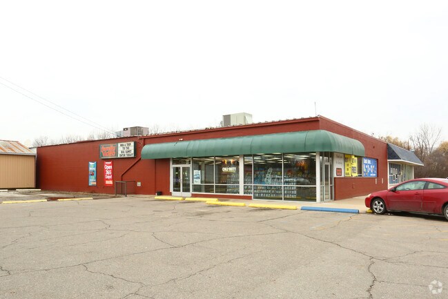
Property Record
1053 E M 21, Owosso, MI 48867


Property Detail
1053 E M 21
007-18-400-028-02
SEC. 18, T7N, R3E. COM 916.74 FT E ALG S SEC LN FROM S 14 POST OF SEC, TH N0108'W 238 FT, TH S8912'W 100 FT, TH N0108'W 120 F
Storebuilding
SHIAWASSEE
AE The base floodplain where base flood elevations are provided. AE Zones are now used on new format FIRMs instead of A1-A30 Zones.
Michigan
2024
1.77 AC
2025
Michigan North Central Area
031700
Other Market Areas
8,040 SF
Owosso, MI
NEARBY LISTINGS FOR SALE OR LEASE
DEMOGRAPHICS near 1053 E M 21
1 mile
3 mile
5 mile
2025 Total Population
6,608
23,581
27,589
2030 Population
6,595
23,605
27,610
Pop Growth 2025-2030
(0.20%)
+ 0.10%
+ 0.08%
Average Age
39
41
42
2025 Total Households
2,775
10,064
11,748
HH Growth 2025-2030
(0.25%)
+ 0.07%
+ 0.05%
Median Household Inc
$46,395
$49,478
$49,371
Avg Household Size
2.30
2.30
2.30
2025 Avg HH Vehicles
2.00
2.00
2.00
Median Home Value
$137,235
$145,794
$150,329
Median Year Built
1952
1958
1961
Nearby Places
Map Layers
Map Styles
 Street
 Aerial
Transit
 Traffic
 Biking
Places
Listings with unknown addresses are not visible on the map
- Restaurants
- Banks
- Shops
- Fitness
- Groceries
PUBLIC TRANSPORTATION
AIRPORT
Bishop International
Drive
Walk
Distance
Bishop International
44 min
25.9 mi
Capital Region International
Drive
Walk
Distance
Capital Region International
54 min
38.5 mi
Freight Ports
Port of Toledo
Drive
Walk
Distance
Port of Toledo
162 min
134.8 mi
SALE & LEASE HISTORY
LISTING DATE
SALE/LEASE

Nov 03, 2016
For Sale
Mar 17, 2017
For Lease
Jun 27, 2018
For Lease
Nearby Properties
Address
Land Use
TOTAL SIZE
Lot Size
Zoning
Address
Land Use
TOTAL SIZE
Lot Size
Zoning
207,259 SF
24.89 AC
Address
Land Use
TOTAL SIZE
Lot Size
Zoning
171,070 SF
38 AC
Address
Land Use
TOTAL SIZE
Lot Size
Zoning
20.30 AC
Address
Land Use
TOTAL SIZE
Lot Size
Zoning
32.95 AC
Address
Land Use
TOTAL SIZE
Lot Size
Zoning
4,960 SF
6.83 AC
RA
Address
Land Use
TOTAL SIZE
Lot Size
Zoning
11.10 AC
Address
Land Use
TOTAL SIZE
Lot Size
Zoning
10,100 SF
17.75 AC
Address
Land Use
TOTAL SIZE
Lot Size
Zoning
7.10 AC
Address
Land Use
TOTAL SIZE
Lot Size
Zoning
10.25 AC
Address
Land Use
TOTAL SIZE
Lot Size
Zoning
93,128 SF
10.98 AC
Address
Land Use
TOTAL SIZE
Lot Size
Zoning
11.90 AC
Address
Land Use
TOTAL SIZE
Lot Size
Zoning
16,202 SF
5.15 AC
Address
Land Use
TOTAL SIZE
Lot Size
Zoning
50,301 SF
8.20 AC
Address
Land Use
TOTAL SIZE
Lot Size
Zoning
1.72 AC
Address
Land Use
TOTAL SIZE
Lot Size
Zoning
17.17 AC
Address
Land Use
TOTAL SIZE
Lot Size
Zoning
8.50 AC
RA
Address
Land Use
TOTAL SIZE
Lot Size
Zoning
Address
Land Use
TOTAL SIZE
Lot Size
Zoning
56,456 SF
6.50 AC
Address
Land Use
TOTAL SIZE
Lot Size
Zoning
0.64 AC
Address
Land Use
TOTAL SIZE
Lot Size
Zoning
11.05 AC
Address
Land Use
TOTAL SIZE
Lot Size
Zoning
15.80 AC
Address
Land Use
TOTAL SIZE
Lot Size
Zoning
18.83 AC
Address
Land Use
TOTAL SIZE
Lot Size
Zoning
23.09 AC
Address
Land Use
TOTAL SIZE
Lot Size
Zoning
11,014 SF
2.61 AC
Address
Land Use
TOTAL SIZE
Lot Size
Zoning
4.16 AC
Address
Land Use
TOTAL SIZE
Lot Size
Zoning
2.52 AC
Address
Land Use
TOTAL SIZE
Lot Size
Zoning
0.39 AC
Address
Land Use
TOTAL SIZE
Lot Size
Zoning
212,405 SF
29 AC
Address
Land Use
TOTAL SIZE
Lot Size
Zoning
4.88 AC
Address
Land Use
TOTAL SIZE
Lot Size
Zoning
10.56 AC
The World's #1 Commercial Real Estate Marketplace
Connect with us
© 2026 CoStar Group
The information above has been obtained from sources believed reliable. While we do not doubt its accuracy we have not verified it and make no guarantee, warranty or representation about it. It is your responsibility to independently confirm its accuracy and completeness. Any projections, opinions, assumptions, or estimates used are for example only and do not represent the current or future performance of the property. The value of this transaction to you depends on tax and other factors which should be evaluated by your tax, financial, and legal advisors. You and your advisors should conduct a careful, independent investigation of the property to determine to your satisfaction the suitability of the property for your needs.