Property Record
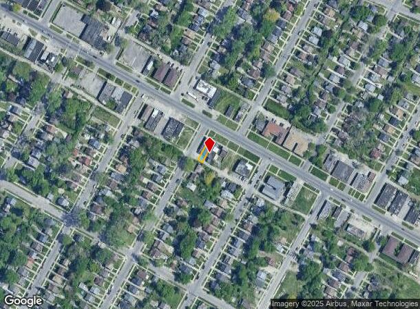
10545 Whittier St, Detroit, MI 48224
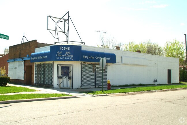
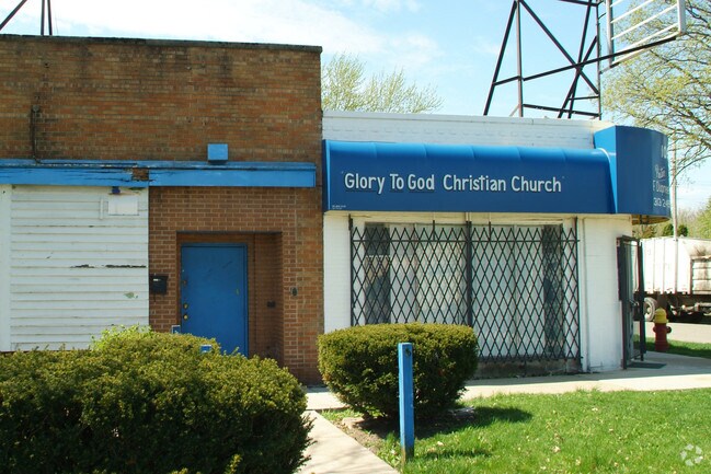
This Property Is For Sale
NEARBY LISTINGS FOR SALE OR LEASE
Property Detail
10545 Whittier St
21-072554
Park Drive No 5
Storebuilding
W WHITTIER W 20 FT 1790 PARK DRIVE SUB NO 5 L54 P50 PLATS, W C R 21/874 20 X 90
X
Wayne
26163C0140F
Michigan
2024
0.04 AC
2025
Detroit E of Woodward
501200
Detroit
1,480 SF
Detroit-Warren-Dearborn, MI
DEMOGRAPHICS near 10545 Whittier St
1 Mile
3 Mile
5 Mile
2024 Total Population
25,612
161,422
318,374
2029 Population
25,759
161,408
317,335
Pop Growth 2024-2029
+ 0.57%
(0.01%)
(0.33%)
Average Age
35
37
39
2024 Total Households
8,893
59,169
123,377
HH Growth 2024-2029
+ 0.57%
(0.12%)
(0.38%)
Median Household Inc
$37,241
$45,969
$47,189
Avg Household Size
2.80
2.60
2.50
2024 Avg HH Vehicles
1.00
1.00
1.00
Median Home Value
$68,437
$100,207
$120,673
Median Year Built
1948
1950
1952
Nearby Places
Map Layers
Map Styles
 Street
 Aerial
- Restaurants
- Banks
- Shops
- Fitness
- Groceries
PUBLIC TRANSPORTATION
COMMUTER RAIL
DRIVE
WALK
Distance
14 min
8.3 mi
AIRPORT
Windsor International
DRIVE
WALK
Distance
Windsor International
39 min
19.7 mi
Detroit Metro Wayne County
DRIVE
WALK
Distance
Detroit Metro Wayne County
42 min
29.2 mi
Nearby Properties
Address
Land Use
TOTAL SIZE
Lot Size
Zoning
Address
Land Use
TOTAL SIZE
Lot Size
Zoning
1,034,990 SF
28.60 AC
Address
Land Use
TOTAL SIZE
Lot Size
Zoning
2,005,073 SF
108.66 AC
M4
Address
Land Use
TOTAL SIZE
Lot Size
Zoning
211,065 SF
8.84 AC
C.F
Address
Land Use
TOTAL SIZE
Lot Size
Zoning
482,649 SF
M4
Address
Land Use
TOTAL SIZE
Lot Size
Zoning
575,081 SF
8.53 AC
R6
Address
Land Use
TOTAL SIZE
Lot Size
Zoning
182,866 SF
5.08 AC
PD
Address
Land Use
TOTAL SIZE
Lot Size
Zoning
101,733 SF
1.10 AC
C-2
Address
Land Use
TOTAL SIZE
Lot Size
Zoning
49,437 SF
0.47 AC
Address
Land Use
TOTAL SIZE
Lot Size
Zoning
93,296 SF
1.05 AC
C-2
Address
Land Use
TOTAL SIZE
Lot Size
Zoning
358,327 SF
M4
Address
Land Use
TOTAL SIZE
Lot Size
Zoning
62,195 SF
1.50 AC
Address
Land Use
TOTAL SIZE
Lot Size
Zoning
302,305 SF
M4
Address
Land Use
TOTAL SIZE
Lot Size
Zoning
156,352 SF
2.72 AC
B-3
Address
Land Use
TOTAL SIZE
Lot Size
Zoning
72,940 SF
83.37 AC
M4
Address
Land Use
TOTAL SIZE
Lot Size
Zoning
28,055 SF
0.44 AC
Address
Land Use
TOTAL SIZE
Lot Size
Zoning
36,417 SF
0.68 AC
B4
Address
Land Use
TOTAL SIZE
Lot Size
Zoning
80,320 SF
4.73 AC
RM-1
Address
Land Use
TOTAL SIZE
Lot Size
Zoning
42,113 SF
0.54 AC
Address
Land Use
TOTAL SIZE
Lot Size
Zoning
102,205 SF
214.30 AC
Address
Land Use
TOTAL SIZE
Lot Size
Zoning
20,625 SF
0.48 AC
C-2
Address
Land Use
TOTAL SIZE
Lot Size
Zoning
49,807 SF
0.84 AC
PD
Address
Land Use
TOTAL SIZE
Lot Size
Zoning
10,908 SF
2.78 AC
B-3
Address
Land Use
TOTAL SIZE
Lot Size
Zoning
92,610 SF
1.76 AC
B-3
Address
Land Use
TOTAL SIZE
Lot Size
Zoning
36,086 SF
2.05 AC
B2
Address
Land Use
TOTAL SIZE
Lot Size
Zoning
25,500 SF
0.23 AC
Address
Land Use
TOTAL SIZE
Lot Size
Zoning
55,321 SF
4.01 AC
PD
Address
Land Use
TOTAL SIZE
Lot Size
Zoning
176,106 SF
11.95 AC
M4
Address
Land Use
TOTAL SIZE
Lot Size
Zoning
101,814 SF
3.74 AC
R-2
Address
Land Use
TOTAL SIZE
Lot Size
Zoning
60,484 SF
4.85 AC
PD
Address
Land Use
TOTAL SIZE
Lot Size
Zoning
28,444 SF
0.97 AC
B-3
The World's #1 Commercial Real Estate Marketplace
Connect with us
© 2025 CoStar Group
The information above has been obtained from sources believed reliable. While we do not doubt its accuracy we have not verified it and make no guarantee, warranty or representation about it. It is your responsibility to independently confirm its accuracy and completeness. Any projections, opinions, assumptions, or estimates used are for example only and do not represent the current or future performance of the property. The value of this transaction to you depends on tax and other factors which should be evaluated by your tax, financial, and legal advisors. You and your advisors should conduct a careful, independent investigation of the property to determine to your satisfaction the suitability of the property for your needs.