Property Record
10549 E Highway 84, Axtell, TX 76624

NEARBY LISTINGS FOR SALE OR LEASE
-
-
View all Axtell listings for sale on LoopNet.com
Property Detail
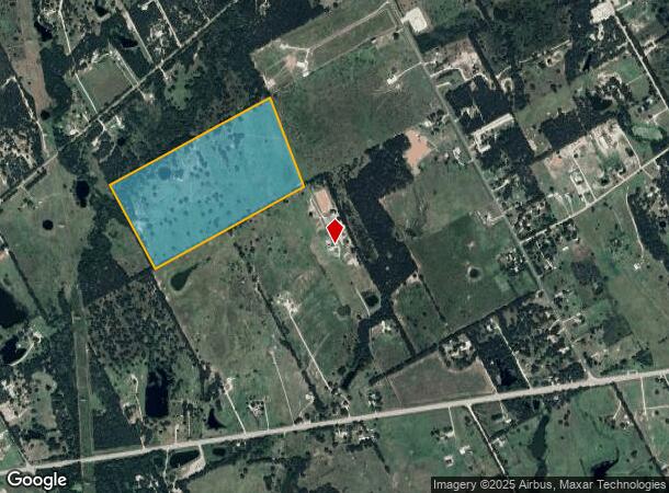
10549 E Highway 84
Waco, TX
Tomas De La Vega
12-004300-010203-0
TOMAS DE LA VEGA ACRES 56.82
Privatepreserveopenspacevacantlandforestlandconservation
Mclennan
A
Texas
48217C0700D
56.82 AC
2024
Waco & Killeen
2025
Other Market Areas
003500
DEMOGRAPHICS near 10549 E Highway 84
1 Mile
3 Mile
5 Mile
2024 Total Population
292
1,951
2,625
2029 Population
294
1,970
2,656
Pop Growth 2024-2029
+ 0.68%
+ 0.97%
+ 1.18%
Average Age
40
41
41
2024 Total Households
105
709
961
HH Growth 2024-2029
+ 0.95%
+ 1.13%
+ 1.35%
Median Household Inc
$99,999
$100,227
$95,598
Avg Household Size
2.60
2.60
2.60
2024 Avg HH Vehicles
3.00
3.00
3.00
Median Home Value
$178,124
$192,423
$193,157
Median Year Built
1985
1984
1984
Nearby Places
Map Layers
Map Styles
 Street
 Aerial
- Restaurants
- Banks
- Shops
- Fitness
- Groceries
PUBLIC TRANSPORTATION
AIRPORT
Waco Regional
DRIVE
WALK
Distance
Waco Regional
31 min
17.7 mi
SALE & LEASE HISTORY
LISTING DATE
SALE/LEASE

Sep 04, 2017
For Sale
Jun 14, 2018
For Sale
Nearby Properties
Address
Land Use
TOTAL SIZE
Lot Size
Zoning
Address
Land Use
TOTAL SIZE
Lot Size
Zoning
38,079 SF
79.93 AC
Address
Land Use
TOTAL SIZE
Lot Size
Zoning
5,145 SF
12.07 AC
Address
Land Use
TOTAL SIZE
Lot Size
Zoning
12,736 SF
1.59 AC
Address
Land Use
TOTAL SIZE
Lot Size
Zoning
6,650 SF
12.22 AC
R
Address
Land Use
TOTAL SIZE
Lot Size
Zoning
320 SF
11.61 AC
Address
Land Use
TOTAL SIZE
Lot Size
Zoning
6,140 SF
198.92 AC
R
Address
Land Use
TOTAL SIZE
Lot Size
Zoning
4,001 SF
20.89 AC
R
Address
Land Use
TOTAL SIZE
Lot Size
Zoning
3,940 SF
28.64 AC
Address
Land Use
TOTAL SIZE
Lot Size
Zoning
13,490 SF
5.51 AC
R
Address
Land Use
TOTAL SIZE
Lot Size
Zoning
3,687 SF
17.48 AC
R
Address
Land Use
TOTAL SIZE
Lot Size
Zoning
4,155 SF
59.95 AC
R
Address
Land Use
TOTAL SIZE
Lot Size
Zoning
4,294 SF
34.23 AC
Address
Land Use
TOTAL SIZE
Lot Size
Zoning
2,801 SF
10 AC
Address
Land Use
TOTAL SIZE
Lot Size
Zoning
4,701 SF
25.78 AC
R
Address
Land Use
TOTAL SIZE
Lot Size
Zoning
3,416 SF
121.95 AC
R
Address
Land Use
TOTAL SIZE
Lot Size
Zoning
3,971 SF
33.29 AC
R
Address
Land Use
TOTAL SIZE
Lot Size
Zoning
2,665 SF
168.85 AC
Address
Land Use
TOTAL SIZE
Lot Size
Zoning
9,993 SF
9.96 AC
R
Address
Land Use
TOTAL SIZE
Lot Size
Zoning
7,388 SF
109.62 AC
R
Address
Land Use
TOTAL SIZE
Lot Size
Zoning
2,779 SF
14.48 AC
Address
Land Use
TOTAL SIZE
Lot Size
Zoning
3,460 SF
20 AC
Address
Land Use
TOTAL SIZE
Lot Size
Zoning
1,584 SF
87.98 AC
R
Address
Land Use
TOTAL SIZE
Lot Size
Zoning
4,393 SF
61.34 AC
R
Address
Land Use
TOTAL SIZE
Lot Size
Zoning
2,703 SF
34.54 AC
R
Address
Land Use
TOTAL SIZE
Lot Size
Zoning
2,603 SF
16.21 AC
Address
Land Use
TOTAL SIZE
Lot Size
Zoning
10,400 SF
0.87 AC
C
Address
Land Use
TOTAL SIZE
Lot Size
Zoning
7,880 SF
Address
Land Use
TOTAL SIZE
Lot Size
Zoning
4,407 SF
48.22 AC
R
Address
Land Use
TOTAL SIZE
Lot Size
Zoning
4,385 SF
10.23 AC
R
Address
Land Use
TOTAL SIZE
Lot Size
Zoning
2,286 SF
31.10 AC
R
The World's #1 Commercial Real Estate Marketplace
Connect with us
© 2025 CoStar Group
The information above has been obtained from sources believed reliable. While we do not doubt its accuracy we have not verified it and make no guarantee, warranty or representation about it. It is your responsibility to independently confirm its accuracy and completeness. Any projections, opinions, assumptions, or estimates used are for example only and do not represent the current or future performance of the property. The value of this transaction to you depends on tax and other factors which should be evaluated by your tax, financial, and legal advisors. You and your advisors should conduct a careful, independent investigation of the property to determine to your satisfaction the suitability of the property for your needs.