Property Record
1055 E Main St, Pulaski, VA 24301
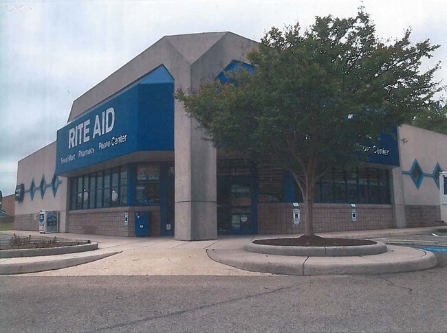

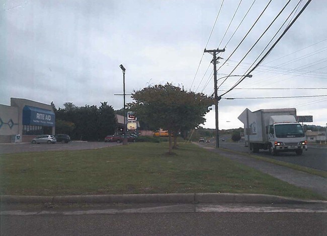
Property Detail
1055 E Main St
07602
PARCEL ON N SIDE RT 99
Commercialnec
Pulaski
PB2
Virginia
B and X Area of moderate flood hazard, usually the area between the limits of the 100-year and 500-year floods.
2.50 AC
2025
Blacksburg & Wytheville
2025
Other Market Areas
210201
Blacksburg-Christiansburg-Radford, VA
NEARBY LISTINGS FOR SALE OR LEASE
DEMOGRAPHICS near 1055 E Main St
1 mile
3 mile
5 mile
2025 Total Population
3,986
11,939
16,805
2030 Population
3,961
11,965
16,788
Pop Growth 2025-2030
(0.63%)
+ 0.22%
(0.10%)
Average Age
41
43
44
2025 Total Households
1,748
5,160
7,178
HH Growth 2025-2030
(0.57%)
+ 0.17%
(0.14%)
Median Household Inc
$40,221
$50,529
$55,182
Avg Household Size
2.30
2.30
2.30
2025 Avg HH Vehicles
2.00
2.00
2.00
Median Home Value
$154,359
$163,829
$180,803
Median Year Built
1965
1962
1967
Nearby Places
Map Layers
Map Styles
 Street
 Aerial
Transit
 Traffic
 Biking
Places
Listings with unknown addresses are not visible on the map
- Restaurants
- Banks
- Shops
- Fitness
- Groceries
SALE & LEASE HISTORY
LISTING DATE
SALE/LEASE

Dec 13, 2016
For Lease
Nearby Properties
Address
Land Use
TOTAL SIZE
Lot Size
Zoning
Address
Land Use
TOTAL SIZE
Lot Size
Zoning
51.77 AC
I2
Address
Land Use
TOTAL SIZE
Lot Size
Zoning
270.75 AC
I1
Address
Land Use
TOTAL SIZE
Lot Size
Zoning
39.42 AC
I1
Address
Land Use
TOTAL SIZE
Lot Size
Zoning
22.28 AC
R
Address
Land Use
TOTAL SIZE
Lot Size
Zoning
2.07 AC
R
Address
Land Use
TOTAL SIZE
Lot Size
Zoning
17.08 AC
R1
Address
Land Use
TOTAL SIZE
Lot Size
Zoning
2.72 AC
I1
Address
Land Use
TOTAL SIZE
Lot Size
Zoning
35.80 AC
R
Address
Land Use
TOTAL SIZE
Lot Size
Zoning
30 AC
I1
Address
Land Use
TOTAL SIZE
Lot Size
Zoning
10.12 AC
PI2
Address
Land Use
TOTAL SIZE
Lot Size
Zoning
8.76 AC
I1
Address
Land Use
TOTAL SIZE
Lot Size
Zoning
Address
Land Use
TOTAL SIZE
Lot Size
Zoning
16.71 AC
R
Address
Land Use
TOTAL SIZE
Lot Size
Zoning
3.02 AC
R
Address
Land Use
TOTAL SIZE
Lot Size
Zoning
7.22 AC
R
Address
Land Use
TOTAL SIZE
Lot Size
Zoning
6.11 AC
R
Address
Land Use
TOTAL SIZE
Lot Size
Zoning
24.74 AC
R
Address
Land Use
TOTAL SIZE
Lot Size
Zoning
3.96 AC
PB2
Address
Land Use
TOTAL SIZE
Lot Size
Zoning
6.95 AC
R
Address
Land Use
TOTAL SIZE
Lot Size
Zoning
20.71 AC
0059
Address
Land Use
TOTAL SIZE
Lot Size
Zoning
8.46 AC
R
Address
Land Use
TOTAL SIZE
Lot Size
Zoning
13.53 AC
PI2
Address
Land Use
TOTAL SIZE
Lot Size
Zoning
6.20 AC
PB2
Address
Land Use
TOTAL SIZE
Lot Size
Zoning
9.83 AC
I1
Address
Land Use
TOTAL SIZE
Lot Size
Zoning
5.89 AC
PB3
Address
Land Use
TOTAL SIZE
Lot Size
Zoning
3.96 AC
PB2
Address
Land Use
TOTAL SIZE
Lot Size
Zoning
17.86 AC
R
Address
Land Use
TOTAL SIZE
Lot Size
Zoning
688.20 AC
A1
Address
Land Use
TOTAL SIZE
Lot Size
Zoning
0.45 AC
PB3
The World's #1 Commercial Real Estate Marketplace
Connect with us
© 2026 CoStar Group
The information above has been obtained from sources believed reliable. While we do not doubt its accuracy we have not verified it and make no guarantee, warranty or representation about it. It is your responsibility to independently confirm its accuracy and completeness. Any projections, opinions, assumptions, or estimates used are for example only and do not represent the current or future performance of the property. The value of this transaction to you depends on tax and other factors which should be evaluated by your tax, financial, and legal advisors. You and your advisors should conduct a careful, independent investigation of the property to determine to your satisfaction the suitability of the property for your needs.