Property Record
1055 Fortner Rd, Metter, GA 30439

Property Detail
1055 Fortner Rd
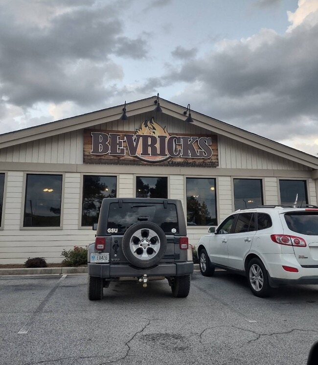
Restaurantbuilding
1.756 ACRES AND RESTAURANT
002
CANDLER
A Areas with a 1% annual chance of flooding and a 26% chance of flooding over the life of a 30-year mortgage.
Georgia
2025
1.75 AC
2025
Georgia South Area
950200
Other Market Areas
7,574 SF
037-048
NEARBY LISTINGS FOR SALE OR LEASE
-
-
View all Metter listings for sale on LoopNet.com
DEMOGRAPHICS near 1055 Fortner Rd
1 mile
3 mile
5 mile
2025 Total Population
538
5,247
7,157
2030 Population
549
5,367
7,297
Pop Growth 2025-2030
+ 2.04%
+ 2.29%
+ 1.96%
Average Age
40
40
40
2025 Total Households
209
1,995
2,692
HH Growth 2025-2030
+ 1.91%
+ 2.36%
+ 2.04%
Median Household Inc
$49,820
$44,711
$47,649
Avg Household Size
2.60
2.50
2.60
2025 Avg HH Vehicles
2.00
2.00
2.00
Median Home Value
$93,037
$144,094
$140,495
Median Year Built
1979
1982
1985
Nearby Places
Map Layers
Map Styles
 Street
 Aerial
Layers
 Traffic
 Biking
Places
Listings with unknown addresses are not visible on the map
- Restaurants
- Banks
- Shops
- Fitness
- Groceries
Nearby Properties
Address
Land Use
TOTAL SIZE
Lot Size
Zoning
Address
Land Use
TOTAL SIZE
Lot Size
Zoning
161,796 SF
43.04 AC
007
Address
Land Use
TOTAL SIZE
Lot Size
Zoning
200,000 SF
35.53 AC
LI
Address
Land Use
TOTAL SIZE
Lot Size
Zoning
121,003 SF
48.85 AC
007
Address
Land Use
TOTAL SIZE
Lot Size
Zoning
45,704 SF
7.87 AC
PEH
Address
Land Use
TOTAL SIZE
Lot Size
Zoning
75,630 SF
20 AC
PEH
Address
Land Use
TOTAL SIZE
Lot Size
Zoning
95,878 SF
8.52 AC
PEH
Address
Land Use
TOTAL SIZE
Lot Size
Zoning
208,890 SF
17.86 AC
LI
Address
Land Use
TOTAL SIZE
Lot Size
Zoning
13,926 SF
0.79 AC
CBD
Address
Land Use
TOTAL SIZE
Lot Size
Zoning
21,504 SF
62 AC
HOC
Address
Land Use
TOTAL SIZE
Lot Size
Zoning
15,708 SF
17.08 AC
LI
Address
Land Use
TOTAL SIZE
Lot Size
Zoning
1,514 SF
5.14 AC
R2
Address
Land Use
TOTAL SIZE
Lot Size
Zoning
44,539 SF
13.20 AC
PEH
Address
Land Use
TOTAL SIZE
Lot Size
Zoning
8,287 SF
24.97 AC
HOC
Address
Land Use
TOTAL SIZE
Lot Size
Zoning
28,263 SF
3 AC
PEH
Address
Land Use
TOTAL SIZE
Lot Size
Zoning
18,336 SF
12 AC
LI
Address
Land Use
TOTAL SIZE
Lot Size
Zoning
2,820 SF
8.22 AC
R2
Address
Land Use
TOTAL SIZE
Lot Size
Zoning
10,968 SF
1 AC
CBD
Address
Land Use
TOTAL SIZE
Lot Size
Zoning
14,390 SF
0.73 AC
CBD
Address
Land Use
TOTAL SIZE
Lot Size
Zoning
20,587 SF
3.16 AC
R3
Address
Land Use
TOTAL SIZE
Lot Size
Zoning
13,482 SF
2.80 AC
002
Address
Land Use
TOTAL SIZE
Lot Size
Zoning
11,428 SF
0.72 AC
R3
Address
Land Use
TOTAL SIZE
Lot Size
Zoning
10,902 SF
2.26 AC
HOC
Address
Land Use
TOTAL SIZE
Lot Size
Zoning
50,000 SF
57.98 AC
GC
Address
Land Use
TOTAL SIZE
Lot Size
Zoning
12,828 SF
1.66 AC
R3
Address
Land Use
TOTAL SIZE
Lot Size
Zoning
10,284 SF
7.82 AC
LI
Address
Land Use
TOTAL SIZE
Lot Size
Zoning
5,120 SF
2.75 AC
HOC
Address
Land Use
TOTAL SIZE
Lot Size
Zoning
30,264 SF
5.40 AC
LI
Address
Land Use
TOTAL SIZE
Lot Size
Zoning
23,320 SF
9.80 AC
LI
Address
Land Use
TOTAL SIZE
Lot Size
Zoning
13,896 SF
6.57 AC
R2
Address
Land Use
TOTAL SIZE
Lot Size
Zoning
11,803 SF
4.05 AC
R2
The World's #1 Commercial Real Estate Marketplace
Connect with us
© 2026 CoStar Group
The information above has been obtained from sources believed reliable. While we do not doubt its accuracy we have not verified it and make no guarantee, warranty or representation about it. It is your responsibility to independently confirm its accuracy and completeness. Any projections, opinions, assumptions, or estimates used are for example only and do not represent the current or future performance of the property. The value of this transaction to you depends on tax and other factors which should be evaluated by your tax, financial, and legal advisors. You and your advisors should conduct a careful, independent investigation of the property to determine to your satisfaction the suitability of the property for your needs.