Property Record
1055 Sw 48Th Ave, Okeechobee, FL 34974

Property Detail
1055 Sw 48Th Ave
R1-24-37-34-0A00-00003-A000
BEGINNING AT THE SOUTHWEST CORNER OF SECTION 24, TOWNSHIP 37 SOUTH, RANGE 34 EAST, THENCE NORTH 891435 EAST, ALONG THE SOUTH LINE OF SAID SECTION 24, A DISTANCE OF 1360.46 FEET TO THE SOUTHEAST CORNER OF THE SW1/4 OF SW1/4 OF SAID SECTION 24; THENCE
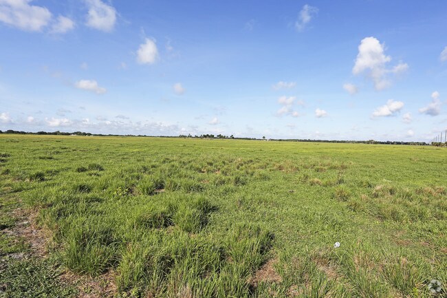
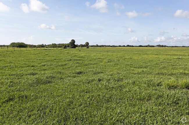
Pasture
OKEECHOBEE
A Areas with a 1% annual chance of flooding and a 26% chance of flooding over the life of a 30-year mortgage.
Florida
2025
182.03 AC
2025
Florida Central South Area
910602
Other Market Areas
11,713 SF
Okeechobee, FL
NEARBY LISTINGS FOR SALE OR LEASE
DEMOGRAPHICS near 1055 Sw 48Th Ave
1 mile
3 mile
5 mile
2025 Total Population
199
8,246
19,388
2030 Population
214
8,776
20,828
Pop Growth 2025-2030
+ 7.54%
+ 6.43%
+ 7.43%
Average Age
42
38
41
2025 Total Households
73
2,837
7,247
HH Growth 2025-2030
+ 6.85%
+ 6.70%
+ 7.96%
Median Household Inc
$106,250
$77,091
$62,560
Avg Household Size
2.70
2.80
2.60
2025 Avg HH Vehicles
2.00
2.00
2.00
Median Home Value
$353,571
$258,770
$224,498
Median Year Built
1992
1982
1986
Nearby Places
Map Layers
Map Styles
 Street
 Aerial
Layers
 Traffic
 Biking
Places
Listings with unknown addresses are not visible on the map
- Restaurants
- Banks
- Shops
- Fitness
- Groceries
PUBLIC TRANSPORTATION
COMMUTER RAIL
Okeechobee Amtrak (Silver Star - Amtrak)
Drive
Walk
Distance
Okeechobee Amtrak (Silver Star - Amtrak)
9 min
4.2 mi
Freight Ports
Port of Palm Beach
Drive
Walk
Distance
Port of Palm Beach
93 min
63.0 mi
Nearby Properties
Address
Land Use
TOTAL SIZE
Lot Size
Zoning
Address
Land Use
TOTAL SIZE
Lot Size
Zoning
80,699 SF
110.96 AC
Address
Land Use
TOTAL SIZE
Lot Size
Zoning
119,085 SF
14.79 AC
Address
Land Use
TOTAL SIZE
Lot Size
Zoning
166,487 SF
40 AC
Address
Land Use
TOTAL SIZE
Lot Size
Zoning
179,505 SF
30.43 AC
Address
Land Use
TOTAL SIZE
Lot Size
Zoning
90,801 SF
15.10 AC
Address
Land Use
TOTAL SIZE
Lot Size
Zoning
77,019 SF
7.76 AC
Address
Land Use
TOTAL SIZE
Lot Size
Zoning
58,312 SF
7.50 AC
Address
Land Use
TOTAL SIZE
Lot Size
Zoning
2,470 SF
258.06 AC
Address
Land Use
TOTAL SIZE
Lot Size
Zoning
29,199 SF
12 AC
Address
Land Use
TOTAL SIZE
Lot Size
Zoning
36,316 SF
4.96 AC
Address
Land Use
TOTAL SIZE
Lot Size
Zoning
24,520 SF
2.07 AC
Address
Land Use
TOTAL SIZE
Lot Size
Zoning
40,062 SF
3.22 AC
Address
Land Use
TOTAL SIZE
Lot Size
Zoning
37,334 SF
7.91 AC
Address
Land Use
TOTAL SIZE
Lot Size
Zoning
4,798 SF
2.19 AC
Address
Land Use
TOTAL SIZE
Lot Size
Zoning
14,358 SF
2.39 AC
Address
Land Use
TOTAL SIZE
Lot Size
Zoning
20,128 SF
5.83 AC
Address
Land Use
TOTAL SIZE
Lot Size
Zoning
38,109 SF
5.07 AC
Address
Land Use
TOTAL SIZE
Lot Size
Zoning
9,647 SF
330.61 AC
Address
Land Use
TOTAL SIZE
Lot Size
Zoning
19,680 SF
5 AC
Address
Land Use
TOTAL SIZE
Lot Size
Zoning
15,490 SF
1.58 AC
Address
Land Use
TOTAL SIZE
Lot Size
Zoning
17,997 SF
2 AC
Address
Land Use
TOTAL SIZE
Lot Size
Zoning
41,606 SF
7.43 AC
Address
Land Use
TOTAL SIZE
Lot Size
Zoning
655.80 AC
Address
Land Use
TOTAL SIZE
Lot Size
Zoning
19,500 SF
3.48 AC
Address
Land Use
TOTAL SIZE
Lot Size
Zoning
12,376 SF
2.07 AC
Address
Land Use
TOTAL SIZE
Lot Size
Zoning
2,100 SF
4.68 AC
Address
Land Use
TOTAL SIZE
Lot Size
Zoning
4,500 SF
3.70 AC
Address
Land Use
TOTAL SIZE
Lot Size
Zoning
3,286 SF
0.99 AC
Address
Land Use
TOTAL SIZE
Lot Size
Zoning
19,324 SF
3.74 AC
Address
Land Use
TOTAL SIZE
Lot Size
Zoning
39.47 AC
The World's #1 Commercial Real Estate Marketplace
Connect with us
© 2026 CoStar Group
The information above has been obtained from sources believed reliable. While we do not doubt its accuracy we have not verified it and make no guarantee, warranty or representation about it. It is your responsibility to independently confirm its accuracy and completeness. Any projections, opinions, assumptions, or estimates used are for example only and do not represent the current or future performance of the property. The value of this transaction to you depends on tax and other factors which should be evaluated by your tax, financial, and legal advisors. You and your advisors should conduct a careful, independent investigation of the property to determine to your satisfaction the suitability of the property for your needs.