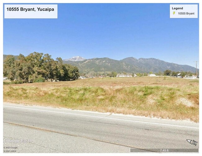
Property Record
10555 Bryant St, Yucaipa, CA 92399


NEARBY LISTINGS FOR SALE OR LEASE
-
-
View all Yucaipa listings for sale on LoopNet.com
Property Detail
10555 Bryant St
Riverside-San Bernardino-Ontario, CA
Yucapa Valley Colony
0321-011-10
YUCA1PA VALLEY COLONY SUB NO 1 S 441.6 FT LOT 1 BLK B EX ST 5.9 AC M/L
Vacantlandnec
San Bernardino
X
California
06071C8745H
1
2025
5.90 AC
2025
Redlands/Loma Linda
008800
Inland Empire (California)
DEMOGRAPHICS near 10555 Bryant St
1 mile
3 mile
5 mile
2024 Total Population
5,437
31,300
65,602
2029 Population
5,521
32,006
67,214
Pop Growth 2024-2029
+ 1.54%
+ 2.26%
+ 2.46%
Average Age
43
40
40
2024 Total Households
1,997
11,270
23,531
HH Growth 2024-2029
+ 1.50%
+ 2.31%
+ 2.44%
Median Household Inc
$113,749
$81,166
$79,669
Avg Household Size
2.60
2.70
2.70
2024 Avg HH Vehicles
3.00
2.00
2.00
Median Home Value
$436,715
$442,106
$445,292
Median Year Built
1981
1976
1977
Nearby Places
Map Layers
Map Styles
 Street
 Aerial
Transit
 Traffic
 Biking
Places
Listings with unknown addresses are not visible on the map
- Restaurants
- Banks
- Shops
- Fitness
- Groceries
PUBLIC TRANSPORTATION
AIRPORT
Ontario International
Drive
Walk
Distance
Ontario International
50 min
37.3 mi
Palm Springs International
Drive
Walk
Distance
Palm Springs International
56 min
45.1 mi
SALE & LEASE HISTORY
LISTING DATE
SALE/LEASE

Mar 22, 2021
For Sale
Nearby Properties
Address
Land Use
TOTAL SIZE
Lot Size
Zoning
Address
Land Use
TOTAL SIZE
Lot Size
Zoning
1,663,992 SF
38.20 AC
Address
Land Use
TOTAL SIZE
Lot Size
Zoning
79,299 SF
5.04 AC
Address
Land Use
TOTAL SIZE
Lot Size
Zoning
67,686 SF
4.16 AC
Address
Land Use
TOTAL SIZE
Lot Size
Zoning
24,510 SF
6.88 AC
Address
Land Use
TOTAL SIZE
Lot Size
Zoning
42,634 SF
1.91 AC
Address
Land Use
TOTAL SIZE
Lot Size
Zoning
111,182 SF
3.11 AC
Address
Land Use
TOTAL SIZE
Lot Size
Zoning
44,046 SF
3.77 AC
Address
Land Use
TOTAL SIZE
Lot Size
Zoning
33,000 SF
2.96 AC
Address
Land Use
TOTAL SIZE
Lot Size
Zoning
78,309 SF
7.09 AC
Address
Land Use
TOTAL SIZE
Lot Size
Zoning
29,996 SF
1.86 AC
Address
Land Use
TOTAL SIZE
Lot Size
Zoning
815,000 SF
25.42 AC
Address
Land Use
TOTAL SIZE
Lot Size
Zoning
9.71 AC
Address
Land Use
TOTAL SIZE
Lot Size
Zoning
41,040 SF
4.70 AC
Address
Land Use
TOTAL SIZE
Lot Size
Zoning
23,227 SF
1.81 AC
Address
Land Use
TOTAL SIZE
Lot Size
Zoning
45,862 SF
4.51 AC
Address
Land Use
TOTAL SIZE
Lot Size
Zoning
44,864 SF
5.34 AC
Address
Land Use
TOTAL SIZE
Lot Size
Zoning
17,326 SF
2.24 AC
Address
Land Use
TOTAL SIZE
Lot Size
Zoning
1,305 SF
8.49 AC
Address
Land Use
TOTAL SIZE
Lot Size
Zoning
55,073 SF
4.43 AC
Address
Land Use
TOTAL SIZE
Lot Size
Zoning
27,360 SF
1.91 AC
Address
Land Use
TOTAL SIZE
Lot Size
Zoning
18,586 SF
1.63 AC
Address
Land Use
TOTAL SIZE
Lot Size
Zoning
25,008 SF
1.47 AC
Address
Land Use
TOTAL SIZE
Lot Size
Zoning
3,540 SF
9.17 AC
Address
Land Use
TOTAL SIZE
Lot Size
Zoning
503,668 SF
11.51 AC
Address
Land Use
TOTAL SIZE
Lot Size
Zoning
37,331 SF
2.40 AC
Address
Land Use
TOTAL SIZE
Lot Size
Zoning
67,389 SF
3.78 AC
Address
Land Use
TOTAL SIZE
Lot Size
Zoning
66,410 SF
7.49 AC
Address
Land Use
TOTAL SIZE
Lot Size
Zoning
470,448 SF
10.80 AC
Address
Land Use
TOTAL SIZE
Lot Size
Zoning
19,500 SF
1.86 AC
Address
Land Use
TOTAL SIZE
Lot Size
Zoning
312,760 SF
7.18 AC
The World's #1 Commercial Real Estate Marketplace
Connect with us
© 2026 CoStar Group
The information above has been obtained from sources believed reliable. While we do not doubt its accuracy we have not verified it and make no guarantee, warranty or representation about it. It is your responsibility to independently confirm its accuracy and completeness. Any projections, opinions, assumptions, or estimates used are for example only and do not represent the current or future performance of the property. The value of this transaction to you depends on tax and other factors which should be evaluated by your tax, financial, and legal advisors. You and your advisors should conduct a careful, independent investigation of the property to determine to your satisfaction the suitability of the property for your needs.