Property Record
10555 Iona Ave, Hanford, CA 93230


Current Lease Availabilities
NEARBY LISTINGS FOR SALE OR LEASE
Property Detail
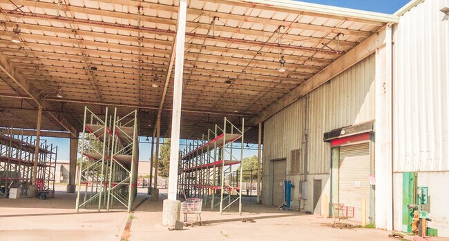
10555 Iona Ave
018-242-056-000
PORTION OF NW 1/4 12/19/21
Heavyindustrial
Kings
X
California
06031C0195C
16.95 AC
2024
Hanford/Armona
2025
Fresno
0012001034
Hanford-Corcoran, CA
141,960 SF
DEMOGRAPHICS near 10555 Iona Ave
1 Mile
3 Mile
5 Mile
2024 Total Population
102
17,431
55,154
2029 Population
103
17,672
56,204
Pop Growth 2024-2029
+ 0.98%
+ 1.38%
+ 1.90%
Average Age
38
33
35
2024 Total Households
32
4,944
17,688
HH Growth 2024-2029
0.00%
+ 1.40%
+ 1.91%
Median Household Inc
$72,499
$50,542
$60,875
Avg Household Size
3.00
3.40
3.00
2024 Avg HH Vehicles
2.00
2.00
2.00
Median Home Value
$383,333
$241,085
$281,955
Median Year Built
1976
1980
1981
Nearby Places
Map Layers
Map Styles
 Street
 Aerial
- Restaurants
- Banks
- Shops
- Fitness
- Groceries
PUBLIC TRANSPORTATION
COMMUTER RAIL
Hanford (San Joaquins - Amtrak)
DRIVE
WALK
Distance
Hanford (San Joaquins - Amtrak)
8 min
3.6 mi
Freight Ports
Port of Stockton
DRIVE
WALK
Distance
Port of Stockton
199 min
177.2 mi
Nearby Properties
Address
Land Use
TOTAL SIZE
Lot Size
Zoning
Address
Land Use
TOTAL SIZE
Lot Size
Zoning
63.26 AC
I-H
Address
Land Use
TOTAL SIZE
Lot Size
Zoning
50 AC
MH
Address
Land Use
TOTAL SIZE
Lot Size
Zoning
1,042,000 SF
67.05 AC
MH
Address
Land Use
TOTAL SIZE
Lot Size
Zoning
75.42 AC
MH
Address
Land Use
TOTAL SIZE
Lot Size
Zoning
18.54 AC
I-H
Address
Land Use
TOTAL SIZE
Lot Size
Zoning
169,750 SF
21.54 AC
H1
Address
Land Use
TOTAL SIZE
Lot Size
Zoning
39,703 SF
0.97 AC
SC
Address
Land Use
TOTAL SIZE
Lot Size
Zoning
53,577 SF
1.46 AC
C-H
Address
Land Use
TOTAL SIZE
Lot Size
Zoning
3.25 AC
RM3
Address
Land Use
TOTAL SIZE
Lot Size
Zoning
41,033 SF
2.18 AC
SC
Address
Land Use
TOTAL SIZE
Lot Size
Zoning
21,925 SF
2.14 AC
RM3
Address
Land Use
TOTAL SIZE
Lot Size
Zoning
5.73 AC
HI
Address
Land Use
TOTAL SIZE
Lot Size
Zoning
64,973 SF
8.39 AC
H1
Address
Land Use
TOTAL SIZE
Lot Size
Zoning
20 AC
I-H
Address
Land Use
TOTAL SIZE
Lot Size
Zoning
80 AC
AG20
Address
Land Use
TOTAL SIZE
Lot Size
Zoning
40,652 SF
5.86 AC
SC
Address
Land Use
TOTAL SIZE
Lot Size
Zoning
984,192 SF
67.69 AC
H1
Address
Land Use
TOTAL SIZE
Lot Size
Zoning
24,000 SF
38.74 AC
H1
Address
Land Use
TOTAL SIZE
Lot Size
Zoning
19,169 SF
2.90 AC
C-R
Address
Land Use
TOTAL SIZE
Lot Size
Zoning
101,726 SF
5.74 AC
RM3
Address
Land Use
TOTAL SIZE
Lot Size
Zoning
1,944 SF
34.20 AC
RM3
Address
Land Use
TOTAL SIZE
Lot Size
Zoning
4.08 AC
SC
Address
Land Use
TOTAL SIZE
Lot Size
Zoning
32,185 SF
0.32 AC
MX-D
Address
Land Use
TOTAL SIZE
Lot Size
Zoning
5.36 AC
SC
Address
Land Use
TOTAL SIZE
Lot Size
Zoning
44,428 SF
4.25 AC
RM3
Address
Land Use
TOTAL SIZE
Lot Size
Zoning
72,750 SF
3.84 AC
RM3
Address
Land Use
TOTAL SIZE
Lot Size
Zoning
29,331 SF
2.85 AC
CC
Address
Land Use
TOTAL SIZE
Lot Size
Zoning
1,528 SF
10 AC
AG20
The World's #1 Commercial Real Estate Marketplace
Connect with us
© 2025 CoStar Group
The information above has been obtained from sources believed reliable. While we do not doubt its accuracy we have not verified it and make no guarantee, warranty or representation about it. It is your responsibility to independently confirm its accuracy and completeness. Any projections, opinions, assumptions, or estimates used are for example only and do not represent the current or future performance of the property. The value of this transaction to you depends on tax and other factors which should be evaluated by your tax, financial, and legal advisors. You and your advisors should conduct a careful, independent investigation of the property to determine to your satisfaction the suitability of the property for your needs.