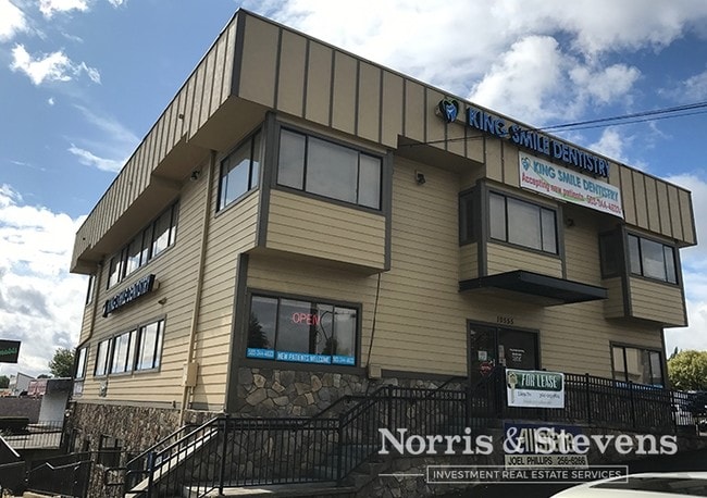
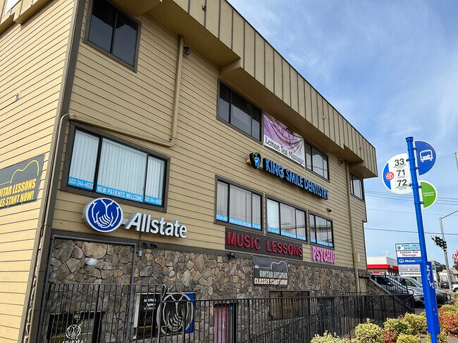
Property Record
10555 Se 82Nd Ave, Happy Valley, OR 97086


Current Lease Availabilities
Property Detail
10555 Se 82Nd Ave
00100713
417 PARK VIEW AC PT LTS 133&134&PT VAC RD
Commercialbuilding
Clackamas
RTL
Oregon
B and X Area of moderate flood hazard, usually the area between the limits of the 100-year and 500-year floods.
133-1
2025
0.21 AC
2025
Clackamas/Milwaukie
021602
Portland
5,346 SF
Portland-Vancouver-Hillsboro, OR-WA
NEARBY LISTINGS FOR SALE OR LEASE
DEMOGRAPHICS near 10555 Se 82Nd Ave
1 mile
3 mile
5 mile
2025 Total Population
18,315
126,776
336,096
2030 Population
18,524
126,326
334,641
Pop Growth 2025-2030
+ 1.14%
(0.35%)
(0.43%)
Average Age
39
41
41
2025 Total Households
7,427
48,732
130,121
HH Growth 2025-2030
+ 1.04%
(0.49%)
(0.63%)
Median Household Inc
$71,011
$92,037
$91,080
Avg Household Size
2.40
2.50
2.50
2025 Avg HH Vehicles
2.00
2.00
2.00
Median Home Value
$461,908
$538,171
$569,395
Median Year Built
1985
1975
1974
Nearby Places
Map Layers
Map Styles
 Street
 Aerial
Layers
 Traffic
 Biking
Places
Listings with unknown addresses are not visible on the map
- Restaurants
- Banks
- Shops
- Fitness
- Groceries
PUBLIC TRANSPORTATION
TRANSIT/SUBWAY
Se Fuller Road (MAX Green Line - Tri-County Metropolitan Transportation District of Oregon Rail (TriMet Rail))
Drive
Walk
Distance
Se Fuller Road (MAX Green Line - Tri-County Metropolitan Transportation District of Oregon Rail (TriMet Rail))
2 min
14 min
0.7 mi
COMMUTER RAIL
Oregon City Amtrak (Amtrak Cascades - Amtrak)
Drive
Walk
Distance
Oregon City Amtrak (Amtrak Cascades - Amtrak)
10 min
6.4 mi
Portland (Amtrak Cascades - Amtrak, Coast Starlight - Amtrak, Empire Builder - Amtrak)
Drive
Walk
Distance
Portland (Amtrak Cascades - Amtrak, Coast Starlight - Amtrak, Empire Builder - Amtrak)
21 min
9.8 mi
AIRPORT
Portland International
Drive
Walk
Distance
Portland International
20 min
12.4 mi
Freight Ports
Port of Portland
Drive
Walk
Distance
Port of Portland
24 min
12.4 mi
Nearby Properties
Address
Land Use
TOTAL SIZE
Lot Size
Zoning
Address
Land Use
TOTAL SIZE
Lot Size
Zoning
22 AC
PMU1
Address
Land Use
TOTAL SIZE
Lot Size
Zoning
40.94 AC
IPU
Address
Land Use
TOTAL SIZE
Lot Size
Zoning
28.83 AC
RCO
Address
Land Use
TOTAL SIZE
Lot Size
Zoning
Address
Land Use
TOTAL SIZE
Lot Size
Zoning
Address
Land Use
TOTAL SIZE
Lot Size
Zoning
Address
Land Use
TOTAL SIZE
Lot Size
Zoning
828 SF
23.69 AC
MR2
Address
Land Use
TOTAL SIZE
Lot Size
Zoning
6.48 AC
R-3
Address
Land Use
TOTAL SIZE
Lot Size
Zoning
15.05 AC
CC
Address
Land Use
TOTAL SIZE
Lot Size
Zoning
2,183 SF
6 AC
RCHDR
Address
Land Use
TOTAL SIZE
Lot Size
Zoning
2,108 SF
12.08 AC
HDR
Address
Land Use
TOTAL SIZE
Lot Size
Zoning
11 AC
RCHDR
Address
Land Use
TOTAL SIZE
Lot Size
Zoning
Address
Land Use
TOTAL SIZE
Lot Size
Zoning
Address
Land Use
TOTAL SIZE
Lot Size
Zoning
24 AC
LI
Address
Land Use
TOTAL SIZE
Lot Size
Zoning
12.16 AC
C3
Address
Land Use
TOTAL SIZE
Lot Size
Zoning
57,300 SF
4.38 AC
R5
Address
Land Use
TOTAL SIZE
Lot Size
Zoning
20 AC
RTL
Address
Land Use
TOTAL SIZE
Lot Size
Zoning
14.06 AC
C3
Address
Land Use
TOTAL SIZE
Lot Size
Zoning
Address
Land Use
TOTAL SIZE
Lot Size
Zoning
500 SF
9 AC
RCHDR
Address
Land Use
TOTAL SIZE
Lot Size
Zoning
0.26 AC
C3
Address
Land Use
TOTAL SIZE
Lot Size
Zoning
12 AC
LI
Address
Land Use
TOTAL SIZE
Lot Size
Zoning
64,658 SF
7.79 AC
R5
Address
Land Use
TOTAL SIZE
Lot Size
Zoning
1,032 SF
5.50 AC
MR2
Address
Land Use
TOTAL SIZE
Lot Size
Zoning
5.24 AC
SCMU
Address
Land Use
TOTAL SIZE
Lot Size
Zoning
143,116 SF
0.92 AC
CM2
Address
Land Use
TOTAL SIZE
Lot Size
Zoning
3.10 AC
RCO
Address
Land Use
TOTAL SIZE
Lot Size
Zoning
4 AC
RCHDR
Address
Land Use
TOTAL SIZE
Lot Size
Zoning
5.69 AC
IG2
The World's #1 Commercial Real Estate Marketplace
Connect with us
© 2026 CoStar Group
The information above has been obtained from sources believed reliable. While we do not doubt its accuracy we have not verified it and make no guarantee, warranty or representation about it. It is your responsibility to independently confirm its accuracy and completeness. Any projections, opinions, assumptions, or estimates used are for example only and do not represent the current or future performance of the property. The value of this transaction to you depends on tax and other factors which should be evaluated by your tax, financial, and legal advisors. You and your advisors should conduct a careful, independent investigation of the property to determine to your satisfaction the suitability of the property for your needs.