Property Record
10560 N Loop Dr, Socorro, TX 79927


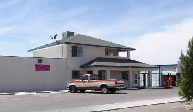

Property Detail
10560 N Loop Dr
T249-000-0010-0300
1 THREE MISSIONS SUBDIVISION 3 TO 5 (176352.66 SQ FT)
Commercialnec
EL PASO
C2
Texas
2024
4.05 AC
2025
East
010408
El Paso
77,290 SF
El Paso, TX
NEARBY LISTINGS FOR SALE OR LEASE
-
-
View all Socorro listings for sale on LoopNet.com
DEMOGRAPHICS near 10560 N Loop Dr
1 mile
3 mile
5 mile
2025 Total Population
8,751
52,108
134,759
2030 Population
8,773
53,595
137,804
Pop Growth 2025-2030
+ 0.25%
+ 2.85%
+ 2.26%
Average Age
37
36
36
2025 Total Households
2,687
15,850
41,393
HH Growth 2025-2030
+ 0.41%
+ 2.89%
+ 2.24%
Median Household Inc
$55,375
$55,607
$61,077
Avg Household Size
3.30
3.30
3.20
2025 Avg HH Vehicles
2.00
2.00
2.00
Median Home Value
$149,814
$166,069
$184,788
Median Year Built
1999
1997
2000
Nearby Places
Map Layers
Map Styles
 Street
 Aerial
Layers
 Traffic
 Biking
Places
Listings with unknown addresses are not visible on the map
- Restaurants
- Banks
- Shops
- Fitness
- Groceries
PUBLIC TRANSPORTATION
AIRPORT
El Paso International
Drive
Walk
Distance
El Paso International
33 min
16.6 mi
Nearby Properties
Address
Land Use
TOTAL SIZE
Lot Size
Zoning
Address
Land Use
TOTAL SIZE
Lot Size
Zoning
2,562,545 SF
62.04 AC
Address
Land Use
TOTAL SIZE
Lot Size
Zoning
770,870 SF
44.65 AC
Address
Land Use
TOTAL SIZE
Lot Size
Zoning
800,449 SF
50.57 AC
Address
Land Use
TOTAL SIZE
Lot Size
Zoning
393,206 SF
66.48 AC
SU
Address
Land Use
TOTAL SIZE
Lot Size
Zoning
953,000 SF
45.97 AC
M2
Address
Land Use
TOTAL SIZE
Lot Size
Zoning
123,306 SF
53.62 AC
M1
Address
Land Use
TOTAL SIZE
Lot Size
Zoning
109,039 SF
25.07 AC
Address
Land Use
TOTAL SIZE
Lot Size
Zoning
366,600 SF
21.24 AC
Address
Land Use
TOTAL SIZE
Lot Size
Zoning
392,214 SF
29.67 AC
Address
Land Use
TOTAL SIZE
Lot Size
Zoning
400,929 SF
30.05 AC
Address
Land Use
TOTAL SIZE
Lot Size
Zoning
652,080 SF
32.64 AC
Address
Land Use
TOTAL SIZE
Lot Size
Zoning
656,540 SF
36.94 AC
M1S
Address
Land Use
TOTAL SIZE
Lot Size
Zoning
127,840 SF
17.66 AC
Address
Land Use
TOTAL SIZE
Lot Size
Zoning
334,161 SF
20.28 AC
Address
Land Use
TOTAL SIZE
Lot Size
Zoning
230,263 SF
27.25 AC
C3S
Address
Land Use
TOTAL SIZE
Lot Size
Zoning
179,391 SF
8.23 AC
SD
Address
Land Use
TOTAL SIZE
Lot Size
Zoning
253,144 SF
3 AC
C2
Address
Land Use
TOTAL SIZE
Lot Size
Zoning
180,139 SF
24.81 AC
Address
Land Use
TOTAL SIZE
Lot Size
Zoning
450,900 SF
20.46 AC
M2
Address
Land Use
TOTAL SIZE
Lot Size
Zoning
110,080 SF
10.36 AC
Address
Land Use
TOTAL SIZE
Lot Size
Zoning
214,346 SF
11.90 AC
Address
Land Use
TOTAL SIZE
Lot Size
Zoning
475,547 SF
26.82 AC
Address
Land Use
TOTAL SIZE
Lot Size
Zoning
210,794 SF
13.90 AC
Address
Land Use
TOTAL SIZE
Lot Size
Zoning
79,402 SF
2.61 AC
Address
Land Use
TOTAL SIZE
Lot Size
Zoning
152,833 SF
9.75 AC
Address
Land Use
TOTAL SIZE
Lot Size
Zoning
80,499 SF
25.31 AC
Address
Land Use
TOTAL SIZE
Lot Size
Zoning
123,256 SF
39.56 AC
C4
Address
Land Use
TOTAL SIZE
Lot Size
Zoning
156,914 SF
10.37 AC
Address
Land Use
TOTAL SIZE
Lot Size
Zoning
64,991 SF
8.68 AC
Address
Land Use
TOTAL SIZE
Lot Size
Zoning
95,986 SF
4.19 AC
The World's #1 Commercial Real Estate Marketplace
Connect with us
© 2026 CoStar Group
The information above has been obtained from sources believed reliable. While we do not doubt its accuracy we have not verified it and make no guarantee, warranty or representation about it. It is your responsibility to independently confirm its accuracy and completeness. Any projections, opinions, assumptions, or estimates used are for example only and do not represent the current or future performance of the property. The value of this transaction to you depends on tax and other factors which should be evaluated by your tax, financial, and legal advisors. You and your advisors should conduct a careful, independent investigation of the property to determine to your satisfaction the suitability of the property for your needs.