Property Record
10568 Caledonia Rd, Belvidere, IL 61008

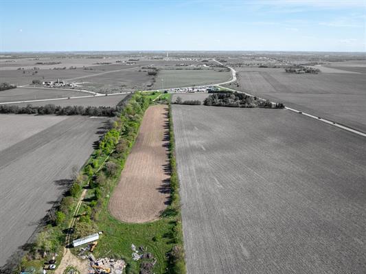
Property Detail
10568 Caledonia Rd
05-11-300-015
11-44-3 BEG 1472.88' NELY SW COR NW 1/4 E 980.42' NWLY 2265.75' SWLY 300' 2078.24' W 699.57' SELY 124.65' TO POB (EX COM W 1/
Commercialnec
Boone
B1
Illinois
B and X Area of moderate flood hazard, usually the area between the limits of the 100-year and 500-year floods.
4.53 AC
2025
Boone County
2025
Chicago
0105002056
Rockford, IL
1,125 SF
NEARBY LISTINGS FOR SALE OR LEASE
-
-
View all Belvidere listings for sale on LoopNet.com
DEMOGRAPHICS near 10568 Caledonia Rd
1 mile
3 mile
5 mile
2025 Total Population
1,173
14,440
46,050
2030 Population
1,157
14,472
46,186
Pop Growth 2025-2030
(1.36%)
+ 0.22%
+ 0.30%
Average Age
41
40
40
2025 Total Households
405
5,141
16,395
HH Growth 2025-2030
(1.23%)
+ 0.27%
+ 0.30%
Median Household Inc
$99,156
$87,838
$82,369
Avg Household Size
2.90
2.80
2.80
2025 Avg HH Vehicles
2.00
2.00
2.00
Median Home Value
$312,069
$242,525
$202,681
Median Year Built
1999
1989
1989
Nearby Places
Map Layers
Map Styles
 Street
 Aerial
Layers
 Traffic
 Biking
Places
Listings with unknown addresses are not visible on the map
- Restaurants
- Banks
- Shops
- Fitness
- Groceries
PUBLIC TRANSPORTATION
AIRPORT
Chicago/Rockford International
Drive
Walk
Distance
Chicago/Rockford International
35 min
22.2 mi
Freight Ports
Port Milwaukee
Drive
Walk
Distance
Port Milwaukee
101 min
82.8 mi
SALE & LEASE HISTORY
LISTING DATE
SALE/LEASE

Sep 24, 2016
For Sale
May 16, 2024
For Sale
Nearby Properties
Address
Land Use
TOTAL SIZE
Lot Size
Zoning
Address
Land Use
TOTAL SIZE
Lot Size
Zoning
76,993 SF
7.76 AC
Address
Land Use
TOTAL SIZE
Lot Size
Zoning
1,824 SF
45.62 AC
Address
Land Use
TOTAL SIZE
Lot Size
Zoning
1,946 SF
46.97 AC
Address
Land Use
TOTAL SIZE
Lot Size
Zoning
99,619 SF
7.84 AC
Address
Land Use
TOTAL SIZE
Lot Size
Zoning
100 SF
5.35 AC
R1
Address
Land Use
TOTAL SIZE
Lot Size
Zoning
78,208 SF
6.17 AC
Address
Land Use
TOTAL SIZE
Lot Size
Zoning
31,228 SF
4.63 AC
Address
Land Use
TOTAL SIZE
Lot Size
Zoning
38,731 SF
3.45 AC
Address
Land Use
TOTAL SIZE
Lot Size
Zoning
30,780 SF
2.72 AC
Address
Land Use
TOTAL SIZE
Lot Size
Zoning
32,918 SF
23.99 AC
Address
Land Use
TOTAL SIZE
Lot Size
Zoning
15,567 SF
2.79 AC
Address
Land Use
TOTAL SIZE
Lot Size
Zoning
24,540 SF
4.66 AC
Address
Land Use
TOTAL SIZE
Lot Size
Zoning
18,180 SF
3.14 AC
Address
Land Use
TOTAL SIZE
Lot Size
Zoning
146,145 SF
6.22 AC
Address
Land Use
TOTAL SIZE
Lot Size
Zoning
8,155 SF
6.23 AC
Address
Land Use
TOTAL SIZE
Lot Size
Zoning
1,800 SF
1.52 AC
Address
Land Use
TOTAL SIZE
Lot Size
Zoning
27,032 SF
3.08 AC
Address
Land Use
TOTAL SIZE
Lot Size
Zoning
10,080 SF
1.61 AC
Address
Land Use
TOTAL SIZE
Lot Size
Zoning
4,724 SF
0.38 AC
Address
Land Use
TOTAL SIZE
Lot Size
Zoning
17,312 SF
1.53 AC
Address
Land Use
TOTAL SIZE
Lot Size
Zoning
1,675 SF
7.11 AC
A1
Address
Land Use
TOTAL SIZE
Lot Size
Zoning
4,406 SF
5.66 AC
Address
Land Use
TOTAL SIZE
Lot Size
Zoning
11,284 SF
1.72 AC
Address
Land Use
TOTAL SIZE
Lot Size
Zoning
11,585 SF
2.10 AC
Address
Land Use
TOTAL SIZE
Lot Size
Zoning
1,448 SF
1.30 AC
110
Address
Land Use
TOTAL SIZE
Lot Size
Zoning
51,766 SF
2.06 AC
Address
Land Use
TOTAL SIZE
Lot Size
Zoning
11,284 SF
1.71 AC
A1
Address
Land Use
TOTAL SIZE
Lot Size
Zoning
13,495 SF
2.02 AC
Address
Land Use
TOTAL SIZE
Lot Size
Zoning
27,440 SF
1.82 AC
Address
Land Use
TOTAL SIZE
Lot Size
Zoning
3,247 SF
1.47 AC
The World's #1 Commercial Real Estate Marketplace
Connect with us
© 2026 CoStar Group
The information above has been obtained from sources believed reliable. While we do not doubt its accuracy we have not verified it and make no guarantee, warranty or representation about it. It is your responsibility to independently confirm its accuracy and completeness. Any projections, opinions, assumptions, or estimates used are for example only and do not represent the current or future performance of the property. The value of this transaction to you depends on tax and other factors which should be evaluated by your tax, financial, and legal advisors. You and your advisors should conduct a careful, independent investigation of the property to determine to your satisfaction the suitability of the property for your needs.