Property Record
10571 Normandy Blvd, Jacksonville, FL 32221

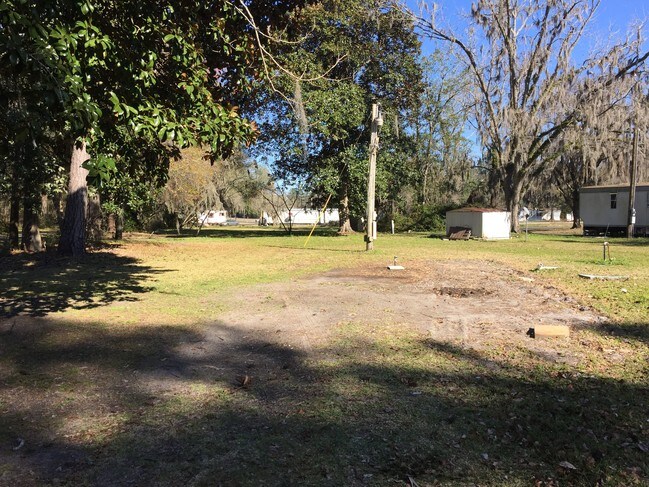
This Property Is For Sale
Property Detail
10571 Normandy Blvd
012774-0010
5-93 06-3S-25E .41 JACKSONVILLE HEIGHTS PT TRACT 5 RECD O/R 11907-3 BLK 1
Commercialacreage
DUVAL
CO
Florida
B and X Area of moderate flood hazard, usually the area between the limits of the 100-year and 500-year floods.
5
2025
0.98 AC
2026
Riverside
011904
Jacksonville (Florida)
728 SF
Jacksonville, FL
NEARBY LISTINGS FOR SALE OR LEASE
DEMOGRAPHICS near 10571 Normandy Blvd
1 mile
3 mile
5 mile
2024 Total Population
5,118
38,841
105,127
2029 Population
5,445
41,415
112,085
Pop Growth 2024-2029
+ 6.39%
+ 6.63%
+ 6.62%
Average Age
38
37
38
2024 Total Households
1,769
13,613
38,138
HH Growth 2024-2029
+ 6.61%
+ 6.83%
+ 6.86%
Median Household Inc
$101,323
$82,385
$70,700
Avg Household Size
2.90
2.80
2.70
2024 Avg HH Vehicles
2.00
2.00
2.00
Median Home Value
$330,537
$310,104
$270,952
Median Year Built
2003
2002
1995
Nearby Places
Map Layers
Map Styles
 Street
 Aerial
Transit
 Traffic
 Biking
Places
Listings with unknown addresses are not visible on the map
- Restaurants
- Banks
- Shops
- Fitness
- Groceries
PUBLIC TRANSPORTATION
AIRPORT
Jacksonville International
Drive
Walk
Distance
Jacksonville International
33 min
22.6 mi
Freight Ports
Jacksonville Port
Drive
Walk
Distance
Jacksonville Port
27 min
15.8 mi
Nearby Properties
Address
Land Use
TOTAL SIZE
Lot Size
Zoning
Address
Land Use
TOTAL SIZE
Lot Size
Zoning
1,020,863 SF
85.89 AC
PUD
Address
Land Use
TOTAL SIZE
Lot Size
Zoning
1,014,416 SF
80.58 AC
PUD
Address
Land Use
TOTAL SIZE
Lot Size
Zoning
557,137 SF
40.70 AC
PUD
Address
Land Use
TOTAL SIZE
Lot Size
Zoning
239,891 SF
21.95 AC
CRO
Address
Land Use
TOTAL SIZE
Lot Size
Zoning
185,662 SF
1,416.80 AC
PBF-3
Address
Land Use
TOTAL SIZE
Lot Size
Zoning
410,800 SF
35.51 AC
PUD
Address
Land Use
TOTAL SIZE
Lot Size
Zoning
221,429 SF
15.42 AC
PUD
Address
Land Use
TOTAL SIZE
Lot Size
Zoning
307,960 SF
18.52 AC
PUD
Address
Land Use
TOTAL SIZE
Lot Size
Zoning
375,127 SF
18.65 AC
PUD
Address
Land Use
TOTAL SIZE
Lot Size
Zoning
509,686 SF
43.32 AC
IL
Address
Land Use
TOTAL SIZE
Lot Size
Zoning
139,435 SF
7.15 AC
CCG-2
Address
Land Use
TOTAL SIZE
Lot Size
Zoning
88,000 SF
11.28 AC
CCG-1
Address
Land Use
TOTAL SIZE
Lot Size
Zoning
136,599 SF
47.95 AC
PBF-2
Address
Land Use
TOTAL SIZE
Lot Size
Zoning
65,052 SF
15.97 AC
PUD
Address
Land Use
TOTAL SIZE
Lot Size
Zoning
30,789 SF
2.10 AC
PUD
Address
Land Use
TOTAL SIZE
Lot Size
Zoning
160,778 SF
25.46 AC
IL
Address
Land Use
TOTAL SIZE
Lot Size
Zoning
108,217 SF
178.52 AC
PBF-1
Address
Land Use
TOTAL SIZE
Lot Size
Zoning
6,792 SF
53.56 AC
PUD
Address
Land Use
TOTAL SIZE
Lot Size
Zoning
80,512 SF
4.05 AC
PUD
Address
Land Use
TOTAL SIZE
Lot Size
Zoning
153,549 SF
15.96 AC
PBF-1
Address
Land Use
TOTAL SIZE
Lot Size
Zoning
29,022 SF
3.17 AC
PUD
Address
Land Use
TOTAL SIZE
Lot Size
Zoning
66,892 SF
9.62 AC
PUD
Address
Land Use
TOTAL SIZE
Lot Size
Zoning
33,424 SF
2.97 AC
PUD
Address
Land Use
TOTAL SIZE
Lot Size
Zoning
89,759 SF
7.05 AC
RMD-D
Address
Land Use
TOTAL SIZE
Lot Size
Zoning
53,527 SF
10.89 AC
CCG-1
Address
Land Use
TOTAL SIZE
Lot Size
Zoning
53,405 SF
6.04 AC
PUD
Address
Land Use
TOTAL SIZE
Lot Size
Zoning
61,580 SF
15.40 AC
RMD-MH
Address
Land Use
TOTAL SIZE
Lot Size
Zoning
36,354 SF
3.72 AC
CCG-1
Address
Land Use
TOTAL SIZE
Lot Size
Zoning
23,532 SF
3.58 AC
CCG-2
Address
Land Use
TOTAL SIZE
Lot Size
Zoning
9,554 SF
2.85 AC
PUD
The World's #1 Commercial Real Estate Marketplace
Connect with us
© 2026 CoStar Group
The information above has been obtained from sources believed reliable. While we do not doubt its accuracy we have not verified it and make no guarantee, warranty or representation about it. It is your responsibility to independently confirm its accuracy and completeness. Any projections, opinions, assumptions, or estimates used are for example only and do not represent the current or future performance of the property. The value of this transaction to you depends on tax and other factors which should be evaluated by your tax, financial, and legal advisors. You and your advisors should conduct a careful, independent investigation of the property to determine to your satisfaction the suitability of the property for your needs.