Property Record
10579 Cedar Grove Rd, Smyrna, TN 37167


Property Detail
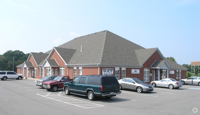
10579 Cedar Grove Rd
028-120.06-000
KATIE BARRETT PB 26 PG 74
Officebuilding
Rutherford
C2
Tennessee
B and X Area of moderate flood hazard, usually the area between the limits of the 100-year and 500-year floods.
1
0
1.08 AC
2025
Rutherford County
040311
Nashville
9,600 SF
Nashville-Davidson--Murfreesboro--Franklin, TN
NEARBY LISTINGS FOR SALE OR LEASE
DEMOGRAPHICS near 10579 Cedar Grove Rd
1 mile
3 mile
5 mile
2025 Total Population
7,098
55,532
117,146
2030 Population
7,823
60,428
126,983
Pop Growth 2025-2030
+ 10.21%
+ 8.82%
+ 8.40%
Average Age
38
37
37
2025 Total Households
2,591
19,936
40,690
HH Growth 2025-2030
+ 10.30%
+ 8.86%
+ 8.51%
Median Household Inc
$89,713
$81,714
$86,193
Avg Household Size
2.60
2.70
2.80
2025 Avg HH Vehicles
2.00
2.00
2.00
Median Home Value
$386,371
$361,035
$372,383
Median Year Built
2004
2000
2000
Nearby Places
Map Layers
Map Styles
 Street
 Aerial
Transit
 Traffic
 Biking
Places
Listings with unknown addresses are not visible on the map
- Restaurants
- Banks
- Shops
- Fitness
- Groceries
PUBLIC TRANSPORTATION
AIRPORT
Nashville International
Drive
Walk
Distance
Nashville International
21 min
14.8 mi
SALE & LEASE HISTORY
LISTING DATE
SALE/LEASE

Sep 25, 2016
For Lease
Mar 05, 2018
For Lease
Feb 21, 2019
For Lease
Nearby Properties
Address
Land Use
TOTAL SIZE
Lot Size
Zoning
Address
Land Use
TOTAL SIZE
Lot Size
Zoning
404,723 SF
1,495 AC
Address
Land Use
TOTAL SIZE
Lot Size
Zoning
302,040 SF
60 AC
Address
Land Use
TOTAL SIZE
Lot Size
Zoning
618,332 SF
45.75 AC
Address
Land Use
TOTAL SIZE
Lot Size
Zoning
564,124 SF
37.66 AC
Address
Land Use
TOTAL SIZE
Lot Size
Zoning
377,869 SF
26.47 AC
Address
Land Use
TOTAL SIZE
Lot Size
Zoning
22,099 SF
18.58 AC
Address
Land Use
TOTAL SIZE
Lot Size
Zoning
323,961 SF
27.38 AC
I-2
Address
Land Use
TOTAL SIZE
Lot Size
Zoning
4,709 SF
25.76 AC
RM14
Address
Land Use
TOTAL SIZE
Lot Size
Zoning
17,953 SF
14.92 AC
Address
Land Use
TOTAL SIZE
Lot Size
Zoning
1,007,188 SF
82.08 AC
Address
Land Use
TOTAL SIZE
Lot Size
Zoning
5,352 SF
30 AC
RMF
Address
Land Use
TOTAL SIZE
Lot Size
Zoning
4,974 SF
18.91 AC
C2
Address
Land Use
TOTAL SIZE
Lot Size
Zoning
301,272 SF
26.09 AC
Address
Land Use
TOTAL SIZE
Lot Size
Zoning
588,845 SF
72.56 AC
Address
Land Use
TOTAL SIZE
Lot Size
Zoning
163,177 SF
39.68 AC
Address
Land Use
TOTAL SIZE
Lot Size
Zoning
99,209 SF
44.41 AC
Address
Land Use
TOTAL SIZE
Lot Size
Zoning
2,928 SF
13.60 AC
Address
Land Use
TOTAL SIZE
Lot Size
Zoning
202,737 SF
41 AC
Address
Land Use
TOTAL SIZE
Lot Size
Zoning
132,470 SF
42.16 AC
Address
Land Use
TOTAL SIZE
Lot Size
Zoning
768,304 SF
40.03 AC
I-2
Address
Land Use
TOTAL SIZE
Lot Size
Zoning
212,268 SF
49 AC
Address
Land Use
TOTAL SIZE
Lot Size
Zoning
304,456 SF
40.14 AC
Address
Land Use
TOTAL SIZE
Lot Size
Zoning
3,142 SF
11.40 AC
C2
Address
Land Use
TOTAL SIZE
Lot Size
Zoning
105,638 SF
17.63 AC
Address
Land Use
TOTAL SIZE
Lot Size
Zoning
121,104 SF
30 AC
Address
Land Use
TOTAL SIZE
Lot Size
Zoning
3,296 SF
14.63 AC
Address
Land Use
TOTAL SIZE
Lot Size
Zoning
22,500 SF
23.38 AC
RM16
Address
Land Use
TOTAL SIZE
Lot Size
Zoning
503,475 SF
22.24 AC
I2
Address
Land Use
TOTAL SIZE
Lot Size
Zoning
121,104 SF
43.60 AC
Address
Land Use
TOTAL SIZE
Lot Size
Zoning
536,732 SF
30.91 AC
I2
The World's #1 Commercial Real Estate Marketplace
Connect with us
© 2026 CoStar Group
The information above has been obtained from sources believed reliable. While we do not doubt its accuracy we have not verified it and make no guarantee, warranty or representation about it. It is your responsibility to independently confirm its accuracy and completeness. Any projections, opinions, assumptions, or estimates used are for example only and do not represent the current or future performance of the property. The value of this transaction to you depends on tax and other factors which should be evaluated by your tax, financial, and legal advisors. You and your advisors should conduct a careful, independent investigation of the property to determine to your satisfaction the suitability of the property for your needs.