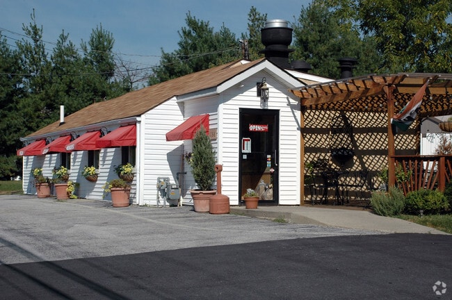
Property Record
1058 Egypt Rd, Phoenixville, PA 19460


NEARBY LISTINGS FOR SALE OR LEASE
Property Detail
1058 Egypt Rd
Philadelphia-Camden-Wilmington, PA-NJ-DE-MD
Plan For The Howard E Famous Estate
61-00-01355-006
ASSESSOR BLOCK-UNIT NUMBER 46-30
Commercialnec
Montgomery
X
Pennsylvania
42029C0065G
30
2024
0.64 AC
2025
Norristown/Valley Forge
300700
Philadelphia
1,056 SF
DEMOGRAPHICS near 1058 Egypt Rd
1 Mile
3 Mile
5 Mile
2024 Total Population
4,329
44,850
131,733
2029 Population
4,300
46,073
135,535
Pop Growth 2024-2029
(0.67%)
+ 2.73%
+ 2.89%
Average Age
41
40
41
2024 Total Households
1,643
16,777
52,472
HH Growth 2024-2029
(0.61%)
+ 2.96%
+ 3.03%
Median Household Inc
$122,510
$113,254
$109,836
Avg Household Size
2.60
2.50
2.40
2024 Avg HH Vehicles
2.00
2.00
2.00
Median Home Value
$454,857
$413,461
$392,294
Median Year Built
1999
1985
1983
Nearby Places
Map Layers
Map Styles
 Street
 Aerial
- Restaurants
- Banks
- Shops
- Fitness
- Groceries
PUBLIC TRANSPORTATION
AIRPORT
Philadelphia International
DRIVE
WALK
Distance
Philadelphia International
43 min
33.6 mi
SALE & LEASE HISTORY
LISTING DATE
SALE/LEASE

Sep 25, 2017
For Sale
Nov 16, 2017
For Sale
Jan 17, 2019
For Sale
Dec 23, 2017
For Sale
Dec 20, 2016
For Sale
Nearby Properties
Address
Land Use
TOTAL SIZE
Lot Size
Zoning
Address
Land Use
TOTAL SIZE
Lot Size
Zoning
1,113,725 SF
196.05 AC
IO
Address
Land Use
TOTAL SIZE
Lot Size
Zoning
989,814 SF
8.87 AC
IO
Address
Land Use
TOTAL SIZE
Lot Size
Zoning
768,913 SF
81.88 AC
IO
Address
Land Use
TOTAL SIZE
Lot Size
Zoning
50,149 SF
26.72 AC
I/L1
Address
Land Use
TOTAL SIZE
Lot Size
Zoning
58,212 SF
20.89 AC
M2
Address
Land Use
TOTAL SIZE
Lot Size
Zoning
1,145,005 SF
149.21 AC
IO
Address
Land Use
TOTAL SIZE
Lot Size
Zoning
404,279 SF
22 AC
PFZ
Address
Land Use
TOTAL SIZE
Lot Size
Zoning
634,096 SF
3.09 AC
IO
Address
Land Use
TOTAL SIZE
Lot Size
Zoning
348,190 SF
68 AC
R1
Address
Land Use
TOTAL SIZE
Lot Size
Zoning
1,470,449 SF
80.02 AC
R1
Address
Land Use
TOTAL SIZE
Lot Size
Zoning
400,875 SF
32.32 AC
IO
Address
Land Use
TOTAL SIZE
Lot Size
Zoning
363,603 SF
10.42 AC
LC
Address
Land Use
TOTAL SIZE
Lot Size
Zoning
420,080 SF
7.33 AC
FCE
Address
Land Use
TOTAL SIZE
Lot Size
Zoning
425,170 SF
23 AC
FCE
Address
Land Use
TOTAL SIZE
Lot Size
Zoning
435,884 SF
26.70 AC
R5
Address
Land Use
TOTAL SIZE
Lot Size
Zoning
204,483 SF
25.02 AC
IO
Address
Land Use
TOTAL SIZE
Lot Size
Zoning
347,779 SF
32.59 AC
IN
Address
Land Use
TOTAL SIZE
Lot Size
Zoning
811,455 SF
18.15 AC
M1
Address
Land Use
TOTAL SIZE
Lot Size
Zoning
2,112 SF
5.06 AC
LI/O
Address
Land Use
TOTAL SIZE
Lot Size
Zoning
1,305,221 SF
21.99 AC
M1
Address
Land Use
TOTAL SIZE
Lot Size
Zoning
7.35 AC
FCE
Address
Land Use
TOTAL SIZE
Lot Size
Zoning
132,002 SF
0.41 AC
LICO1
Address
Land Use
TOTAL SIZE
Lot Size
Zoning
225,716 SF
46.49 AC
R1
Address
Land Use
TOTAL SIZE
Lot Size
Zoning
47,276 SF
20.60 AC
R2
Address
Land Use
TOTAL SIZE
Lot Size
Zoning
127,778 SF
13.43 AC
IP
Address
Land Use
TOTAL SIZE
Lot Size
Zoning
86,046 SF
12.03 AC
R1
Address
Land Use
TOTAL SIZE
Lot Size
Zoning
102,279 SF
17.15 AC
R1
Address
Land Use
TOTAL SIZE
Lot Size
Zoning
99,983 SF
10.41 AC
IP
Address
Land Use
TOTAL SIZE
Lot Size
Zoning
90,300 SF
2.70 AC
PFZ
Address
Land Use
TOTAL SIZE
Lot Size
Zoning
86,632 SF
3.88 AC
M1
The World's #1 Commercial Real Estate Marketplace
Connect with us
© 2026 CoStar Group
The information above has been obtained from sources believed reliable. While we do not doubt its accuracy we have not verified it and make no guarantee, warranty or representation about it. It is your responsibility to independently confirm its accuracy and completeness. Any projections, opinions, assumptions, or estimates used are for example only and do not represent the current or future performance of the property. The value of this transaction to you depends on tax and other factors which should be evaluated by your tax, financial, and legal advisors. You and your advisors should conduct a careful, independent investigation of the property to determine to your satisfaction the suitability of the property for your needs.