Property Record
1058 Unser Blvd Se, Rio Rancho, NM 87124


Property Detail
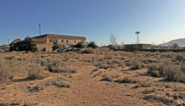
1058 Unser Blvd Se
Albuquerque, NM
LEGAL: SUBD: RIO RANCHO ESTATES BLOCK: EE LOT: 19A1 UNIT: 16
1-011-068-387-287
SANDOVAL
Vacantlandnec
New Mexico
B and X Area of moderate flood hazard, usually the area between the limits of the 100-year and 500-year floods.
19a1
2024
1.23 AC
2025
Rio Rancho
010731
Albuquerque
4,796 SF
NEARBY LISTINGS FOR SALE OR LEASE
DEMOGRAPHICS near 1058 Unser Blvd Se
1 mile
3 mile
5 mile
2025 Total Population
12,391
79,664
150,090
2030 Population
12,830
81,645
152,580
Pop Growth 2025-2030
+ 3.54%
+ 2.49%
+ 1.66%
Average Age
39
41
40
2025 Total Households
4,303
30,014
56,634
HH Growth 2025-2030
+ 3.65%
+ 2.42%
+ 1.56%
Median Household Inc
$90,871
$83,388
$85,937
Avg Household Size
2.80
2.60
2.60
2025 Avg HH Vehicles
2.00
2.00
2.00
Median Home Value
$310,413
$317,047
$327,493
Median Year Built
1996
1997
1997
Nearby Places
Map Layers
Map Styles
 Street
 Aerial
Transit
 Traffic
 Biking
Places
Listings with unknown addresses are not visible on the map
- Restaurants
- Banks
- Shops
- Fitness
- Groceries
PUBLIC TRANSPORTATION
COMMUTER RAIL
Drive
Walk
Distance
19 min
9.3 mi
Drive
Walk
Distance
19 min
9.7 mi
AIRPORT
Albuquerque International Sunport
Drive
Walk
Distance
Albuquerque International Sunport
47 min
23.2 mi
Nearby Properties
Address
Land Use
TOTAL SIZE
Lot Size
Zoning
Address
Land Use
TOTAL SIZE
Lot Size
Zoning
2,095,144 SF
123.59 AC
Address
Land Use
TOTAL SIZE
Lot Size
Zoning
1,087,991 SF
55.76 AC
Address
Land Use
TOTAL SIZE
Lot Size
Zoning
494,839 SF
37.05 AC
Address
Land Use
TOTAL SIZE
Lot Size
Zoning
212,122 SF
9.99 AC
Address
Land Use
TOTAL SIZE
Lot Size
Zoning
381,500 SF
111.32 AC
Address
Land Use
TOTAL SIZE
Lot Size
Zoning
67,905 SF
4.25 AC
Address
Land Use
TOTAL SIZE
Lot Size
Zoning
221,360 SF
8.78 AC
Address
Land Use
TOTAL SIZE
Lot Size
Zoning
176,140 SF
6.15 AC
Address
Land Use
TOTAL SIZE
Lot Size
Zoning
100.17 AC
Address
Land Use
TOTAL SIZE
Lot Size
Zoning
Address
Land Use
TOTAL SIZE
Lot Size
Zoning
36,528 SF
13.05 AC
Address
Land Use
TOTAL SIZE
Lot Size
Zoning
25,668 SF
22.52 AC
Address
Land Use
TOTAL SIZE
Lot Size
Zoning
93,440 SF
12.91 AC
Address
Land Use
TOTAL SIZE
Lot Size
Zoning
66,000 SF
85.14 AC
Address
Land Use
TOTAL SIZE
Lot Size
Zoning
307,481 SF
17.50 AC
Address
Land Use
TOTAL SIZE
Lot Size
Zoning
137,071 SF
8.30 AC
Address
Land Use
TOTAL SIZE
Lot Size
Zoning
62,881 SF
4.67 AC
Address
Land Use
TOTAL SIZE
Lot Size
Zoning
214,871 SF
20.04 AC
Address
Land Use
TOTAL SIZE
Lot Size
Zoning
142,351 SF
7.59 AC
Address
Land Use
TOTAL SIZE
Lot Size
Zoning
124,106 SF
30.54 AC
Address
Land Use
TOTAL SIZE
Lot Size
Zoning
126,044 SF
4.48 AC
Address
Land Use
TOTAL SIZE
Lot Size
Zoning
68,123 SF
6.81 AC
Address
Land Use
TOTAL SIZE
Lot Size
Zoning
143,736 SF
9.91 AC
Address
Land Use
TOTAL SIZE
Lot Size
Zoning
75,911 SF
6.80 AC
Address
Land Use
TOTAL SIZE
Lot Size
Zoning
73,234 SF
16.50 AC
Address
Land Use
TOTAL SIZE
Lot Size
Zoning
94,354 SF
7.96 AC
Address
Land Use
TOTAL SIZE
Lot Size
Zoning
128,972 SF
13.20 AC
Address
Land Use
TOTAL SIZE
Lot Size
Zoning
48,209 SF
4.86 AC
Address
Land Use
TOTAL SIZE
Lot Size
Zoning
64,749 SF
6.21 AC
Address
Land Use
TOTAL SIZE
Lot Size
Zoning
73,234 SF
17.58 AC
The World's #1 Commercial Real Estate Marketplace
Connect with us
© 2026 CoStar Group
The information above has been obtained from sources believed reliable. While we do not doubt its accuracy we have not verified it and make no guarantee, warranty or representation about it. It is your responsibility to independently confirm its accuracy and completeness. Any projections, opinions, assumptions, or estimates used are for example only and do not represent the current or future performance of the property. The value of this transaction to you depends on tax and other factors which should be evaluated by your tax, financial, and legal advisors. You and your advisors should conduct a careful, independent investigation of the property to determine to your satisfaction the suitability of the property for your needs.