Property Record
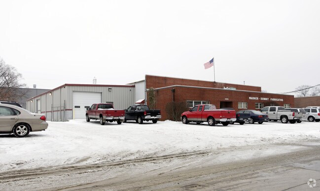
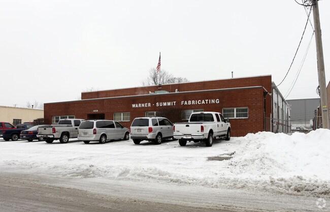
1059 Eagon St, Barberton, OH 44203

Property Detail
1059 Eagon St
Akron, OH
TR 1 LOT 5 29FT FRT ON PRIVATE DR
01-01803
Summit
Industrialgeneral
Ohio
AE The base floodplain where base flood elevations are provided. AE Zones are now used on new format FIRMs instead of A1-A30 Zones.
5
2023
0.59 AC
2025
Akron
510200
Cleveland
34,568 SF
NEARBY LISTINGS FOR SALE OR LEASE
DEMOGRAPHICS near 1059 Eagon St
1 mile
3 mile
5 mile
2025 Total Population
9,666
55,872
148,978
2030 Population
9,654
55,989
149,554
Pop Growth 2025-2030
(0.12%)
+ 0.21%
+ 0.39%
Average Age
41
41
41
2025 Total Households
4,274
24,396
64,853
HH Growth 2025-2030
(0.07%)
+ 0.17%
+ 0.34%
Median Household Inc
$52,935
$47,806
$48,784
Avg Household Size
2.20
2.20
2.20
2025 Avg HH Vehicles
2.00
2.00
2.00
Median Home Value
$103,330
$128,267
$139,826
Median Year Built
1952
1954
1953
Nearby Places
Map Layers
Map Styles
 Street
 Aerial
Transit
 Traffic
 Biking
Places
Listings with unknown addresses are not visible on the map
- Restaurants
- Banks
- Shops
- Fitness
- Groceries
PUBLIC TRANSPORTATION
COMMUTER RAIL
Drive
Walk
Distance
12 min
6.3 mi
Drive
Walk
Distance
18 min
8.8 mi
AIRPORT
Akron-Canton Regional
Drive
Walk
Distance
Akron-Canton Regional
20 min
13.7 mi
Cleveland-Hopkins International
Drive
Walk
Distance
Cleveland-Hopkins International
58 min
40.7 mi
Nearby Properties
Address
Land Use
TOTAL SIZE
Lot Size
Zoning
Address
Land Use
TOTAL SIZE
Lot Size
Zoning
1,397,532 SF
92.95 AC
Address
Land Use
TOTAL SIZE
Lot Size
Zoning
252,222 SF
12.65 AC
Address
Land Use
TOTAL SIZE
Lot Size
Zoning
9.19 AC
Address
Land Use
TOTAL SIZE
Lot Size
Zoning
Address
Land Use
TOTAL SIZE
Lot Size
Zoning
132,611 SF
3.56 AC
Address
Land Use
TOTAL SIZE
Lot Size
Zoning
91,678 SF
5.24 AC
Address
Land Use
TOTAL SIZE
Lot Size
Zoning
Address
Land Use
TOTAL SIZE
Lot Size
Zoning
166,625 SF
11.37 AC
Address
Land Use
TOTAL SIZE
Lot Size
Zoning
Address
Land Use
TOTAL SIZE
Lot Size
Zoning
227,634 SF
21.46 AC
Address
Land Use
TOTAL SIZE
Lot Size
Zoning
184,791 SF
3.25 AC
Address
Land Use
TOTAL SIZE
Lot Size
Zoning
Address
Land Use
TOTAL SIZE
Lot Size
Zoning
121,006 SF
6.09 AC
Address
Land Use
TOTAL SIZE
Lot Size
Zoning
295,142 SF
24.69 AC
Address
Land Use
TOTAL SIZE
Lot Size
Zoning
87,486 SF
7.25 AC
Address
Land Use
TOTAL SIZE
Lot Size
Zoning
57,180 SF
6.67 AC
Address
Land Use
TOTAL SIZE
Lot Size
Zoning
148.10 AC
Address
Land Use
TOTAL SIZE
Lot Size
Zoning
142,266 SF
8.15 AC
Address
Land Use
TOTAL SIZE
Lot Size
Zoning
81,108 SF
3.86 AC
Address
Land Use
TOTAL SIZE
Lot Size
Zoning
253,690 SF
12.18 AC
Address
Land Use
TOTAL SIZE
Lot Size
Zoning
65,436 SF
34.63 AC
Address
Land Use
TOTAL SIZE
Lot Size
Zoning
130,893 SF
11.70 AC
Address
Land Use
TOTAL SIZE
Lot Size
Zoning
Address
Land Use
TOTAL SIZE
Lot Size
Zoning
59,492 SF
5.51 AC
Address
Land Use
TOTAL SIZE
Lot Size
Zoning
65,436 SF
34.84 AC
Address
Land Use
TOTAL SIZE
Lot Size
Zoning
994,273 SF
58.70 AC
Address
Land Use
TOTAL SIZE
Lot Size
Zoning
112,894 SF
12.26 AC
Address
Land Use
TOTAL SIZE
Lot Size
Zoning
77,444 SF
13.02 AC
Address
Land Use
TOTAL SIZE
Lot Size
Zoning
113,321 SF
13.32 AC
Address
Land Use
TOTAL SIZE
Lot Size
Zoning
53,074 SF
7.29 AC
The World's #1 Commercial Real Estate Marketplace
Connect with us
© 2026 CoStar Group
The information above has been obtained from sources believed reliable. While we do not doubt its accuracy we have not verified it and make no guarantee, warranty or representation about it. It is your responsibility to independently confirm its accuracy and completeness. Any projections, opinions, assumptions, or estimates used are for example only and do not represent the current or future performance of the property. The value of this transaction to you depends on tax and other factors which should be evaluated by your tax, financial, and legal advisors. You and your advisors should conduct a careful, independent investigation of the property to determine to your satisfaction the suitability of the property for your needs.