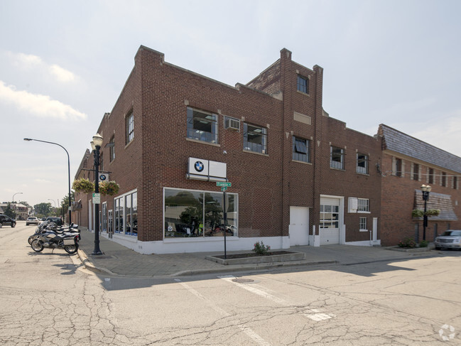
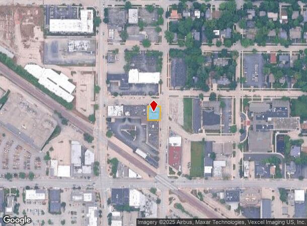
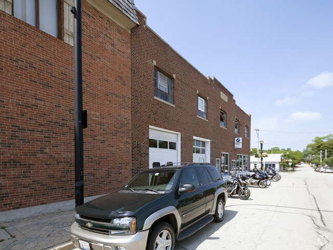
Property Record
126 N Cook St, Barrington, IL 60010
NEARBY LISTINGS FOR SALE OR LEASE
Property Detail
126 N Cook St
Chicago-Naperville-Elgin, IL-IN-WI
Village Of Barrington
13-36-318-004
VILLAGE OF BARRINGTON;PT LT1&2 BLK C BEGAT X OF S LN FRANKLI N ST&W LN COOK ST,S 80.5, W // TO SD S LN 70,N // TO W LN 80.5 TO S LN FRANKLIN ST,E ALG S LN TO POB BLOCK C
Commercialbuilding
Lake
X
Illinois
17097C0219K
1,2
2023
0.13 AC
2024
Central Northwest
864308
Chicago
DEMOGRAPHICS near 126 N Cook St
1 Mile
3 Mile
5 Mile
2024 Total Population
8,510
24,835
89,625
2029 Population
8,344
24,336
87,832
Pop Growth 2024-2029
(1.95%)
(2.01%)
(2.00%)
Average Age
43
43
43
2024 Total Households
3,302
8,878
32,908
HH Growth 2024-2029
(2.15%)
(2.19%)
(2.20%)
Median Household Inc
$127,900
$152,376
$133,257
Avg Household Size
2.50
2.70
2.70
2024 Avg HH Vehicles
2.00
2.00
2.00
Median Home Value
$513,620
$567,076
$449,091
Median Year Built
1968
1976
1980
Nearby Places
- Restaurants
- Banks
- Shops
- Fitness
- Groceries
PUBLIC TRANSPORTATION
COMMUTER RAIL
Barrington Station (Union Pacific Northwest Line - Northeast Illinois Regional Commuter Railroad (Metra))
DRIVE
WALK
Distance
Barrington Station (Union Pacific Northwest Line - Northeast Illinois Regional Commuter Railroad (Metra))
1 min
5 min
0.3 mi
Fox River Grove Station (Union Pacific Northwest Line - Northeast Illinois Regional Commuter Railroad (Metra))
DRIVE
WALK
Distance
Fox River Grove Station (Union Pacific Northwest Line - Northeast Illinois Regional Commuter Railroad (Metra))
9 min
5.7 mi
AIRPORT
Chicago O'Hare International
DRIVE
WALK
Distance
Chicago O'Hare International
34 min
23.0 mi
Freight Ports
Port Milwaukee
DRIVE
WALK
Distance
Port Milwaukee
92 min
69.6 mi
Nearby Properties
Address
Land Use
TOTAL SIZE
Lot Size
Zoning
Address
Land Use
TOTAL SIZE
Lot Size
Zoning
30.07 AC
Address
Land Use
TOTAL SIZE
Lot Size
Zoning
12.80 AC
Address
Land Use
TOTAL SIZE
Lot Size
Zoning
1.17 AC
Address
Land Use
TOTAL SIZE
Lot Size
Zoning
10.21 AC
Address
Land Use
TOTAL SIZE
Lot Size
Zoning
57,293 SF
5.53 AC
Address
Land Use
TOTAL SIZE
Lot Size
Zoning
9.44 AC
Address
Land Use
TOTAL SIZE
Lot Size
Zoning
Address
Land Use
TOTAL SIZE
Lot Size
Zoning
7.52 AC
Address
Land Use
TOTAL SIZE
Lot Size
Zoning
Address
Land Use
TOTAL SIZE
Lot Size
Zoning
25.70 AC
Address
Land Use
TOTAL SIZE
Lot Size
Zoning
13.68 AC
Address
Land Use
TOTAL SIZE
Lot Size
Zoning
20.54 AC
Address
Land Use
TOTAL SIZE
Lot Size
Zoning
107,982 SF
8.12 AC
Address
Land Use
TOTAL SIZE
Lot Size
Zoning
100,527 SF
3.22 AC
Address
Land Use
TOTAL SIZE
Lot Size
Zoning
6.45 AC
Address
Land Use
TOTAL SIZE
Lot Size
Zoning
Address
Land Use
TOTAL SIZE
Lot Size
Zoning
Address
Land Use
TOTAL SIZE
Lot Size
Zoning
Address
Land Use
TOTAL SIZE
Lot Size
Zoning
20.71 AC
Address
Land Use
TOTAL SIZE
Lot Size
Zoning
Address
Land Use
TOTAL SIZE
Lot Size
Zoning
5.42 AC
Address
Land Use
TOTAL SIZE
Lot Size
Zoning
93,482 SF
4.75 AC
Address
Land Use
TOTAL SIZE
Lot Size
Zoning
Address
Land Use
TOTAL SIZE
Lot Size
Zoning
19.14 AC
Address
Land Use
TOTAL SIZE
Lot Size
Zoning
0.64 AC
Address
Land Use
TOTAL SIZE
Lot Size
Zoning
2.12 AC
Address
Land Use
TOTAL SIZE
Lot Size
Zoning
Address
Land Use
TOTAL SIZE
Lot Size
Zoning
2,852 SF
15.66 AC
Address
Land Use
TOTAL SIZE
Lot Size
Zoning
1.26 AC
Address
Land Use
TOTAL SIZE
Lot Size
Zoning
265,471 SF
18.48 AC
The World's #1 Commercial Real Estate Marketplace
Connect with us
© 2025 CoStar Group
The information above has been obtained from sources believed reliable. While we do not doubt its accuracy we have not verified it and make no guarantee, warranty or representation about it. It is your responsibility to independently confirm its accuracy and completeness. Any projections, opinions, assumptions, or estimates used are for example only and do not represent the current or future performance of the property. The value of this transaction to you depends on tax and other factors which should be evaluated by your tax, financial, and legal advisors. You and your advisors should conduct a careful, independent investigation of the property to determine to your satisfaction the suitability of the property for your needs.