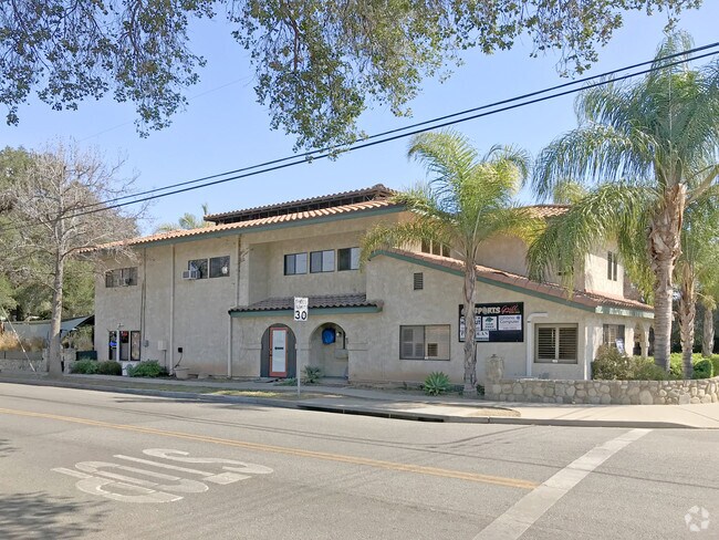
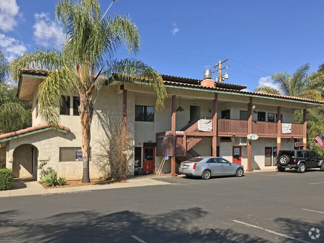
Property Record
106 E El Roblar Dr, Ojai, CA 93023


Property Detail
106 E El Roblar Dr
017-0-090-470
PR APN 0170090310
Storesoffices
Ventura
CPD
California
B and X Area of moderate flood hazard, usually the area between the limits of the 100-year and 500-year floods.
0.35 AC
2024
Ojai/NW County
2025
Los Angeles
001002
Oxnard-Thousand Oaks-Ventura, CA
3,767 SF
NEARBY LISTINGS FOR SALE OR LEASE
DEMOGRAPHICS near 106 E El Roblar Dr
1 mile
3 mile
5 mile
2025 Total Population
5,604
19,223
25,272
2030 Population
5,583
19,045
25,043
Pop Growth 2025-2030
(0.37%)
(0.93%)
(0.91%)
Average Age
46
46
46
2025 Total Households
2,161
7,608
9,878
HH Growth 2025-2030
(0.51%)
(1.12%)
(1.08%)
Median Household Inc
$74,699
$83,808
$90,046
Avg Household Size
2.50
2.40
2.50
2025 Avg HH Vehicles
2.00
2.00
2.00
Median Home Value
$746,031
$865,050
$855,642
Median Year Built
1968
1966
1966
Nearby Places
Map Layers
Map Styles
 Street
 Aerial
Transit
 Traffic
 Biking
Places
Listings with unknown addresses are not visible on the map
- Restaurants
- Banks
- Shops
- Fitness
- Groceries
PUBLIC TRANSPORTATION
AIRPORT
Santa Barbara Municipal
Drive
Walk
Distance
Santa Barbara Municipal
58 min
41.6 mi
Freight Ports
The Port of Hueneme
Drive
Walk
Distance
The Port of Hueneme
43 min
26.5 mi
SALE & LEASE HISTORY
LISTING DATE
SALE/LEASE

Mar 23, 2017
For Lease
Jul 27, 2017
For Lease
Jul 25, 2017
For Lease
Nearby Properties
Address
Land Use
TOTAL SIZE
Lot Size
Zoning
Address
Land Use
TOTAL SIZE
Lot Size
Zoning
182.91 AC
Address
Land Use
TOTAL SIZE
Lot Size
Zoning
6.23 AC
Address
Land Use
TOTAL SIZE
Lot Size
Zoning
2.01 AC
C1
Address
Land Use
TOTAL SIZE
Lot Size
Zoning
37,790 SF
5.13 AC
RPD-10U
Address
Land Use
TOTAL SIZE
Lot Size
Zoning
25,301 SF
1.74 AC
BP
Address
Land Use
TOTAL SIZE
Lot Size
Zoning
28.32 AC
RE20
Address
Land Use
TOTAL SIZE
Lot Size
Zoning
5.05 AC
CR
Address
Land Use
TOTAL SIZE
Lot Size
Zoning
534.56 AC
OS40AC
Address
Land Use
TOTAL SIZE
Lot Size
Zoning
4,900 SF
11.01 AC
Address
Land Use
TOTAL SIZE
Lot Size
Zoning
1.93 AC
CPD
Address
Land Use
TOTAL SIZE
Lot Size
Zoning
Address
Land Use
TOTAL SIZE
Lot Size
Zoning
126.17 AC
OS20AC
Address
Land Use
TOTAL SIZE
Lot Size
Zoning
12.68 AC
PL
Address
Land Use
TOTAL SIZE
Lot Size
Zoning
1,440 SF
98.32 AC
AE
Address
Land Use
TOTAL SIZE
Lot Size
Zoning
1,028 SF
4.87 AC
Address
Land Use
TOTAL SIZE
Lot Size
Zoning
54,259 SF
2.56 AC
M1
Address
Land Use
TOTAL SIZE
Lot Size
Zoning
2,690 SF
0.80 AC
Address
Land Use
TOTAL SIZE
Lot Size
Zoning
9.70 AC
Address
Land Use
TOTAL SIZE
Lot Size
Zoning
15,668 SF
1.46 AC
CPD
Address
Land Use
TOTAL SIZE
Lot Size
Zoning
35,318 SF
2.59 AC
BP
Address
Land Use
TOTAL SIZE
Lot Size
Zoning
29,708 SF
2.08 AC
M1
Address
Land Use
TOTAL SIZE
Lot Size
Zoning
3,452 SF
21.55 AC
AE
Address
Land Use
TOTAL SIZE
Lot Size
Zoning
100 SF
0.61 AC
C1
Address
Land Use
TOTAL SIZE
Lot Size
Zoning
36.30 AC
RA20AC
Address
Land Use
TOTAL SIZE
Lot Size
Zoning
107.07 AC
OS80AC
Address
Land Use
TOTAL SIZE
Lot Size
Zoning
7.09 AC
Address
Land Use
TOTAL SIZE
Lot Size
Zoning
14,812 SF
1.86 AC
MULT
Address
Land Use
TOTAL SIZE
Lot Size
Zoning
0.67 AC
Address
Land Use
TOTAL SIZE
Lot Size
Zoning
76 AC
OS40AC
Address
Land Use
TOTAL SIZE
Lot Size
Zoning
404.15 AC
OS40AC
The World's #1 Commercial Real Estate Marketplace
Connect with us
© 2026 CoStar Group
The information above has been obtained from sources believed reliable. While we do not doubt its accuracy we have not verified it and make no guarantee, warranty or representation about it. It is your responsibility to independently confirm its accuracy and completeness. Any projections, opinions, assumptions, or estimates used are for example only and do not represent the current or future performance of the property. The value of this transaction to you depends on tax and other factors which should be evaluated by your tax, financial, and legal advisors. You and your advisors should conduct a careful, independent investigation of the property to determine to your satisfaction the suitability of the property for your needs.