Property Record
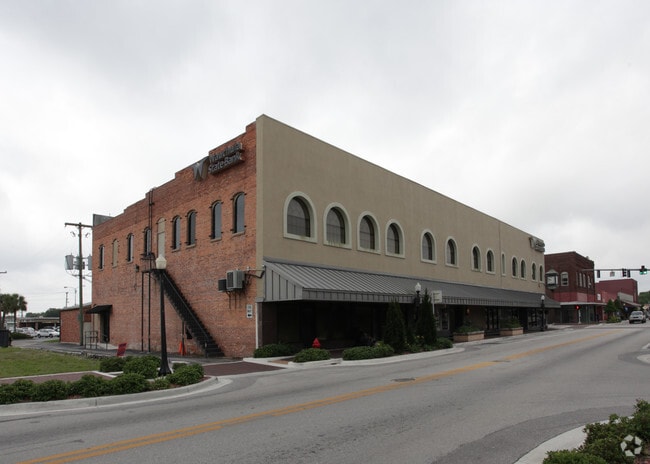
106 E Main St, Wauchula, FL 33873


Property Detail
106 E Main St
0334-25-0200-00024-0011
LOTS 11 12 N 32 FT OF LOT 13 & LOTS 15 16 & 17 BLK 24 WAUCHULA ORS LOCATED IN SEC 4 34 25 402P358 421P110 424P44-67 DC & PRO(MICHAEL) 568P969P971P 973 674P1(C/L) 682P1128 722P400 201225007779 202425002436-AFF/3432-AFF 202525000267-AFF
Financialbuilding
Hardee
HC-1
Florida
B and X Area of moderate flood hazard, usually the area between the limits of the 100-year and 500-year floods.
11
2025
0.80 AC
2025
Florida Central South Area
970401
Other Market Areas
29,145 SF
NEARBY LISTINGS FOR SALE OR LEASE
DEMOGRAPHICS near 106 E Main St
1 mile
3 mile
5 mile
2025 Total Population
5,182
10,320
15,453
2030 Population
5,197
10,507
15,752
Pop Growth 2025-2030
+ 0.29%
+ 1.81%
+ 1.93%
Average Age
35
37
38
2025 Total Households
1,689
3,452
5,223
HH Growth 2025-2030
+ 0.41%
+ 2.00%
+ 2.11%
Median Household Inc
$38,016
$51,776
$55,404
Avg Household Size
3.00
2.90
2.90
2025 Avg HH Vehicles
2.00
2.00
2.00
Median Home Value
$160,480
$221,146
$209,630
Median Year Built
1977
1978
1979
Nearby Places
Map Layers
Map Styles
 Street
 Aerial
Layers
 Traffic
 Biking
Places
Listings with unknown addresses are not visible on the map
- Restaurants
- Banks
- Shops
- Fitness
- Groceries
Nearby Properties
Address
Land Use
TOTAL SIZE
Lot Size
Zoning
Address
Land Use
TOTAL SIZE
Lot Size
Zoning
60.50 AC
F-R
Address
Land Use
TOTAL SIZE
Lot Size
Zoning
25 AC
F-R
Address
Land Use
TOTAL SIZE
Lot Size
Zoning
22.21 AC
P-SP
Address
Land Use
TOTAL SIZE
Lot Size
Zoning
47,399 SF
55.51 AC
C-2
Address
Land Use
TOTAL SIZE
Lot Size
Zoning
50,071 SF
9.78 AC
C-2
Address
Land Use
TOTAL SIZE
Lot Size
Zoning
59,117 SF
70 AC
A-1
Address
Land Use
TOTAL SIZE
Lot Size
Zoning
107,610 SF
14.32 AC
C-1
Address
Land Use
TOTAL SIZE
Lot Size
Zoning
45,018 SF
17.48 AC
P-SP
Address
Land Use
TOTAL SIZE
Lot Size
Zoning
40,161 SF
4.48 AC
C-1
Address
Land Use
TOTAL SIZE
Lot Size
Zoning
104,690 SF
9.96 AC
F-R
Address
Land Use
TOTAL SIZE
Lot Size
Zoning
89,500 SF
6.80 AC
C-2
Address
Land Use
TOTAL SIZE
Lot Size
Zoning
54,007 SF
9 AC
P-SP
Address
Land Use
TOTAL SIZE
Lot Size
Zoning
13.28 AC
F-R
Address
Land Use
TOTAL SIZE
Lot Size
Zoning
47,374 SF
1.79 AC
P-SP
Address
Land Use
TOTAL SIZE
Lot Size
Zoning
28.95 AC
P-SP
Address
Land Use
TOTAL SIZE
Lot Size
Zoning
432 SF
9.75 AC
P-SP
Address
Land Use
TOTAL SIZE
Lot Size
Zoning
60,546 SF
14.57 AC
R-3
Address
Land Use
TOTAL SIZE
Lot Size
Zoning
35,140 SF
2.02 AC
P-SP
Address
Land Use
TOTAL SIZE
Lot Size
Zoning
65,778 SF
7.46 AC
F-R
Address
Land Use
TOTAL SIZE
Lot Size
Zoning
53,214 SF
12.50 AC
R-1A
Address
Land Use
TOTAL SIZE
Lot Size
Zoning
68,254 SF
11 AC
R-3
Address
Land Use
TOTAL SIZE
Lot Size
Zoning
26,155 SF
8.86 AC
A-1
Address
Land Use
TOTAL SIZE
Lot Size
Zoning
80,371 SF
7.52 AC
C-2
Address
Land Use
TOTAL SIZE
Lot Size
Zoning
38,275 SF
18.72 AC
C-2
Address
Land Use
TOTAL SIZE
Lot Size
Zoning
35,537 SF
30 AC
F-R
Address
Land Use
TOTAL SIZE
Lot Size
Zoning
27,168 SF
3.62 AC
C-1
Address
Land Use
TOTAL SIZE
Lot Size
Zoning
97,776 SF
6.29 AC
I
Address
Land Use
TOTAL SIZE
Lot Size
Zoning
36,053 SF
15.50 AC
C-2
Address
Land Use
TOTAL SIZE
Lot Size
Zoning
40,860 SF
4.63 AC
C-2
The World's #1 Commercial Real Estate Marketplace
Connect with us
© 2026 CoStar Group
The information above has been obtained from sources believed reliable. While we do not doubt its accuracy we have not verified it and make no guarantee, warranty or representation about it. It is your responsibility to independently confirm its accuracy and completeness. Any projections, opinions, assumptions, or estimates used are for example only and do not represent the current or future performance of the property. The value of this transaction to you depends on tax and other factors which should be evaluated by your tax, financial, and legal advisors. You and your advisors should conduct a careful, independent investigation of the property to determine to your satisfaction the suitability of the property for your needs.