Property Record
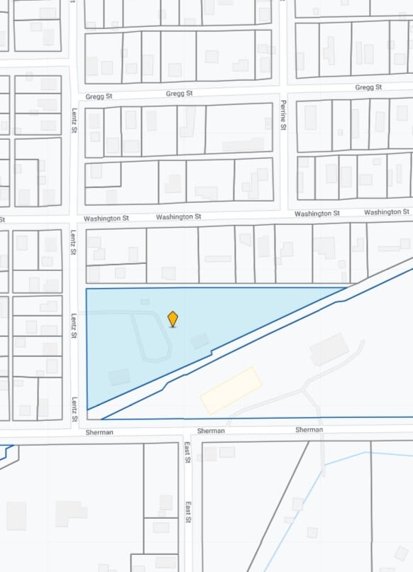
106 Lentz St, Nashville, MI 49073

NEARBY LISTINGS FOR SALE OR LEASE
-
-
View all Nashville listings for sale on LoopNet.com
Property Detail
106 Lentz St
52-001-155-00
COM ON N LINE MCRR R.O.W. WHERE IT INTERSECTS THE LINE LENTZ ST SEC 36 T3N R7W FOR POB; TH N 386.1FT, TH E 725.68FT +/- TO NLY LINE OF SD RR R/W, TH SWLY ABOUT 796.72FT +/- TO BEG. ALSO COM CENT SEC 36 T3N R7W, TH N0?11?15?E 186.18FT TO N ROW LINE FO
Multifamilydwelling
Barry
A
Michigan
26045C0275E
2.90 AC
2024
Barry County
2025
West Michigan
010100
Grand Rapids-Wyoming-Kentwood, MI
27,248 SF
DEMOGRAPHICS near 106 Lentz St
1 Mile
3 Mile
5 Mile
2024 Total Population
1,522
2,772
5,884
2029 Population
1,581
2,858
6,054
Pop Growth 2024-2029
+ 3.88%
+ 3.10%
+ 2.89%
Average Age
40
41
41
2024 Total Households
608
1,080
2,281
HH Growth 2024-2029
+ 3.78%
+ 3.15%
+ 2.94%
Median Household Inc
$42,395
$48,730
$50,621
Avg Household Size
2.50
2.60
2.60
2024 Avg HH Vehicles
2.00
2.00
2.00
Median Home Value
$102,400
$145,950
$156,583
Median Year Built
1947
1948
1967
Nearby Places
Map Layers
Map Styles
 Street
 Aerial
- Restaurants
- Banks
- Shops
- Fitness
- Groceries
PUBLIC TRANSPORTATION
AIRPORT
Gerald R Ford International
DRIVE
WALK
Distance
Gerald R Ford International
62 min
37.2 mi
Capital Region International
DRIVE
WALK
Distance
Capital Region International
56 min
39.5 mi
Kalamazoo/Battle Creek International
DRIVE
WALK
Distance
Kalamazoo/Battle Creek International
79 min
48.5 mi
Nearby Properties
Address
Land Use
TOTAL SIZE
Lot Size
Zoning
Address
Land Use
TOTAL SIZE
Lot Size
Zoning
109.35 AC
AG
Address
Land Use
TOTAL SIZE
Lot Size
Zoning
21,058 SF
1.54 AC
R1
Address
Land Use
TOTAL SIZE
Lot Size
Zoning
3,591 SF
138.90 AC
LA
Address
Land Use
TOTAL SIZE
Lot Size
Zoning
2,304 SF
212.64 AC
LA
Address
Land Use
TOTAL SIZE
Lot Size
Zoning
199.10 AC
AGRICULTUR
Address
Land Use
TOTAL SIZE
Lot Size
Zoning
12,554 SF
8.30 AC
AG
Address
Land Use
TOTAL SIZE
Lot Size
Zoning
99.90 AC
AGRICULTUR
Address
Land Use
TOTAL SIZE
Lot Size
Zoning
10,465 SF
1.62 AC
R1
Address
Land Use
TOTAL SIZE
Lot Size
Zoning
110.30 AC
LA
Address
Land Use
TOTAL SIZE
Lot Size
Zoning
85.30 AC
AG
Address
Land Use
TOTAL SIZE
Lot Size
Zoning
160.20 AC
AGRICULTUR
Address
Land Use
TOTAL SIZE
Lot Size
Zoning
2,246 SF
91.44 AC
LA
Address
Land Use
TOTAL SIZE
Lot Size
Zoning
2,912 SF
71.19 AC
LA
Address
Land Use
TOTAL SIZE
Lot Size
Zoning
93.44 AC
AG
Address
Land Use
TOTAL SIZE
Lot Size
Zoning
9,372 SF
1.19 AC
B1
Address
Land Use
TOTAL SIZE
Lot Size
Zoning
16,560 SF
8.12 AC
B1
Address
Land Use
TOTAL SIZE
Lot Size
Zoning
65 AC
LA
Address
Land Use
TOTAL SIZE
Lot Size
Zoning
1,528 SF
120 AC
LA
Address
Land Use
TOTAL SIZE
Lot Size
Zoning
1,752 SF
86 AC
LA
Address
Land Use
TOTAL SIZE
Lot Size
Zoning
2,378 SF
108 AC
LA
Address
Land Use
TOTAL SIZE
Lot Size
Zoning
3,591 SF
69 AC
LA
Address
Land Use
TOTAL SIZE
Lot Size
Zoning
1,274 SF
81 AC
LA
Address
Land Use
TOTAL SIZE
Lot Size
Zoning
1,676 SF
78.99 AC
LA
Address
Land Use
TOTAL SIZE
Lot Size
Zoning
2,353 SF
61 AC
LA
Address
Land Use
TOTAL SIZE
Lot Size
Zoning
21,150 SF
4.80 AC
B1
Address
Land Use
TOTAL SIZE
Lot Size
Zoning
97.80 AC
Address
Land Use
TOTAL SIZE
Lot Size
Zoning
1,392 SF
101.10 AC
LA
Address
Land Use
TOTAL SIZE
Lot Size
Zoning
127 AC
AGRICULTUR
Address
Land Use
TOTAL SIZE
Lot Size
Zoning
2,724 SF
40.72 AC
LA
The World's #1 Commercial Real Estate Marketplace
Connect with us
© 2026 CoStar Group
The information above has been obtained from sources believed reliable. While we do not doubt its accuracy we have not verified it and make no guarantee, warranty or representation about it. It is your responsibility to independently confirm its accuracy and completeness. Any projections, opinions, assumptions, or estimates used are for example only and do not represent the current or future performance of the property. The value of this transaction to you depends on tax and other factors which should be evaluated by your tax, financial, and legal advisors. You and your advisors should conduct a careful, independent investigation of the property to determine to your satisfaction the suitability of the property for your needs.