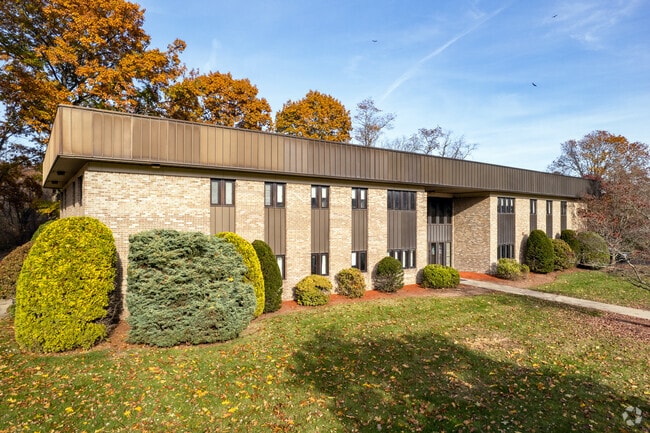
Property Record
106 Nate Whipple Hwy, Cumberland, RI 02864
Current Lease Availabilities
NEARBY LISTINGS FOR SALE OR LEASE
Property Detail
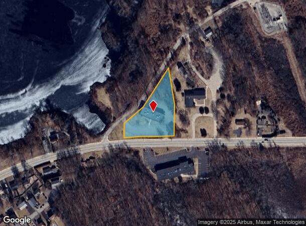
106 Nate Whipple Hwy
Commercialbuilding
Providence
X
Rhode Island
25005C0100F
1.51 AC
2025
Woonsocket
2025
Providence
011402
Providence-Warwick, RI-MA
10,630 SF
CUMB-000045-000096-000000
DEMOGRAPHICS near 106 Nate Whipple Hwy
1 Mile
3 Mile
5 Mile
2024 Total Population
4,774
35,782
104,692
2029 Population
4,809
35,751
104,140
Pop Growth 2024-2029
+ 0.73%
(0.09%)
(0.53%)
Average Age
43
42
41
2024 Total Households
1,952
14,370
41,961
HH Growth 2024-2029
+ 0.56%
(0.24%)
(0.66%)
Median Household Inc
$98,623
$87,080
$78,982
Avg Household Size
2.40
2.40
2.40
2024 Avg HH Vehicles
2.00
2.00
2.00
Median Home Value
$365,704
$359,987
$362,010
Median Year Built
1972
1971
1964
Nearby Places
Map Layers
Map Styles
 Street
 Aerial
- Restaurants
- Banks
- Shops
- Fitness
- Groceries
PUBLIC TRANSPORTATION
COMMUTER RAIL
DRIVE
WALK
Distance
14 min
8.6 mi
South Attleboro (Providence/Stoughton Line - Massachusetts Bay Transportation Authority Commuter Rail (Purple Line))
DRIVE
WALK
Distance
South Attleboro (Providence/Stoughton Line - Massachusetts Bay Transportation Authority Commuter Rail (Purple Line))
17 min
10.0 mi
AIRPORT
Rhode Island Tf Green International
DRIVE
WALK
Distance
Rhode Island Tf Green International
35 min
22.4 mi
Worcester Regional
DRIVE
WALK
Distance
Worcester Regional
50 min
36.4 mi
Nearby Properties
Address
Land Use
TOTAL SIZE
Lot Size
Zoning
Address
Land Use
TOTAL SIZE
Lot Size
Zoning
227,000 SF
6.72 AC
R3
Address
Land Use
TOTAL SIZE
Lot Size
Zoning
41.01 AC
30
Address
Land Use
TOTAL SIZE
Lot Size
Zoning
16.10 AC
60
Address
Land Use
TOTAL SIZE
Lot Size
Zoning
26.54 AC
90
Address
Land Use
TOTAL SIZE
Lot Size
Zoning
54.49 AC
RS20
Address
Land Use
TOTAL SIZE
Lot Size
Zoning
17.10 AC
I1
Address
Land Use
TOTAL SIZE
Lot Size
Zoning
11.61 AC
60
Address
Land Use
TOTAL SIZE
Lot Size
Zoning
1 AC
R4
Address
Land Use
TOTAL SIZE
Lot Size
Zoning
18.49 AC
60
Address
Land Use
TOTAL SIZE
Lot Size
Zoning
175,122 SF
22.44 AC
ML05
Address
Land Use
TOTAL SIZE
Lot Size
Zoning
5,520 SF
9.81 AC
R1
Address
Land Use
TOTAL SIZE
Lot Size
Zoning
19,774 SF
23.53 AC
R1
Address
Land Use
TOTAL SIZE
Lot Size
Zoning
147,146 SF
28.05 AC
BH
Address
Land Use
TOTAL SIZE
Lot Size
Zoning
8.33 AC
R2
Address
Land Use
TOTAL SIZE
Lot Size
Zoning
103,520 SF
3.44 AC
BH
Address
Land Use
TOTAL SIZE
Lot Size
Zoning
105,384 SF
17.07 AC
120
Address
Land Use
TOTAL SIZE
Lot Size
Zoning
10.09 AC
RG7
Address
Land Use
TOTAL SIZE
Lot Size
Zoning
149,422 SF
14.45 AC
60
Address
Land Use
TOTAL SIZE
Lot Size
Zoning
403,844 SF
10.78 AC
I2
Address
Land Use
TOTAL SIZE
Lot Size
Zoning
65,344 SF
12.03 AC
40
Address
Land Use
TOTAL SIZE
Lot Size
Zoning
5.63 AC
R2
Address
Land Use
TOTAL SIZE
Lot Size
Zoning
74,147 SF
19.64 AC
RS12
Address
Land Use
TOTAL SIZE
Lot Size
Zoning
9.28 AC
60
Address
Land Use
TOTAL SIZE
Lot Size
Zoning
23.19 AC
C2
Address
Land Use
TOTAL SIZE
Lot Size
Zoning
132,005 SF
17.07 AC
ML05
Address
Land Use
TOTAL SIZE
Lot Size
Zoning
103,988 SF
25.42 AC
30
Address
Land Use
TOTAL SIZE
Lot Size
Zoning
85,921 SF
34.74 AC
90
Address
Land Use
TOTAL SIZE
Lot Size
Zoning
43,796 SF
10.45 AC
R3
Address
Land Use
TOTAL SIZE
Lot Size
Zoning
69,708 SF
3.23 AC
120
Address
Land Use
TOTAL SIZE
Lot Size
Zoning
8.25 AC
C2
The World's #1 Commercial Real Estate Marketplace
Connect with us
© 2026 CoStar Group
The information above has been obtained from sources believed reliable. While we do not doubt its accuracy we have not verified it and make no guarantee, warranty or representation about it. It is your responsibility to independently confirm its accuracy and completeness. Any projections, opinions, assumptions, or estimates used are for example only and do not represent the current or future performance of the property. The value of this transaction to you depends on tax and other factors which should be evaluated by your tax, financial, and legal advisors. You and your advisors should conduct a careful, independent investigation of the property to determine to your satisfaction the suitability of the property for your needs.