Property Record
106 S 14Th St, West Memphis, AR 72301

Save to a Folder
{{folder.Name}}
{{folder.ListingIds.length}} Properties
{{folder.ListingIds.length}} Property
Create a New Folder
Property Detail
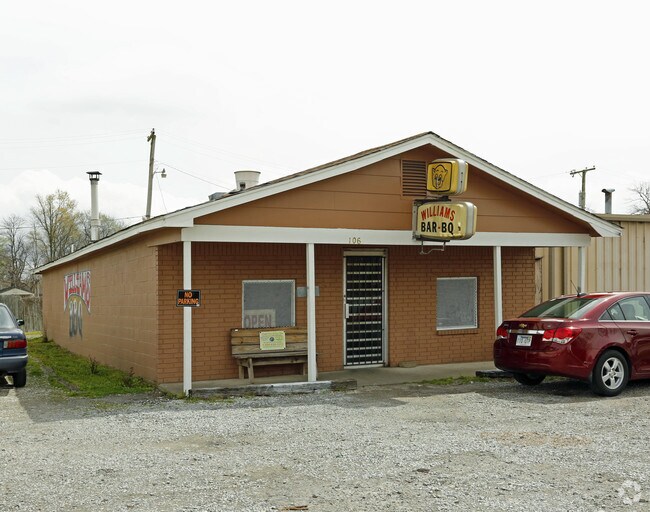
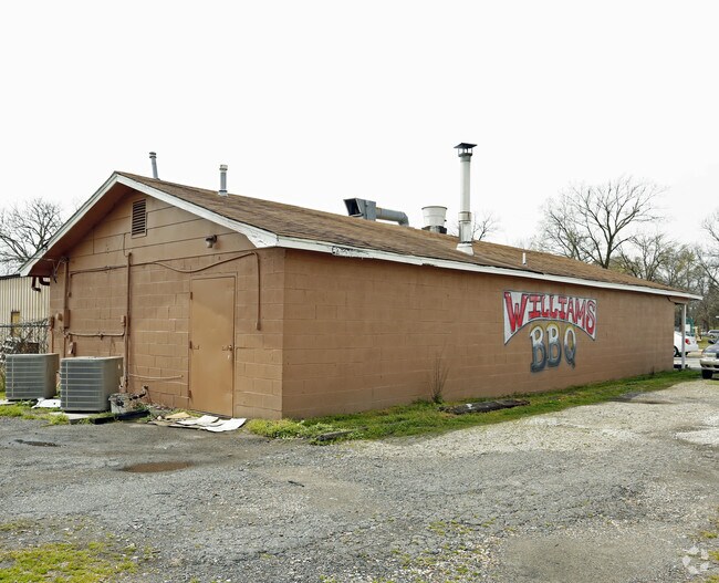
106 S 14Th St
Memphis, TN-MS-AR
PLAT BK 1 PG'S 24 & 25
368-741000-000
Crittenden
Restaurantbuilding
Arkansas
C and X Area of minimal flood hazard, usually depicted on FIRMs as above the 500-year flood level.
3-4
2025
0.17 AC
2025
Crittenden County
031200
Memphis
1,224 SF
NEARBY LISTINGS FOR SALE OR LEASE
DEMOGRAPHICS near 106 S 14Th St
1 mile
3 mile
5 mile
2025 Total Population
7,550
24,095
34,605
2030 Population
7,571
23,601
33,734
Pop Growth 2025-2030
+ 0.28%
(2.05%)
(2.52%)
Average Age
38
38
38
2025 Total Households
2,896
9,586
13,509
HH Growth 2025-2030
+ 0.31%
(2.18%)
(2.61%)
Median Household Inc
$34,171
$43,343
$51,214
Avg Household Size
2.50
2.40
2.50
2025 Avg HH Vehicles
1.00
1.00
2.00
Median Home Value
$74,024
$129,323
$162,167
Median Year Built
1972
1976
1982
Nearby Places
Map Layers
Map Styles
 Street
 Aerial
Layers
 Traffic
 Biking
Places
Listings with unknown addresses are not visible on the map
- Restaurants
- Banks
- Shops
- Fitness
- Groceries
PUBLIC TRANSPORTATION
COMMUTER RAIL
Central Station (Riverfront Loop - Memphis Area Transit Authority Trolley (MataTrolley))
Drive
Walk
Distance
Central Station (Riverfront Loop - Memphis Area Transit Authority Trolley (MataTrolley))
11 min
7.1 mi
AIRPORT
Memphis International
Drive
Walk
Distance
Memphis International
28 min
16.5 mi
Nearby Properties
Address
Land Use
TOTAL SIZE
Lot Size
Zoning
Address
Land Use
TOTAL SIZE
Lot Size
Zoning
148,005 SF
134.67 AC
Address
Land Use
TOTAL SIZE
Lot Size
Zoning
69,600 SF
38.09 AC
Address
Land Use
TOTAL SIZE
Lot Size
Zoning
46,927 SF
7.52 AC
Address
Land Use
TOTAL SIZE
Lot Size
Zoning
665,000 SF
46.40 AC
Address
Land Use
TOTAL SIZE
Lot Size
Zoning
209,064 SF
26.97 AC
Address
Land Use
TOTAL SIZE
Lot Size
Zoning
79,208 SF
3.98 AC
Address
Land Use
TOTAL SIZE
Lot Size
Zoning
72,051 SF
1.98 AC
Address
Land Use
TOTAL SIZE
Lot Size
Zoning
87,608 SF
10.02 AC
Address
Land Use
TOTAL SIZE
Lot Size
Zoning
28,600 SF
7 AC
Address
Land Use
TOTAL SIZE
Lot Size
Zoning
70,994 SF
3.06 AC
Address
Land Use
TOTAL SIZE
Lot Size
Zoning
7,482 SF
7.17 AC
Address
Land Use
TOTAL SIZE
Lot Size
Zoning
328,229 SF
20 AC
Address
Land Use
TOTAL SIZE
Lot Size
Zoning
12,088 SF
98.07 AC
Address
Land Use
TOTAL SIZE
Lot Size
Zoning
46,035 SF
2.31 AC
Address
Land Use
TOTAL SIZE
Lot Size
Zoning
148,342 SF
9.87 AC
Address
Land Use
TOTAL SIZE
Lot Size
Zoning
2,728 SF
10.54 AC
Address
Land Use
TOTAL SIZE
Lot Size
Zoning
43,781 SF
1.65 AC
Address
Land Use
TOTAL SIZE
Lot Size
Zoning
43,570 SF
1.80 AC
Address
Land Use
TOTAL SIZE
Lot Size
Zoning
64,791 SF
3.57 AC
Address
Land Use
TOTAL SIZE
Lot Size
Zoning
2,817 SF
7.30 AC
Address
Land Use
TOTAL SIZE
Lot Size
Zoning
23,900 SF
11.23 AC
Address
Land Use
TOTAL SIZE
Lot Size
Zoning
52,902 SF
Address
Land Use
TOTAL SIZE
Lot Size
Zoning
3,456 SF
6.09 AC
Address
Land Use
TOTAL SIZE
Lot Size
Zoning
8,178 SF
6.06 AC
Address
Land Use
TOTAL SIZE
Lot Size
Zoning
8,178 SF
3.99 AC
Address
Land Use
TOTAL SIZE
Lot Size
Zoning
12,000 SF
10.35 AC
Address
Land Use
TOTAL SIZE
Lot Size
Zoning
31,630 SF
9.58 AC
Address
Land Use
TOTAL SIZE
Lot Size
Zoning
13,015 SF
11.60 AC
Address
Land Use
TOTAL SIZE
Lot Size
Zoning
7,056 SF
7.63 AC
Address
Land Use
TOTAL SIZE
Lot Size
Zoning
67,750 SF
5.24 AC
The World's #1 Commercial Real Estate Marketplace
Connect with us
© 2026 CoStar Group
The information above has been obtained from sources believed reliable. While we do not doubt its accuracy we have not verified it and make no guarantee, warranty or representation about it. It is your responsibility to independently confirm its accuracy and completeness. Any projections, opinions, assumptions, or estimates used are for example only and do not represent the current or future performance of the property. The value of this transaction to you depends on tax and other factors which should be evaluated by your tax, financial, and legal advisors. You and your advisors should conduct a careful, independent investigation of the property to determine to your satisfaction the suitability of the property for your needs.