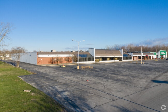
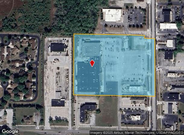
Property Record
1050 S Main St, Bowling Green, OH 43402
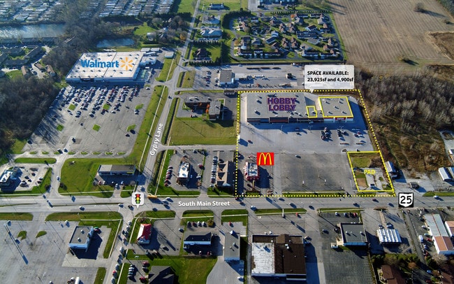
NEARBY LISTINGS FOR SALE OR LEASE
Property Detail
1050 S Main St
B08-510-250401015000
N600 S943.80 E371 LESS NECOR SE SE
Regionalshoppingcenterormallwithanchorstore
Wood
X
Ohio
39173C0260D
10 AC
2023
Perrysburg/Northwood
2024
Toledo
021901
Toledo, OH
98,548 SF
DEMOGRAPHICS near 1050 S Main St
1 Mile
3 Mile
5 Mile
2024 Total Population
7,991
31,331
34,573
2029 Population
8,136
31,760
35,003
Pop Growth 2024-2029
+ 1.81%
+ 1.37%
+ 1.24%
Average Age
35
34
35
2024 Total Households
4,184
12,640
13,852
HH Growth 2024-2029
+ 1.82%
+ 1.53%
+ 1.41%
Median Household Inc
$36,182
$40,167
$43,819
Avg Household Size
1.90
2.10
2.10
2024 Avg HH Vehicles
2.00
2.00
2.00
Median Home Value
$166,011
$197,627
$202,888
Median Year Built
1976
1979
1979
Nearby Places
Map Layers
Map Styles
 Street
 Aerial
- Restaurants
- Banks
- Shops
- Fitness
- Groceries
PUBLIC TRANSPORTATION
AIRPORT
Eugene F Kranz Toledo Express
DRIVE
WALK
Distance
Eugene F Kranz Toledo Express
48 min
25.4 mi
Freight Ports
Port of Toledo
DRIVE
WALK
Distance
Port of Toledo
45 min
29.5 mi
SALE & LEASE HISTORY
LISTING DATE
SALE/LEASE

Sep 25, 2016
For Lease
Nearby Properties
Address
Land Use
TOTAL SIZE
Lot Size
Zoning
Address
Land Use
TOTAL SIZE
Lot Size
Zoning
4,258,392 SF
81.52 AC
Address
Land Use
TOTAL SIZE
Lot Size
Zoning
Address
Land Use
TOTAL SIZE
Lot Size
Zoning
302,240 SF
7.21 AC
Address
Land Use
TOTAL SIZE
Lot Size
Zoning
550,767 SF
20.56 AC
Address
Land Use
TOTAL SIZE
Lot Size
Zoning
322,830 SF
38.74 AC
Address
Land Use
TOTAL SIZE
Lot Size
Zoning
429,859 SF
21.79 AC
Address
Land Use
TOTAL SIZE
Lot Size
Zoning
122,962 SF
19.30 AC
Address
Land Use
TOTAL SIZE
Lot Size
Zoning
14,124 SF
13.26 AC
Address
Land Use
TOTAL SIZE
Lot Size
Zoning
148,952 SF
2.39 AC
Address
Land Use
TOTAL SIZE
Lot Size
Zoning
94,350 SF
57.70 AC
Address
Land Use
TOTAL SIZE
Lot Size
Zoning
446,800 SF
34.76 AC
Address
Land Use
TOTAL SIZE
Lot Size
Zoning
89,694 SF
7.90 AC
Address
Land Use
TOTAL SIZE
Lot Size
Zoning
127,806 SF
10.19 AC
Address
Land Use
TOTAL SIZE
Lot Size
Zoning
28,901 SF
11.36 AC
Address
Land Use
TOTAL SIZE
Lot Size
Zoning
104,233 SF
19.35 AC
Address
Land Use
TOTAL SIZE
Lot Size
Zoning
40.10 AC
Address
Land Use
TOTAL SIZE
Lot Size
Zoning
37,586 SF
17.78 AC
Address
Land Use
TOTAL SIZE
Lot Size
Zoning
136,154 SF
11.47 AC
Address
Land Use
TOTAL SIZE
Lot Size
Zoning
217,995 SF
24.23 AC
Address
Land Use
TOTAL SIZE
Lot Size
Zoning
51,900 SF
13.34 AC
Address
Land Use
TOTAL SIZE
Lot Size
Zoning
28,269 SF
15.85 AC
Address
Land Use
TOTAL SIZE
Lot Size
Zoning
21,445 SF
12 AC
Address
Land Use
TOTAL SIZE
Lot Size
Zoning
32,105 SF
0.39 AC
Address
Land Use
TOTAL SIZE
Lot Size
Zoning
40,577 SF
38.79 AC
Address
Land Use
TOTAL SIZE
Lot Size
Zoning
10,560 SF
6.74 AC
Address
Land Use
TOTAL SIZE
Lot Size
Zoning
36,595 SF
39.99 AC
Address
Land Use
TOTAL SIZE
Lot Size
Zoning
79.35 AC
Address
Land Use
TOTAL SIZE
Lot Size
Zoning
182,682 SF
15.46 AC
Address
Land Use
TOTAL SIZE
Lot Size
Zoning
177,236 SF
15 AC
Address
Land Use
TOTAL SIZE
Lot Size
Zoning
26,032 SF
2.37 AC
The World's #1 Commercial Real Estate Marketplace
Connect with us
© 2025 CoStar Group
The information above has been obtained from sources believed reliable. While we do not doubt its accuracy we have not verified it and make no guarantee, warranty or representation about it. It is your responsibility to independently confirm its accuracy and completeness. Any projections, opinions, assumptions, or estimates used are for example only and do not represent the current or future performance of the property. The value of this transaction to you depends on tax and other factors which should be evaluated by your tax, financial, and legal advisors. You and your advisors should conduct a careful, independent investigation of the property to determine to your satisfaction the suitability of the property for your needs.