Property Record
10600 Forest Hill Blvd, Wellington, FL 33414

Current Lease Availabilities
NEARBY LISTINGS FOR SALE OR LEASE
Property Detail
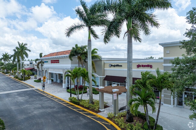
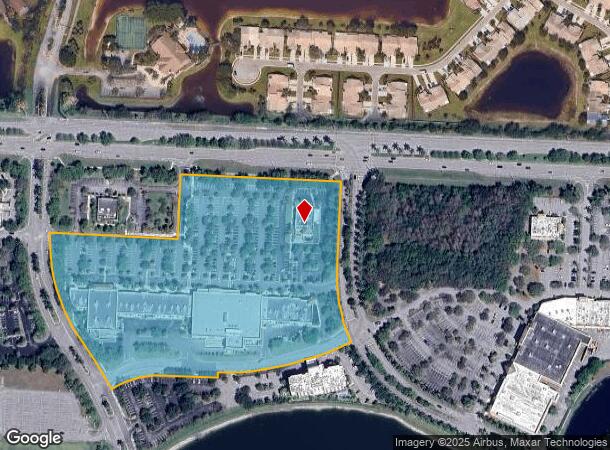
10600 Forest Hill Blvd
73-41-44-13-04-001-0000
Wellington Green
Regionalshoppingcenterormallwithanchorstore
WELLINGTON GREEN MUPD/PUD REPL OF TR B TR 1
X
Palm Beach
12099C0564F
Florida
2024
13.01 AC
2024
Royal Palm Bch/Wellington
007752
South Florida
55,779 SF
West Palm Beach-Boca Raton-Delray Beach, FL
DEMOGRAPHICS near 10600 Forest Hill Blvd
1 Mile
3 Mile
5 Mile
2024 Total Population
7,527
64,934
163,555
2029 Population
7,754
66,536
167,262
Pop Growth 2024-2029
+ 3.02%
+ 2.47%
+ 2.27%
Average Age
40
40
41
2024 Total Households
2,852
22,147
59,353
HH Growth 2024-2029
+ 2.70%
+ 1.87%
+ 1.73%
Median Household Inc
$90,250
$103,848
$80,038
Avg Household Size
2.60
2.80
2.60
2024 Avg HH Vehicles
2.00
2.00
2.00
Median Home Value
$480,117
$445,857
$369,152
Median Year Built
2001
1998
1990
Nearby Places
- Restaurants
- Banks
- Shops
- Fitness
- Groceries
PUBLIC TRANSPORTATION
AIRPORT
Palm Beach International
DRIVE
WALK
Distance
Palm Beach International
18 min
9.8 mi
Freight Ports
Port of Palm Beach
DRIVE
WALK
Distance
Port of Palm Beach
32 min
17.4 mi
Nearby Properties
Address
Land Use
TOTAL SIZE
Lot Size
Zoning
Address
Land Use
TOTAL SIZE
Lot Size
Zoning
590,128 SF
19.55 AC
MUPD
Address
Land Use
TOTAL SIZE
Lot Size
Zoning
398,622 SF
21.61 AC
RM-18
Address
Land Use
TOTAL SIZE
Lot Size
Zoning
536,770 SF
25.06 AC
PUD
Address
Land Use
TOTAL SIZE
Lot Size
Zoning
209,750 SF
36.10 AC
PUD
Address
Land Use
TOTAL SIZE
Lot Size
Zoning
535,508 SF
19.17 AC
PUD
Address
Land Use
TOTAL SIZE
Lot Size
Zoning
199,032 SF
769.86 AC
PO
Address
Land Use
TOTAL SIZE
Lot Size
Zoning
435,320 SF
13.75 AC
MCPD
Address
Land Use
TOTAL SIZE
Lot Size
Zoning
691,249 SF
33.20 AC
MUPD
Address
Land Use
TOTAL SIZE
Lot Size
Zoning
377,137 SF
17.64 AC
PUD
Address
Land Use
TOTAL SIZE
Lot Size
Zoning
346,161 SF
17.21 AC
PUD
Address
Land Use
TOTAL SIZE
Lot Size
Zoning
349,929 SF
49.95 AC
CG
Address
Land Use
TOTAL SIZE
Lot Size
Zoning
318,687 SF
29.98 AC
RM-9
Address
Land Use
TOTAL SIZE
Lot Size
Zoning
286,092 SF
11.62 AC
PUD
Address
Land Use
TOTAL SIZE
Lot Size
Zoning
294,321 SF
109.37 AC
PO
Address
Land Use
TOTAL SIZE
Lot Size
Zoning
338,248 SF
54.21 AC
CF
Address
Land Use
TOTAL SIZE
Lot Size
Zoning
106,630 SF
25.01 AC
MUPD
Address
Land Use
TOTAL SIZE
Lot Size
Zoning
180,153 SF
19.22 AC
MUPD
Address
Land Use
TOTAL SIZE
Lot Size
Zoning
113,379 SF
16.56 AC
MUPD
Address
Land Use
TOTAL SIZE
Lot Size
Zoning
185,453 SF
9.63 AC
PUD
Address
Land Use
TOTAL SIZE
Lot Size
Zoning
131,955 SF
9.15 AC
MUPD
Address
Land Use
TOTAL SIZE
Lot Size
Zoning
159,433 SF
38.65 AC
PO
Address
Land Use
TOTAL SIZE
Lot Size
Zoning
116,601 SF
13.94 AC
CG
Address
Land Use
TOTAL SIZE
Lot Size
Zoning
114,960 SF
11.71 AC
PUD
Address
Land Use
TOTAL SIZE
Lot Size
Zoning
169,063 SF
27.05 AC
PUD
Address
Land Use
TOTAL SIZE
Lot Size
Zoning
229,274 SF
24.34 AC
CG
Address
Land Use
TOTAL SIZE
Lot Size
Zoning
149,934 SF
3.47 AC
CG
Address
Land Use
TOTAL SIZE
Lot Size
Zoning
124,261 SF
18.22 AC
PUD
Address
Land Use
TOTAL SIZE
Lot Size
Zoning
94,041 SF
21.56 AC
PUD
Address
Land Use
TOTAL SIZE
Lot Size
Zoning
129,117 SF
12.62 AC
CG
Address
Land Use
TOTAL SIZE
Lot Size
Zoning
58,491 SF
114.83 AC
CF
The World's #1 Commercial Real Estate Marketplace
Connect with us
© 2025 CoStar Group
The information above has been obtained from sources believed reliable. While we do not doubt its accuracy we have not verified it and make no guarantee, warranty or representation about it. It is your responsibility to independently confirm its accuracy and completeness. Any projections, opinions, assumptions, or estimates used are for example only and do not represent the current or future performance of the property. The value of this transaction to you depends on tax and other factors which should be evaluated by your tax, financial, and legal advisors. You and your advisors should conduct a careful, independent investigation of the property to determine to your satisfaction the suitability of the property for your needs.