Property Record
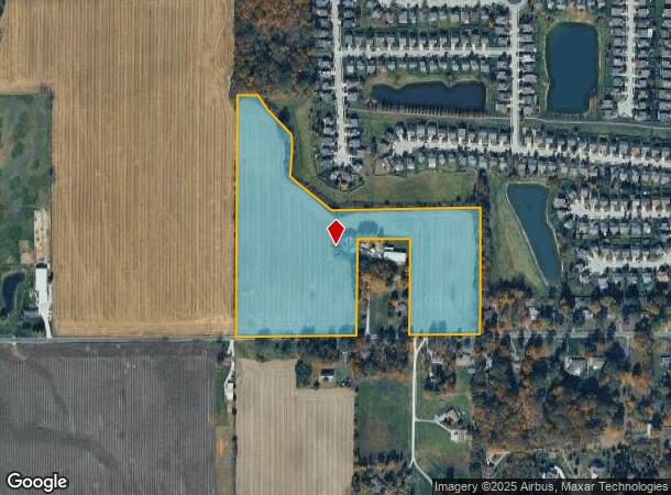
10600 Maze Rd, Indianapolis, IN 46259

NEARBY LISTINGS FOR SALE OR LEASE
Property Detail
10600 Maze Rd
Indianapolis-Carmel-Anderson, IN
PT SW1/4 NE1/4 S21 T14 R5 BEG SW COR N 1337.91 E113.29 SE IRR 808.03 E 818.4 S 707.99 W 388.5N 560 W 290 S 560 W 659.54 TO BEG 22.229AC(21.585AC TAX)
49-16-21-112-015.000-300
Marion
Agriculturalland
Indiana
AE
15
18097C0290F
22.23 AC
2023
Beech Grove/SE County
2024
Indianapolis
390300
DEMOGRAPHICS near 10600 Maze Rd
1 Mile
3 Mile
5 Mile
2024 Total Population
1,844
10,897
50,077
2029 Population
1,799
10,859
50,073
Pop Growth 2024-2029
(2.44%)
(0.35%)
(0.01%)
Average Age
35
39
37
2024 Total Households
598
3,741
17,373
HH Growth 2024-2029
(2.51%)
(0.21%)
(0.06%)
Median Household Inc
$88,976
$109,095
$97,370
Avg Household Size
3.00
2.90
2.80
2024 Avg HH Vehicles
3.00
2.00
2.00
Median Home Value
$179,687
$284,607
$257,854
Median Year Built
1999
1997
2000
Nearby Places
Map Layers
Map Styles
 Street
 Aerial
- Restaurants
- Banks
- Shops
- Fitness
- Groceries
PUBLIC TRANSPORTATION
AIRPORT
Indianapolis International
DRIVE
WALK
Distance
Indianapolis International
43 min
25.6 mi
Freight Ports
Port of Toledo
DRIVE
WALK
Distance
Port of Toledo
279 min
233.7 mi
Nearby Properties
Address
Land Use
TOTAL SIZE
Lot Size
Zoning
Address
Land Use
TOTAL SIZE
Lot Size
Zoning
Address
Land Use
TOTAL SIZE
Lot Size
Zoning
53.64 AC
Address
Land Use
TOTAL SIZE
Lot Size
Zoning
11,868 SF
15.48 AC
ZO01
Address
Land Use
TOTAL SIZE
Lot Size
Zoning
111,285 SF
15.72 AC
ZO01
Address
Land Use
TOTAL SIZE
Lot Size
Zoning
98,888 SF
20.32 AC
ZO01
Address
Land Use
TOTAL SIZE
Lot Size
Zoning
116,275 SF
9.55 AC
ZO01
Address
Land Use
TOTAL SIZE
Lot Size
Zoning
30,240 SF
16.65 AC
Address
Land Use
TOTAL SIZE
Lot Size
Zoning
16,943 SF
3.97 AC
ZO01
Address
Land Use
TOTAL SIZE
Lot Size
Zoning
23,880 SF
4.05 AC
ZO01
Address
Land Use
TOTAL SIZE
Lot Size
Zoning
22,653 SF
3.15 AC
ZO01
Address
Land Use
TOTAL SIZE
Lot Size
Zoning
85,528 SF
6.65 AC
Address
Land Use
TOTAL SIZE
Lot Size
Zoning
6,720 SF
8 AC
Address
Land Use
TOTAL SIZE
Lot Size
Zoning
15,128 SF
3 AC
ZO01
Address
Land Use
TOTAL SIZE
Lot Size
Zoning
32,000 SF
6.40 AC
Address
Land Use
TOTAL SIZE
Lot Size
Zoning
5,300 SF
1.27 AC
ZO01
Address
Land Use
TOTAL SIZE
Lot Size
Zoning
9,873 SF
22.39 AC
Address
Land Use
TOTAL SIZE
Lot Size
Zoning
6.33 AC
ZO01
Address
Land Use
TOTAL SIZE
Lot Size
Zoning
6.08 AC
ZO01
Address
Land Use
TOTAL SIZE
Lot Size
Zoning
16,944 SF
6.25 AC
ZO01
Address
Land Use
TOTAL SIZE
Lot Size
Zoning
6,030 SF
3.50 AC
Address
Land Use
TOTAL SIZE
Lot Size
Zoning
4,272 SF
0.62 AC
ZO01
Address
Land Use
TOTAL SIZE
Lot Size
Zoning
5,380 SF
138.18 AC
ZO01
Address
Land Use
TOTAL SIZE
Lot Size
Zoning
4,272 SF
0.63 AC
ZO01
Address
Land Use
TOTAL SIZE
Lot Size
Zoning
Address
Land Use
TOTAL SIZE
Lot Size
Zoning
6,018 SF
52.28 AC
Address
Land Use
TOTAL SIZE
Lot Size
Zoning
12,000 SF
14.15 AC
Address
Land Use
TOTAL SIZE
Lot Size
Zoning
6,210 SF
1.25 AC
ZO01
Address
Land Use
TOTAL SIZE
Lot Size
Zoning
5,818 SF
40.92 AC
ZO01
Address
Land Use
TOTAL SIZE
Lot Size
Zoning
7,171 SF
10 AC
Address
Land Use
TOTAL SIZE
Lot Size
Zoning
2,579 SF
15 AC
The World's #1 Commercial Real Estate Marketplace
Connect with us
© 2025 CoStar Group
The information above has been obtained from sources believed reliable. While we do not doubt its accuracy we have not verified it and make no guarantee, warranty or representation about it. It is your responsibility to independently confirm its accuracy and completeness. Any projections, opinions, assumptions, or estimates used are for example only and do not represent the current or future performance of the property. The value of this transaction to you depends on tax and other factors which should be evaluated by your tax, financial, and legal advisors. You and your advisors should conduct a careful, independent investigation of the property to determine to your satisfaction the suitability of the property for your needs.