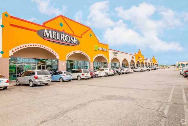
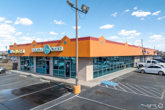
Property Record
10600 N Loop Dr, Socorro, TX 79927
Property Detail
10600 N Loop Dr
H787-000-0010-0335
1 HORIZON SHOPPING CENTER PT OF 3 BEG 196.64 NE OF SWC (135.53 ON NELY & SWLY-330.59 ON SELY & NWLY) (44804.34 SQ FT)
Commercialnec
EL PASO
C2
Texas
2024
1.90 AC
2025
East
010408
El Paso
19,800 SF
El Paso, TX
NEARBY LISTINGS FOR SALE OR LEASE
DEMOGRAPHICS near 10600 N Loop Dr
1 mile
3 mile
5 mile
2025 Total Population
7,250
51,619
130,640
2030 Population
7,282
53,047
133,592
Pop Growth 2025-2030
+ 0.44%
+ 2.77%
+ 2.26%
Average Age
37
37
36
2025 Total Households
2,263
15,622
39,897
HH Growth 2025-2030
+ 0.57%
+ 2.80%
+ 2.25%
Median Household Inc
$50,261
$54,505
$59,938
Avg Household Size
3.20
3.30
3.20
2025 Avg HH Vehicles
2.00
2.00
2.00
Median Home Value
$145,808
$162,937
$182,378
Median Year Built
1992
1996
2000
Nearby Places
Map Layers
Map Styles
 Street
 Aerial
Layers
 Traffic
 Biking
Places
Listings with unknown addresses are not visible on the map
- Restaurants
- Banks
- Shops
- Fitness
- Groceries
PUBLIC TRANSPORTATION
AIRPORT
El Paso International
Drive
Walk
Distance
El Paso International
32 min
16.6 mi
Freight Ports
Port of Corpus Christi
Drive
Walk
Distance
Port of Corpus Christi
663 min
678.7 mi
SALE & LEASE HISTORY
LISTING DATE
SALE/LEASE

Sep 25, 2016
For Lease
Nov 20, 2018
For Sale
Mar 22, 2017
For Lease
Jan 31, 2018
For Lease
Feb 09, 2021
For Lease
Nearby Properties
Address
Land Use
TOTAL SIZE
Lot Size
Zoning
Address
Land Use
TOTAL SIZE
Lot Size
Zoning
2,562,545 SF
62.04 AC
Address
Land Use
TOTAL SIZE
Lot Size
Zoning
770,870 SF
44.65 AC
Address
Land Use
TOTAL SIZE
Lot Size
Zoning
800,449 SF
50.57 AC
Address
Land Use
TOTAL SIZE
Lot Size
Zoning
393,206 SF
66.48 AC
SU
Address
Land Use
TOTAL SIZE
Lot Size
Zoning
953,000 SF
45.97 AC
M2
Address
Land Use
TOTAL SIZE
Lot Size
Zoning
123,306 SF
53.62 AC
M1
Address
Land Use
TOTAL SIZE
Lot Size
Zoning
109,039 SF
25.07 AC
Address
Land Use
TOTAL SIZE
Lot Size
Zoning
366,600 SF
21.24 AC
Address
Land Use
TOTAL SIZE
Lot Size
Zoning
392,214 SF
29.67 AC
Address
Land Use
TOTAL SIZE
Lot Size
Zoning
400,929 SF
30.05 AC
Address
Land Use
TOTAL SIZE
Lot Size
Zoning
652,080 SF
32.64 AC
Address
Land Use
TOTAL SIZE
Lot Size
Zoning
618,222 SF
25.18 AC
M2
Address
Land Use
TOTAL SIZE
Lot Size
Zoning
127,840 SF
17.66 AC
Address
Land Use
TOTAL SIZE
Lot Size
Zoning
334,161 SF
20.28 AC
Address
Land Use
TOTAL SIZE
Lot Size
Zoning
253,144 SF
3 AC
C2
Address
Land Use
TOTAL SIZE
Lot Size
Zoning
180,139 SF
24.81 AC
Address
Land Use
TOTAL SIZE
Lot Size
Zoning
450,900 SF
20.46 AC
M2
Address
Land Use
TOTAL SIZE
Lot Size
Zoning
110,080 SF
10.36 AC
Address
Land Use
TOTAL SIZE
Lot Size
Zoning
214,346 SF
11.90 AC
Address
Land Use
TOTAL SIZE
Lot Size
Zoning
475,547 SF
26.82 AC
Address
Land Use
TOTAL SIZE
Lot Size
Zoning
210,794 SF
13.90 AC
Address
Land Use
TOTAL SIZE
Lot Size
Zoning
79,402 SF
2.61 AC
Address
Land Use
TOTAL SIZE
Lot Size
Zoning
152,833 SF
9.75 AC
Address
Land Use
TOTAL SIZE
Lot Size
Zoning
80,499 SF
25.31 AC
Address
Land Use
TOTAL SIZE
Lot Size
Zoning
156,914 SF
10.37 AC
Address
Land Use
TOTAL SIZE
Lot Size
Zoning
64,991 SF
8.68 AC
Address
Land Use
TOTAL SIZE
Lot Size
Zoning
95,986 SF
4.19 AC
Address
Land Use
TOTAL SIZE
Lot Size
Zoning
84,207 SF
20 AC
Address
Land Use
TOTAL SIZE
Lot Size
Zoning
41,778 SF
4.37 AC
A2S
Address
Land Use
TOTAL SIZE
Lot Size
Zoning
136,597 SF
10.14 AC
The World's #1 Commercial Real Estate Marketplace
Connect with us
© 2026 CoStar Group
The information above has been obtained from sources believed reliable. While we do not doubt its accuracy we have not verified it and make no guarantee, warranty or representation about it. It is your responsibility to independently confirm its accuracy and completeness. Any projections, opinions, assumptions, or estimates used are for example only and do not represent the current or future performance of the property. The value of this transaction to you depends on tax and other factors which should be evaluated by your tax, financial, and legal advisors. You and your advisors should conduct a careful, independent investigation of the property to determine to your satisfaction the suitability of the property for your needs.