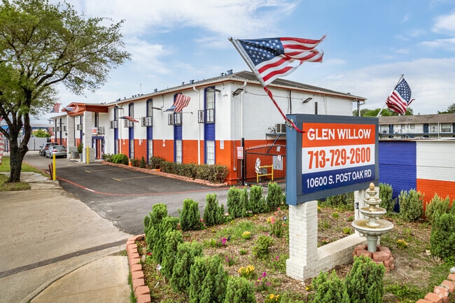
Property Record
10600 S Post Oak Rd, Houston, TX 77035


Property Detail
10600 S Post Oak Rd
0840040000050
RES B8 BLK 1 WESTBURY SEC 1
Apartment
HARRIS
B and X Area of moderate flood hazard, usually the area between the limits of the 100-year and 500-year floods.
Texas
2024
3.64 AC
2025
Meyerland Area
420600
Houston
108,810 SF
Houston-Pasadena-The Woodlands, TX
NEARBY LISTINGS FOR SALE OR LEASE
-
-
View all Houston listings for sale on LoopNet.com
DEMOGRAPHICS near 10600 S Post Oak Rd
1 mile
3 mile
5 mile
2025 Total Population
14,134
165,537
472,888
2030 Population
15,088
176,970
506,517
Pop Growth 2025-2030
+ 6.75%
+ 6.91%
+ 7.11%
Average Age
40
38
37
2025 Total Households
5,547
62,627
182,452
HH Growth 2025-2030
+ 6.74%
+ 7.16%
+ 7.34%
Median Household Inc
$115,979
$69,833
$63,213
Avg Household Size
2.50
2.60
2.50
2025 Avg HH Vehicles
2.00
2.00
2.00
Median Home Value
$419,625
$382,950
$317,932
Median Year Built
1960
1977
1981
Nearby Places
Map Layers
Map Styles
 Street
 Aerial
Layers
 Traffic
 Biking
Places
Listings with unknown addresses are not visible on the map
- Restaurants
- Banks
- Shops
- Fitness
- Groceries
PUBLIC TRANSPORTATION
AIRPORT
William P Hobby
Drive
Walk
Distance
William P Hobby
28 min
16.0 mi
George Bush Intcntl/Houston
Drive
Walk
Distance
George Bush Intcntl/Houston
39 min
31.1 mi
Freight Ports
Port of Houston
Drive
Walk
Distance
Port of Houston
24 min
16.2 mi
SALE & LEASE HISTORY
LISTING DATE
SALE/LEASE

Jul 17, 2019
For Sale
Jan 22, 2020
For Sale
Feb 26, 2023
For Sale
Apr 15, 2022
For Sale
Nearby Properties
Address
Land Use
TOTAL SIZE
Lot Size
Zoning
Address
Land Use
TOTAL SIZE
Lot Size
Zoning
777,791 SF
47.90 AC
Address
Land Use
TOTAL SIZE
Lot Size
Zoning
507,499 SF
7.66 AC
Address
Land Use
TOTAL SIZE
Lot Size
Zoning
1,202,191 SF
39.08 AC
Address
Land Use
TOTAL SIZE
Lot Size
Zoning
15.46 AC
Address
Land Use
TOTAL SIZE
Lot Size
Zoning
550,115 SF
6.38 AC
Address
Land Use
TOTAL SIZE
Lot Size
Zoning
284,836 SF
4.22 AC
Address
Land Use
TOTAL SIZE
Lot Size
Zoning
335,626 SF
4.22 AC
Address
Land Use
TOTAL SIZE
Lot Size
Zoning
544,698 SF
15.66 AC
Address
Land Use
TOTAL SIZE
Lot Size
Zoning
640,860 SF
5.31 AC
Address
Land Use
TOTAL SIZE
Lot Size
Zoning
398,772 SF
2.97 AC
Address
Land Use
TOTAL SIZE
Lot Size
Zoning
297,620 SF
11.01 AC
Address
Land Use
TOTAL SIZE
Lot Size
Zoning
422,115 SF
6.18 AC
Address
Land Use
TOTAL SIZE
Lot Size
Zoning
292,644 SF
15.47 AC
Address
Land Use
TOTAL SIZE
Lot Size
Zoning
432,938 SF
4.31 AC
Address
Land Use
TOTAL SIZE
Lot Size
Zoning
534,800 SF
33.43 AC
Address
Land Use
TOTAL SIZE
Lot Size
Zoning
426,919 SF
12.62 AC
Address
Land Use
TOTAL SIZE
Lot Size
Zoning
290,624 SF
3.17 AC
Address
Land Use
TOTAL SIZE
Lot Size
Zoning
255,680 SF
13.42 AC
Address
Land Use
TOTAL SIZE
Lot Size
Zoning
301,360 SF
11.97 AC
Address
Land Use
TOTAL SIZE
Lot Size
Zoning
242,982 SF
11.56 AC
Address
Land Use
TOTAL SIZE
Lot Size
Zoning
456,076 SF
19.09 AC
Address
Land Use
TOTAL SIZE
Lot Size
Zoning
363,134 SF
18.52 AC
Address
Land Use
TOTAL SIZE
Lot Size
Zoning
87,017 SF
3.19 AC
Address
Land Use
TOTAL SIZE
Lot Size
Zoning
414,014 SF
7.77 AC
Address
Land Use
TOTAL SIZE
Lot Size
Zoning
253,163 SF
8.66 AC
Address
Land Use
TOTAL SIZE
Lot Size
Zoning
623,343 SF
22.89 AC
Address
Land Use
TOTAL SIZE
Lot Size
Zoning
371,335 SF
31.65 AC
Address
Land Use
TOTAL SIZE
Lot Size
Zoning
287,776 SF
4.84 AC
Address
Land Use
TOTAL SIZE
Lot Size
Zoning
391,473 SF
17.11 AC
Address
Land Use
TOTAL SIZE
Lot Size
Zoning
186,759 SF
42.60 AC
The World's #1 Commercial Real Estate Marketplace
Connect with us
© 2026 CoStar Group
The information above has been obtained from sources believed reliable. While we do not doubt its accuracy we have not verified it and make no guarantee, warranty or representation about it. It is your responsibility to independently confirm its accuracy and completeness. Any projections, opinions, assumptions, or estimates used are for example only and do not represent the current or future performance of the property. The value of this transaction to you depends on tax and other factors which should be evaluated by your tax, financial, and legal advisors. You and your advisors should conduct a careful, independent investigation of the property to determine to your satisfaction the suitability of the property for your needs.