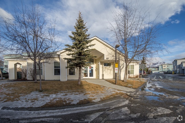
Property Record
10601 Spruce View Loop, Anchorage, AK 99507


Property Detail
10601 Spruce View Loop
01623478000
RIDGEMONT TR H
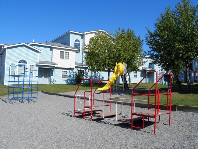
Apartment
Anchorage
R3SL
Alaska
B and X Area of moderate flood hazard, usually the area between the limits of the 100-year and 500-year floods.
5.68 AC
2024
Abbott Loop
2025
Anchorage
002811
Anchorage, AK
6,734 SF
NEARBY LISTINGS FOR SALE OR LEASE
-
-
View all Anchorage listings for sale on LoopNet.com
DEMOGRAPHICS near 10601 Spruce View Loop
1 mile
3 mile
5 mile
2025 Total Population
11,737
67,406
134,802
2030 Population
11,695
67,015
134,462
Pop Growth 2025-2030
(0.36%)
(0.58%)
(0.25%)
Average Age
37
38
39
2025 Total Households
4,559
24,863
50,656
HH Growth 2025-2030
(0.44%)
(0.56%)
(0.22%)
Median Household Inc
$99,595
$112,115
$109,585
Avg Household Size
2.50
2.60
2.60
2025 Avg HH Vehicles
2.00
2.00
2.00
Median Home Value
$348,491
$406,666
$409,110
Median Year Built
1989
1985
1982
Nearby Places
Map Layers
Map Styles
 Street
 Aerial
Transit
 Traffic
 Biking
Places
Listings with unknown addresses are not visible on the map
- Restaurants
- Banks
- Shops
- Fitness
- Groceries
PUBLIC TRANSPORTATION
AIRPORT
Merrill Field
Drive
Walk
Distance
Merrill Field
14 min
6.8 mi
Ted Stevens Anchorage International
Drive
Walk
Distance
Ted Stevens Anchorage International
14 min
8.8 mi
Freight Ports
Port of Anchorage
Drive
Walk
Distance
Port of Anchorage
19 min
9.9 mi
Nearby Properties
Address
Land Use
TOTAL SIZE
Lot Size
Zoning
Address
Land Use
TOTAL SIZE
Lot Size
Zoning
381,477 SF
33.30 AC
B3
Address
Land Use
TOTAL SIZE
Lot Size
Zoning
265,000 SF
49.89 AC
PLISL
Address
Land Use
TOTAL SIZE
Lot Size
Zoning
271,555 SF
55.40 AC
PLI
Address
Land Use
TOTAL SIZE
Lot Size
Zoning
69 AC
PR
Address
Land Use
TOTAL SIZE
Lot Size
Zoning
217,754 SF
14.42 AC
I1
Address
Land Use
TOTAL SIZE
Lot Size
Zoning
150,075 SF
29.17 AC
PLI
Address
Land Use
TOTAL SIZE
Lot Size
Zoning
154,455 SF
16.38 AC
I1
Address
Land Use
TOTAL SIZE
Lot Size
Zoning
13,657 SF
12.35 AC
R3
Address
Land Use
TOTAL SIZE
Lot Size
Zoning
79,808 SF
19.54 AC
I2
Address
Land Use
TOTAL SIZE
Lot Size
Zoning
170,381 SF
10.70 AC
I2
Address
Land Use
TOTAL SIZE
Lot Size
Zoning
151,322 SF
9.18 AC
I1
Address
Land Use
TOTAL SIZE
Lot Size
Zoning
178,437 SF
16.02 AC
B3SL
Address
Land Use
TOTAL SIZE
Lot Size
Zoning
149,219 SF
14.56 AC
B3
Address
Land Use
TOTAL SIZE
Lot Size
Zoning
136,593 SF
9.15 AC
I2
Address
Land Use
TOTAL SIZE
Lot Size
Zoning
52,890 SF
10.64 AC
PLI
Address
Land Use
TOTAL SIZE
Lot Size
Zoning
63,305 SF
12.11 AC
I1
Address
Land Use
TOTAL SIZE
Lot Size
Zoning
109,447 SF
4.54 AC
B3SL
Address
Land Use
TOTAL SIZE
Lot Size
Zoning
83,970 SF
12.16 AC
I1
Address
Land Use
TOTAL SIZE
Lot Size
Zoning
50,413 SF
2.42 AC
B3
Address
Land Use
TOTAL SIZE
Lot Size
Zoning
64,207 SF
5.40 AC
I1
Address
Land Use
TOTAL SIZE
Lot Size
Zoning
166,065 SF
11.71 AC
B3
Address
Land Use
TOTAL SIZE
Lot Size
Zoning
171,492 SF
17.08 AC
I1
Address
Land Use
TOTAL SIZE
Lot Size
Zoning
152,964 SF
16.02 AC
I1
Address
Land Use
TOTAL SIZE
Lot Size
Zoning
110,811 SF
6.93 AC
I1
Address
Land Use
TOTAL SIZE
Lot Size
Zoning
46,101 SF
37.80 AC
I2
Address
Land Use
TOTAL SIZE
Lot Size
Zoning
112,590 SF
10.58 AC
I2
Address
Land Use
TOTAL SIZE
Lot Size
Zoning
10,064 SF
12.22 AC
I2
Address
Land Use
TOTAL SIZE
Lot Size
Zoning
73,505 SF
8.78 AC
I2
Address
Land Use
TOTAL SIZE
Lot Size
Zoning
99,959 SF
1.82 AC
B3
Address
Land Use
TOTAL SIZE
Lot Size
Zoning
28.77 AC
I2
The World's #1 Commercial Real Estate Marketplace
Connect with us
© 2026 CoStar Group
The information above has been obtained from sources believed reliable. While we do not doubt its accuracy we have not verified it and make no guarantee, warranty or representation about it. It is your responsibility to independently confirm its accuracy and completeness. Any projections, opinions, assumptions, or estimates used are for example only and do not represent the current or future performance of the property. The value of this transaction to you depends on tax and other factors which should be evaluated by your tax, financial, and legal advisors. You and your advisors should conduct a careful, independent investigation of the property to determine to your satisfaction the suitability of the property for your needs.