Property Record
10608 W Manslick Rd, Fairdale, KY 40118

NEARBY LISTINGS FOR SALE OR LEASE
-
-
View all Fairdale listings for sale on LoopNet.com
Property Detail
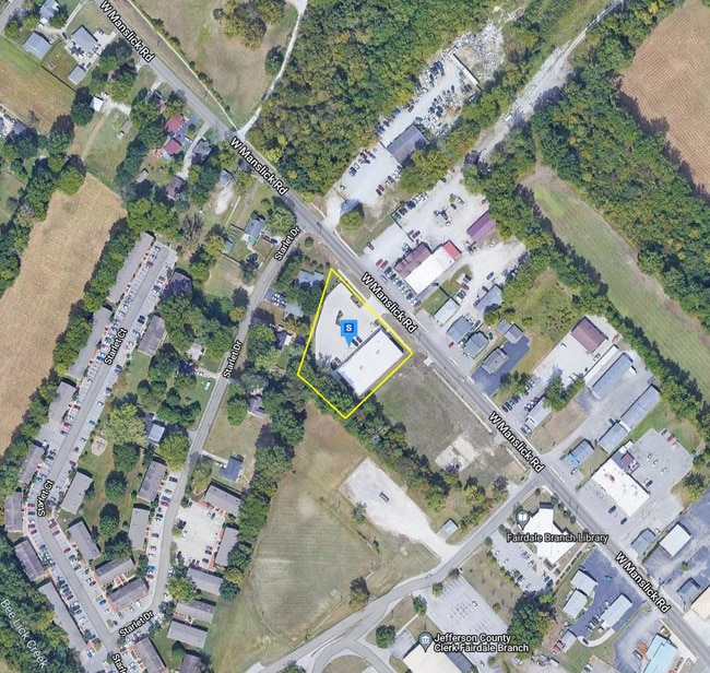
10608 W Manslick Rd
105006200000
0.9405 AC +/-, SWS MANSLICK RD, 97.18 FT SE OF STARLET DR,
Storebuilding
Jefferson
AE
Kentucky
21029C0035G
0.94 AC
2025
South Central
2025
Louisville
012005
Louisville-Jefferson County, KY-IN
2,370 SF
DEMOGRAPHICS near 10608 W Manslick Rd
1 Mile
3 Mile
5 Mile
2024 Total Population
5,233
26,819
98,861
2029 Population
5,225
26,445
98,499
Pop Growth 2024-2029
(0.15%)
(1.39%)
(0.37%)
Average Age
38
39
39
2024 Total Households
2,114
10,384
38,909
HH Growth 2024-2029
(0.24%)
(1.47%)
(0.44%)
Median Household Inc
$55,326
$52,526
$54,410
Avg Household Size
2.40
2.50
2.50
2024 Avg HH Vehicles
2.00
2.00
2.00
Median Home Value
$148,335
$164,792
$163,289
Median Year Built
1982
1973
1971
Nearby Places
Map Layers
Map Styles
 Street
 Aerial
- Restaurants
- Banks
- Shops
- Fitness
- Groceries
PUBLIC TRANSPORTATION
AIRPORT
Louisville Muhammad Ali International
DRIVE
WALK
Distance
Louisville Muhammad Ali International
13 min
6.0 mi
Nearby Properties
Address
Land Use
TOTAL SIZE
Lot Size
Zoning
Address
Land Use
TOTAL SIZE
Lot Size
Zoning
226,400 SF
150.18 AC
EZ1-ENTERP
Address
Land Use
TOTAL SIZE
Lot Size
Zoning
257,385 SF
176.30 AC
Address
Land Use
TOTAL SIZE
Lot Size
Zoning
109.84 AC
R5-RESIDEN
Address
Land Use
TOTAL SIZE
Lot Size
Zoning
221,115 SF
97.92 AC
EZ1-ENTERP
Address
Land Use
TOTAL SIZE
Lot Size
Zoning
822,500 SF
44.75 AC
EZ1-ENTERP
Address
Land Use
TOTAL SIZE
Lot Size
Zoning
Address
Land Use
TOTAL SIZE
Lot Size
Zoning
34.73 AC
Address
Land Use
TOTAL SIZE
Lot Size
Zoning
39.61 AC
Address
Land Use
TOTAL SIZE
Lot Size
Zoning
30.47 AC
R7-RESIDEN
Address
Land Use
TOTAL SIZE
Lot Size
Zoning
2,400 SF
42.61 AC
M2-INDUSTR
Address
Land Use
TOTAL SIZE
Lot Size
Zoning
517,000 SF
31.95 AC
EZ1-ENTERP
Address
Land Use
TOTAL SIZE
Lot Size
Zoning
679,250 SF
35.34 AC
Address
Land Use
TOTAL SIZE
Lot Size
Zoning
22.14 AC
EZ1-ENTERP
Address
Land Use
TOTAL SIZE
Lot Size
Zoning
1,800 SF
31.91 AC
Address
Land Use
TOTAL SIZE
Lot Size
Zoning
28.70 AC
C1-COMMERC
Address
Land Use
TOTAL SIZE
Lot Size
Zoning
18.37 AC
Address
Land Use
TOTAL SIZE
Lot Size
Zoning
2,043 SF
60.14 AC
Address
Land Use
TOTAL SIZE
Lot Size
Zoning
23.20 AC
EZ1-ENTERP
Address
Land Use
TOTAL SIZE
Lot Size
Zoning
2,507 SF
77.40 AC
R5-RESIDEN
Address
Land Use
TOTAL SIZE
Lot Size
Zoning
20,496 SF
18.38 AC
R6-RESIDEN
Address
Land Use
TOTAL SIZE
Lot Size
Zoning
22.40 AC
Address
Land Use
TOTAL SIZE
Lot Size
Zoning
201,600 SF
11.43 AC
EZ1-ENTERP
Address
Land Use
TOTAL SIZE
Lot Size
Zoning
321,501 SF
20 AC
M3-INDUSTR
Address
Land Use
TOTAL SIZE
Lot Size
Zoning
15.72 AC
R6-RESIDEN
Address
Land Use
TOTAL SIZE
Lot Size
Zoning
350,000 SF
20.55 AC
CM-COMMERC
Address
Land Use
TOTAL SIZE
Lot Size
Zoning
200 SF
57.08 AC
R4-RESIDEN
Address
Land Use
TOTAL SIZE
Lot Size
Zoning
5,568 SF
13.52 AC
C1-COMMERC
Address
Land Use
TOTAL SIZE
Lot Size
Zoning
285,378 SF
16.79 AC
EZ1-ENTERP
Address
Land Use
TOTAL SIZE
Lot Size
Zoning
23.17 AC
R4-RESIDEN
Address
Land Use
TOTAL SIZE
Lot Size
Zoning
17.93 AC
The World's #1 Commercial Real Estate Marketplace
Connect with us
© 2026 CoStar Group
The information above has been obtained from sources believed reliable. While we do not doubt its accuracy we have not verified it and make no guarantee, warranty or representation about it. It is your responsibility to independently confirm its accuracy and completeness. Any projections, opinions, assumptions, or estimates used are for example only and do not represent the current or future performance of the property. The value of this transaction to you depends on tax and other factors which should be evaluated by your tax, financial, and legal advisors. You and your advisors should conduct a careful, independent investigation of the property to determine to your satisfaction the suitability of the property for your needs.