Property Record
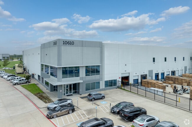
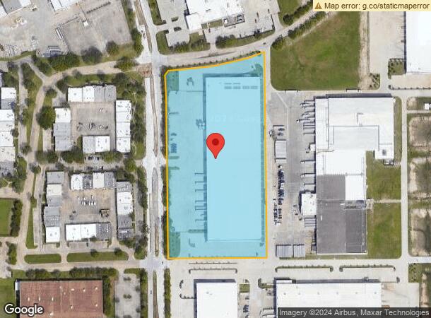
10610 Telge Rd, Houston, TX 77095

NEARBY LISTINGS FOR SALE OR LEASE
Property Detail
10610 Telge Rd
1157380010003
Randalls Distribution Center 2Nd R/P
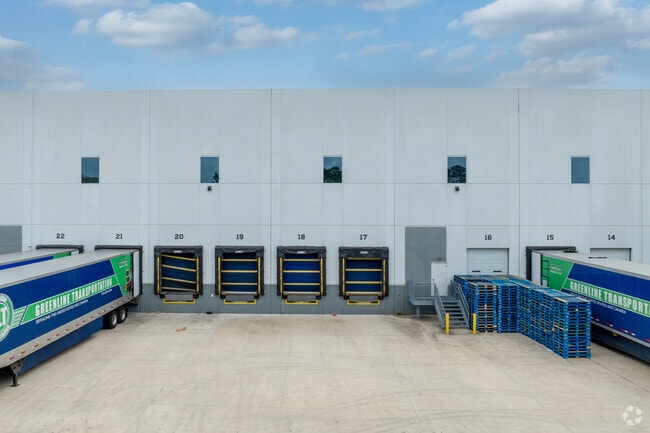
Warehouse
RES C BLK 1 RANDALLS DISTRIBUTION CENTER 2ND R/P
X
Harris
48201C0420P
Texas
2024
10.14 AC
2025
Northwest Outliers
541004
Houston
203,060 SF
Houston-The Woodlands-Sugar Land, TX
DEMOGRAPHICS near 10610 Telge Rd
1 Mile
3 Mile
5 Mile
2024 Total Population
6,369
102,362
297,462
2029 Population
6,382
103,103
301,549
Pop Growth 2024-2029
+ 0.20%
+ 0.72%
+ 1.37%
Average Age
36
38
37
2024 Total Households
2,006
35,855
100,894
HH Growth 2024-2029
+ 0.10%
+ 0.65%
+ 1.30%
Median Household Inc
$88,518
$87,493
$86,967
Avg Household Size
3.10
2.80
2.90
2024 Avg HH Vehicles
2.00
2.00
2.00
Median Home Value
$240,506
$256,706
$255,285
Median Year Built
2002
1997
1997
Nearby Places
Map Layers
Map Styles
 Street
 Aerial
- Restaurants
- Banks
- Shops
- Fitness
- Groceries
PUBLIC TRANSPORTATION
AIRPORT
George Bush Intcntl/Houston
DRIVE
WALK
Distance
George Bush Intcntl/Houston
34 min
23.1 mi
William P Hobby
DRIVE
WALK
Distance
William P Hobby
53 min
36.2 mi
Freight Ports
Port of Houston
DRIVE
WALK
Distance
Port of Houston
44 min
31.8 mi
SALE & LEASE HISTORY
LISTING DATE
SALE/LEASE

May 07, 2019
For Lease
Jul 13, 2018
For Lease
Nearby Properties
Address
Land Use
TOTAL SIZE
Lot Size
Zoning
Address
Land Use
TOTAL SIZE
Lot Size
Zoning
311,285 SF
14.47 AC
Address
Land Use
TOTAL SIZE
Lot Size
Zoning
697,158 SF
Address
Land Use
TOTAL SIZE
Lot Size
Zoning
466,299 SF
23.82 AC
Address
Land Use
TOTAL SIZE
Lot Size
Zoning
560,725 SF
31.41 AC
Address
Land Use
TOTAL SIZE
Lot Size
Zoning
1,353,057 SF
224.60 AC
Address
Land Use
TOTAL SIZE
Lot Size
Zoning
379,588 SF
12.06 AC
Address
Land Use
TOTAL SIZE
Lot Size
Zoning
266,802 SF
3.14 AC
Address
Land Use
TOTAL SIZE
Lot Size
Zoning
327,365 SF
13.85 AC
Address
Land Use
TOTAL SIZE
Lot Size
Zoning
408,710 SF
4.49 AC
Address
Land Use
TOTAL SIZE
Lot Size
Zoning
347,340 SF
16.85 AC
Address
Land Use
TOTAL SIZE
Lot Size
Zoning
307,960 SF
31.75 AC
Address
Land Use
TOTAL SIZE
Lot Size
Zoning
471,800 SF
27.03 AC
Address
Land Use
TOTAL SIZE
Lot Size
Zoning
55.82 AC
Address
Land Use
TOTAL SIZE
Lot Size
Zoning
385,587 SF
34.50 AC
Address
Land Use
TOTAL SIZE
Lot Size
Zoning
449,032 SF
23.46 AC
Address
Land Use
TOTAL SIZE
Lot Size
Zoning
387,245 SF
18.18 AC
Address
Land Use
TOTAL SIZE
Lot Size
Zoning
151,314 SF
3.88 AC
Address
Land Use
TOTAL SIZE
Lot Size
Zoning
399,729 SF
20.15 AC
Address
Land Use
TOTAL SIZE
Lot Size
Zoning
375,251 SF
14.85 AC
Address
Land Use
TOTAL SIZE
Lot Size
Zoning
401,107 SF
33.90 AC
Address
Land Use
TOTAL SIZE
Lot Size
Zoning
384,280 SF
27.19 AC
Address
Land Use
TOTAL SIZE
Lot Size
Zoning
371,729 SF
18.73 AC
Address
Land Use
TOTAL SIZE
Lot Size
Zoning
364,057 SF
22.03 AC
Address
Land Use
TOTAL SIZE
Lot Size
Zoning
221,214 SF
8.33 AC
Address
Land Use
TOTAL SIZE
Lot Size
Zoning
301,102 SF
12.58 AC
Address
Land Use
TOTAL SIZE
Lot Size
Zoning
342,196 SF
15.13 AC
Address
Land Use
TOTAL SIZE
Lot Size
Zoning
373,783 SF
23.12 AC
Address
Land Use
TOTAL SIZE
Lot Size
Zoning
351,468 SF
16.05 AC
Address
Land Use
TOTAL SIZE
Lot Size
Zoning
112,616 SF
0.73 AC
Address
Land Use
TOTAL SIZE
Lot Size
Zoning
324,733 SF
19.26 AC
The World's #1 Commercial Real Estate Marketplace
Connect with us
© 2025 CoStar Group
The information above has been obtained from sources believed reliable. While we do not doubt its accuracy we have not verified it and make no guarantee, warranty or representation about it. It is your responsibility to independently confirm its accuracy and completeness. Any projections, opinions, assumptions, or estimates used are for example only and do not represent the current or future performance of the property. The value of this transaction to you depends on tax and other factors which should be evaluated by your tax, financial, and legal advisors. You and your advisors should conduct a careful, independent investigation of the property to determine to your satisfaction the suitability of the property for your needs.