Property Record
10611 E 59Th St, Indianapolis, IN 46236

Save to a Folder
{{folder.Name}}
{{folder.ListingIds.length}} Properties
{{folder.ListingIds.length}} Property
Create a New Folder
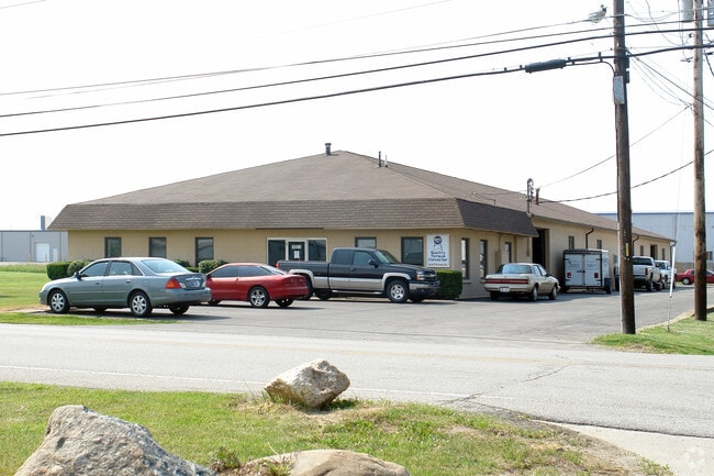
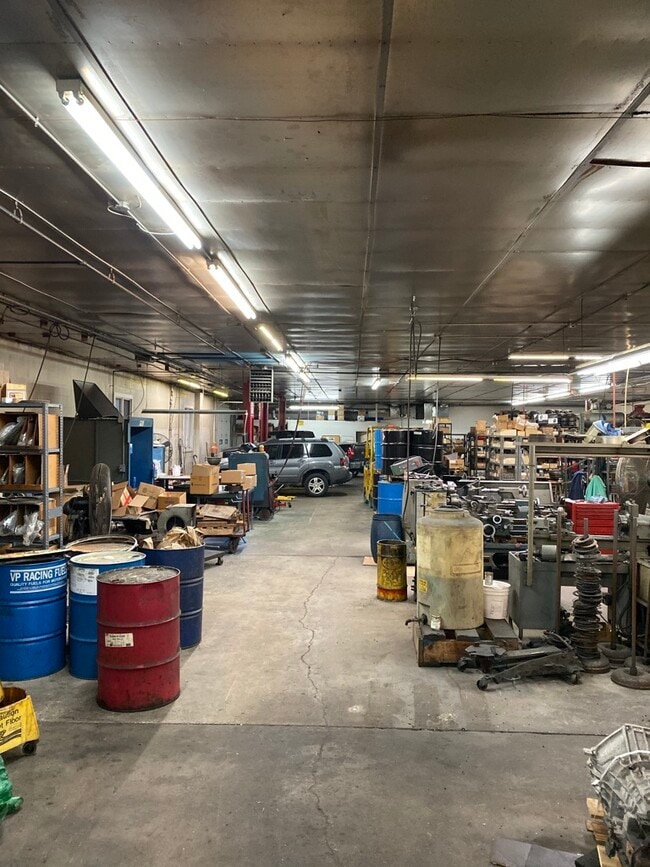
Property Detail
10611 E 59Th St
49-08-04-128-005.000-407
PT NW1/4 SE1/4 S4 T16 R5 BEG 450FT W OF NE COR S270FT W 161FT N 270FT E 161FT TO BEG 1AC
Industrialgeneral
Marion
ZO01
Indiana
B and X Area of moderate flood hazard, usually the area between the limits of the 100-year and 500-year floods.
1 AC
2024
Fort Ben
2025
Indianapolis
330204
Indianapolis-Carmel-Greenwood, IN
9,780 SF
NEARBY LISTINGS FOR SALE OR LEASE
DEMOGRAPHICS near 10611 E 59Th St
1 mile
3 mile
5 mile
2025 Total Population
6,118
66,250
161,661
2030 Population
6,081
67,159
164,032
Pop Growth 2025-2030
(0.60%)
+ 1.37%
+ 1.47%
Average Age
38
36
37
2025 Total Households
2,221
24,614
62,486
HH Growth 2025-2030
(0.63%)
+ 1.34%
+ 1.41%
Median Household Inc
$100,189
$69,242
$71,541
Avg Household Size
2.70
2.60
2.50
2025 Avg HH Vehicles
2.00
2.00
2.00
Median Home Value
$260,474
$249,260
$266,573
Median Year Built
1995
1990
1983
Nearby Places
Map Layers
Map Styles
 Street
 Aerial
Layers
 Traffic
 Biking
Places
Listings with unknown addresses are not visible on the map
- Restaurants
- Banks
- Shops
- Fitness
- Groceries
PUBLIC TRANSPORTATION
AIRPORT
Indianapolis International
Drive
Walk
Distance
Indianapolis International
48 min
26.6 mi
SALE & LEASE HISTORY
LISTING DATE
SALE/LEASE

Jan 15, 2020
For Sale
Nearby Properties
Address
Land Use
TOTAL SIZE
Lot Size
Zoning
Address
Land Use
TOTAL SIZE
Lot Size
Zoning
67.17 AC
Address
Land Use
TOTAL SIZE
Lot Size
Zoning
Address
Land Use
TOTAL SIZE
Lot Size
Zoning
11,154 SF
21.99 AC
Address
Land Use
TOTAL SIZE
Lot Size
Zoning
532,932 SF
61.88 AC
ZO03
Address
Land Use
TOTAL SIZE
Lot Size
Zoning
4,217 SF
7.37 AC
ZO01
Address
Land Use
TOTAL SIZE
Lot Size
Zoning
2,620 SF
32.36 AC
Address
Land Use
TOTAL SIZE
Lot Size
Zoning
125,958 SF
54.85 AC
ZO01
Address
Land Use
TOTAL SIZE
Lot Size
Zoning
2,556 SF
35.56 AC
ZO01
Address
Land Use
TOTAL SIZE
Lot Size
Zoning
2,232 SF
22.88 AC
Address
Land Use
TOTAL SIZE
Lot Size
Zoning
136,336 SF
8.74 AC
ZO01
Address
Land Use
TOTAL SIZE
Lot Size
Zoning
1,769 SF
18.27 AC
Address
Land Use
TOTAL SIZE
Lot Size
Zoning
65,095 SF
4.06 AC
ZO01
Address
Land Use
TOTAL SIZE
Lot Size
Zoning
2,151 SF
11.05 AC
Address
Land Use
TOTAL SIZE
Lot Size
Zoning
293,952 SF
12.88 AC
ZO01
Address
Land Use
TOTAL SIZE
Lot Size
Zoning
109,200 SF
4.63 AC
ZO01
Address
Land Use
TOTAL SIZE
Lot Size
Zoning
245,200 SF
12.08 AC
Address
Land Use
TOTAL SIZE
Lot Size
Zoning
31.13 AC
Address
Land Use
TOTAL SIZE
Lot Size
Zoning
203,720 SF
21.44 AC
Address
Land Use
TOTAL SIZE
Lot Size
Zoning
4,878 SF
25.65 AC
Address
Land Use
TOTAL SIZE
Lot Size
Zoning
192,246 SF
27.51 AC
Address
Land Use
TOTAL SIZE
Lot Size
Zoning
65,541 SF
3.28 AC
ZO01
Address
Land Use
TOTAL SIZE
Lot Size
Zoning
8,386 SF
19.85 AC
Address
Land Use
TOTAL SIZE
Lot Size
Zoning
53,987 SF
2.39 AC
ZO01
Address
Land Use
TOTAL SIZE
Lot Size
Zoning
175,610 SF
23.65 AC
ZO01
Address
Land Use
TOTAL SIZE
Lot Size
Zoning
4,152 SF
19.23 AC
ZO01
Address
Land Use
TOTAL SIZE
Lot Size
Zoning
105,252 SF
9.96 AC
ZO01
Address
Land Use
TOTAL SIZE
Lot Size
Zoning
12,162 SF
18.76 AC
Address
Land Use
TOTAL SIZE
Lot Size
Zoning
109,925 SF
9.23 AC
ZO01
Address
Land Use
TOTAL SIZE
Lot Size
Zoning
80,096 SF
2.72 AC
ZO01
Address
Land Use
TOTAL SIZE
Lot Size
Zoning
1.98 AC
ZO01
The World's #1 Commercial Real Estate Marketplace
Connect with us
© 2026 CoStar Group
The information above has been obtained from sources believed reliable. While we do not doubt its accuracy we have not verified it and make no guarantee, warranty or representation about it. It is your responsibility to independently confirm its accuracy and completeness. Any projections, opinions, assumptions, or estimates used are for example only and do not represent the current or future performance of the property. The value of this transaction to you depends on tax and other factors which should be evaluated by your tax, financial, and legal advisors. You and your advisors should conduct a careful, independent investigation of the property to determine to your satisfaction the suitability of the property for your needs.