Property Record
10620 E 16Th Ave, Spokane Valley, WA 99206


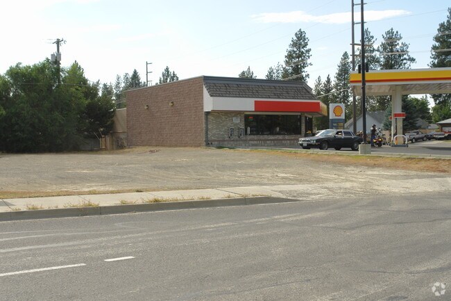
Property Detail
10620 E 16Th Ave
45291.0124
CHESTER HILLS ADDITION: LOT 1 OF BLOCK A; AND THE NORTH 50 FEET OF LOT 4 AND THE NORTH 50 FEET OF THE EAST 20 FEET OF LOT 3 OF BLOCK A; EXCEPT ALL OF THAT PORTION OF UNIVERSITY ROAD CONVEYED TO SPOKANE COUNTY BY SWD UNDER AFN 9104290204
Storebuilding
Spokane
NC
Washington
B and X Area of moderate flood hazard, usually the area between the limits of the 100-year and 500-year floods.
1,4
2026
0.54 AC
2026
Valley
012802
Spokane
2,504 SF
Spokane-Spokane Valley, WA
NEARBY LISTINGS FOR SALE OR LEASE
DEMOGRAPHICS near 10620 E 16Th Ave
1 mile
3 mile
5 mile
2025 Total Population
11,540
74,474
141,919
2030 Population
11,631
75,894
144,998
Pop Growth 2025-2030
+ 0.79%
+ 1.91%
+ 2.17%
Average Age
41
41
40
2025 Total Households
4,357
29,932
56,129
HH Growth 2025-2030
+ 0.71%
+ 1.86%
+ 2.13%
Median Household Inc
$74,455
$72,910
$79,426
Avg Household Size
2.50
2.40
2.50
2025 Avg HH Vehicles
2.00
2.00
2.00
Median Home Value
$374,414
$390,247
$421,203
Median Year Built
1971
1977
1981
Nearby Places
Map Layers
Map Styles
 Street
 Aerial
Layers
 Traffic
 Biking
Places
Listings with unknown addresses are not visible on the map
- Restaurants
- Banks
- Shops
- Fitness
- Groceries
PUBLIC TRANSPORTATION
COMMUTER RAIL
Spokane (Empire Builder - Amtrak)
Drive
Walk
Distance
Spokane (Empire Builder - Amtrak)
15 min
8.3 mi
AIRPORT
Spokane International
Drive
Walk
Distance
Spokane International
23 min
14.2 mi
Freight Ports
Port of Everett
Drive
Walk
Distance
Port of Everett
351 min
309.7 mi
Nearby Properties
Address
Land Use
TOTAL SIZE
Lot Size
Zoning
Address
Land Use
TOTAL SIZE
Lot Size
Zoning
473,651 SF
76.70 AC
R-2
Address
Land Use
TOTAL SIZE
Lot Size
Zoning
260,345 SF
23.70 AC
MDR
Address
Land Use
TOTAL SIZE
Lot Size
Zoning
320,056 SF
13.64 AC
MF-2
Address
Land Use
TOTAL SIZE
Lot Size
Zoning
240,663 SF
8.90 AC
MF-2
Address
Land Use
TOTAL SIZE
Lot Size
Zoning
161,130 SF
6.45 AC
GO
Address
Land Use
TOTAL SIZE
Lot Size
Zoning
Address
Land Use
TOTAL SIZE
Lot Size
Zoning
84,600 SF
17.95 AC
MF-1
Address
Land Use
TOTAL SIZE
Lot Size
Zoning
136,518 SF
7.96 AC
O
Address
Land Use
TOTAL SIZE
Lot Size
Zoning
204,727 SF
8.60 AC
MUC
Address
Land Use
TOTAL SIZE
Lot Size
Zoning
100,060 SF
14.94 AC
R-3
Address
Land Use
TOTAL SIZE
Lot Size
Zoning
68,150 SF
9.99 AC
R-2
Address
Land Use
TOTAL SIZE
Lot Size
Zoning
72,635 SF
8.90 AC
R-3
Address
Land Use
TOTAL SIZE
Lot Size
Zoning
Address
Land Use
TOTAL SIZE
Lot Size
Zoning
87,848 SF
7.36 AC
MF-2
Address
Land Use
TOTAL SIZE
Lot Size
Zoning
150,944 SF
12.16 AC
MF-2
Address
Land Use
TOTAL SIZE
Lot Size
Zoning
Address
Land Use
TOTAL SIZE
Lot Size
Zoning
157,232 SF
3.28 AC
MF-2
Address
Land Use
TOTAL SIZE
Lot Size
Zoning
70,265 SF
9.64 AC
R-2
Address
Land Use
TOTAL SIZE
Lot Size
Zoning
141,372 SF
10.67 AC
MF-2
Address
Land Use
TOTAL SIZE
Lot Size
Zoning
153,262 SF
7.89 AC
MF-2
Address
Land Use
TOTAL SIZE
Lot Size
Zoning
126,906 SF
20.25 AC
LDR
Address
Land Use
TOTAL SIZE
Lot Size
Zoning
47,612 SF
3.38 AC
CMU
Address
Land Use
TOTAL SIZE
Lot Size
Zoning
81,746 SF
6 AC
Address
Land Use
TOTAL SIZE
Lot Size
Zoning
Address
Land Use
TOTAL SIZE
Lot Size
Zoning
87,989 SF
5.38 AC
MF-2
Address
Land Use
TOTAL SIZE
Lot Size
Zoning
117,680 SF
9.26 AC
MF-2
Address
Land Use
TOTAL SIZE
Lot Size
Zoning
118,060 SF
6.17 AC
MUC
Address
Land Use
TOTAL SIZE
Lot Size
Zoning
107,441 SF
4.40 AC
MF-1
Address
Land Use
TOTAL SIZE
Lot Size
Zoning
418,875 SF
18.79 AC
I-1
Address
Land Use
TOTAL SIZE
Lot Size
Zoning
123,938 SF
7.70 AC
MF-2
The World's #1 Commercial Real Estate Marketplace
Connect with us
© 2026 CoStar Group
The information above has been obtained from sources believed reliable. While we do not doubt its accuracy we have not verified it and make no guarantee, warranty or representation about it. It is your responsibility to independently confirm its accuracy and completeness. Any projections, opinions, assumptions, or estimates used are for example only and do not represent the current or future performance of the property. The value of this transaction to you depends on tax and other factors which should be evaluated by your tax, financial, and legal advisors. You and your advisors should conduct a careful, independent investigation of the property to determine to your satisfaction the suitability of the property for your needs.