Property Record
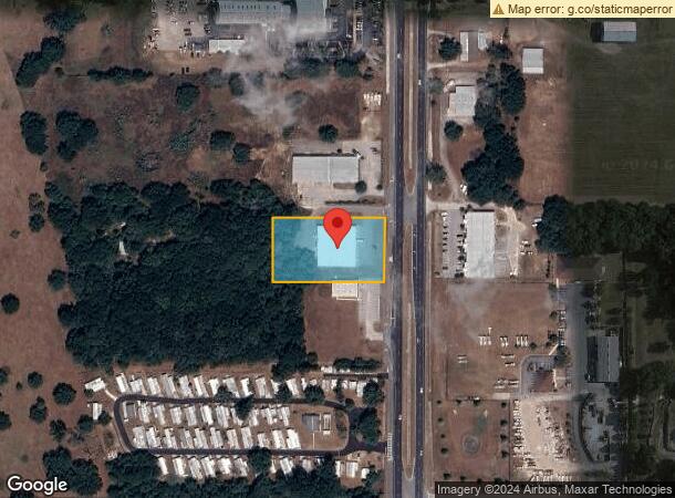
10625 Us Highway 301, Dade City, FL 33525

NEARBY LISTINGS FOR SALE OR LEASE
Property Detail
10625 Us Highway 301
Tampa-St. Petersburg-Clearwater, FL
U.S. 301
15-25-21-0000-00300-0012
COM AT NE COR OF SEC TH S00DEG 21 32W 948.00 FT TH N89DEG 47 04W 52.68 FT TO WLY R/W LINE OF US HWY 301 TH S00DEG 23 51W 822.26 FT FOR POB TH CONT S00DEG 2351W 200.00 FT TH S89DEG 5716W 350.00 FT TH N00DEG 2351E 200.00 FT TH N89DEG 5716E 350.00 FT TO
Storebuilding
Pasco
X
Florida
12101C0287F
12
2024
1.61 AC
2026
Pasco County
032805
Tampa/St Petersburg
14,475 SF
DEMOGRAPHICS near 10625 Us Highway 301
1 Mile
3 Mile
5 Mile
2024 Total Population
1,556
13,966
52,276
2029 Population
1,868
16,921
63,312
Pop Growth 2024-2029
+ 20.05%
+ 21.16%
+ 21.11%
Average Age
54
46
45
2024 Total Households
768
5,840
21,263
HH Growth 2024-2029
+ 20.18%
+ 21.03%
+ 21.34%
Median Household Inc
$50,620
$54,692
$52,494
Avg Household Size
2.00
2.30
2.30
2024 Avg HH Vehicles
2.00
2.00
2.00
Median Home Value
$84,203
$179,025
$176,011
Median Year Built
1986
1990
1987
Nearby Places
Map Layers
Map Styles
 Street
 Aerial
- Restaurants
- Banks
- Shops
- Fitness
- Groceries
PUBLIC TRANSPORTATION
AIRPORT
Tampa International
DRIVE
WALK
Distance
Tampa International
62 min
40.9 mi
Freight Ports
Port of Tampa Bay
DRIVE
WALK
Distance
Port of Tampa Bay
55 min
35.1 mi
SALE & LEASE HISTORY
LISTING DATE
SALE/LEASE

Jun 18, 2018
For Sale
Nearby Properties
Address
Land Use
TOTAL SIZE
Lot Size
Zoning
Address
Land Use
TOTAL SIZE
Lot Size
Zoning
273,092 SF
12.29 AC
R4
Address
Land Use
TOTAL SIZE
Lot Size
Zoning
127,340 SF
15.04 AC
AC
Address
Land Use
TOTAL SIZE
Lot Size
Zoning
191,025 SF
27.54 AC
RIO
Address
Land Use
TOTAL SIZE
Lot Size
Zoning
107,232 SF
12.79 AC
MPUD
Address
Land Use
TOTAL SIZE
Lot Size
Zoning
98,980 SF
5.36 AC
C2
Address
Land Use
TOTAL SIZE
Lot Size
Zoning
80,036 SF
12 AC
C2
Address
Land Use
TOTAL SIZE
Lot Size
Zoning
98,666 SF
19.80 AC
RIO
Address
Land Use
TOTAL SIZE
Lot Size
Zoning
54,371 SF
8.09 AC
CH
Address
Land Use
TOTAL SIZE
Lot Size
Zoning
16,994 SF
2.40 AC
CG
Address
Land Use
TOTAL SIZE
Lot Size
Zoning
111,677 SF
10.40 AC
CG
Address
Land Use
TOTAL SIZE
Lot Size
Zoning
123,959 SF
15.18 AC
C2
Address
Land Use
TOTAL SIZE
Lot Size
Zoning
33,580 SF
6.09 AC
RIO
Address
Land Use
TOTAL SIZE
Lot Size
Zoning
88,358 SF
36.68 AC
OUA
Address
Land Use
TOTAL SIZE
Lot Size
Zoning
86,138 SF
6.62 AC
CG
Address
Land Use
TOTAL SIZE
Lot Size
Zoning
37,368 SF
10.82 AC
CG
Address
Land Use
TOTAL SIZE
Lot Size
Zoning
76,818 SF
15 AC
AC
Address
Land Use
TOTAL SIZE
Lot Size
Zoning
26,520 SF
4.42 AC
CG
Address
Land Use
TOTAL SIZE
Lot Size
Zoning
142.77 AC
MPUD
Address
Land Use
TOTAL SIZE
Lot Size
Zoning
95,673 SF
7.51 AC
PDH2
Address
Land Use
TOTAL SIZE
Lot Size
Zoning
36,518 SF
2.77 AC
CG
Address
Land Use
TOTAL SIZE
Lot Size
Zoning
32,530 SF
33 AC
RIO
Address
Land Use
TOTAL SIZE
Lot Size
Zoning
35,904 SF
5.19 AC
RS1
Address
Land Use
TOTAL SIZE
Lot Size
Zoning
112,952 SF
13.03 AC
MF1
Address
Land Use
TOTAL SIZE
Lot Size
Zoning
16,261 SF
4.35 AC
C2
Address
Land Use
TOTAL SIZE
Lot Size
Zoning
28,109 SF
9.37 AC
AR1
Address
Land Use
TOTAL SIZE
Lot Size
Zoning
54,400 SF
3.03 AC
CG
Address
Land Use
TOTAL SIZE
Lot Size
Zoning
26,350 SF
10.55 AC
AR
Address
Land Use
TOTAL SIZE
Lot Size
Zoning
20,850 SF
5 AC
C2
Address
Land Use
TOTAL SIZE
Lot Size
Zoning
3,440 SF
1.57 AC
CH
Address
Land Use
TOTAL SIZE
Lot Size
Zoning
26,674 SF
1.21 AC
C2
The World's #1 Commercial Real Estate Marketplace
Connect with us
© 2026 CoStar Group
The information above has been obtained from sources believed reliable. While we do not doubt its accuracy we have not verified it and make no guarantee, warranty or representation about it. It is your responsibility to independently confirm its accuracy and completeness. Any projections, opinions, assumptions, or estimates used are for example only and do not represent the current or future performance of the property. The value of this transaction to you depends on tax and other factors which should be evaluated by your tax, financial, and legal advisors. You and your advisors should conduct a careful, independent investigation of the property to determine to your satisfaction the suitability of the property for your needs.