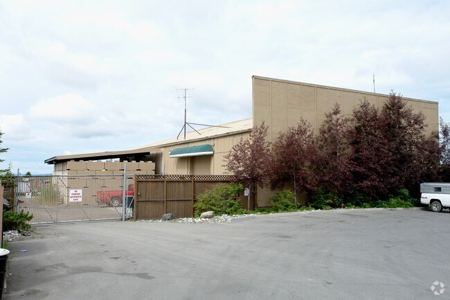
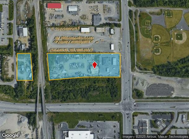
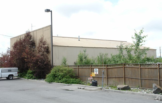
Property Record
10630 Old Seward Hwy, Anchorage, AK 99515
NEARBY LISTINGS FOR SALE OR LEASE
-
-
-
No Photo
-
View all Anchorage listings for sale on LoopNet.com
Property Detail
10630 Old Seward Hwy
01604151000
T12N R3W SEC 18 N2S2SE4SE4PTN
Supermarket
Anchorage
X
Alaska
0200051155D
7.41 AC
2024
Dimond South-20
2025
Anchorage
002712
Anchorage, AK
6,000 SF
DEMOGRAPHICS near 10630 Old Seward Hwy
1 Mile
3 Mile
5 Mile
2024 Total Population
9,317
73,186
130,701
2029 Population
9,083
71,666
128,364
Pop Growth 2024-2029
(2.51%)
(2.08%)
(1.79%)
Average Age
36
38
38
2024 Total Households
3,733
26,873
49,497
HH Growth 2024-2029
(2.60%)
(2.17%)
(1.84%)
Median Household Inc
$78,759
$99,510
$97,630
Avg Household Size
2.50
2.70
2.50
2024 Avg HH Vehicles
2.00
2.00
2.00
Median Home Value
$262,309
$358,151
$366,040
Median Year Built
1988
1985
1982
Nearby Places
Map Layers
Map Styles
 Street
 Aerial
- Restaurants
- Banks
- Shops
- Fitness
- Groceries
PUBLIC TRANSPORTATION
AIRPORT
Ted Stevens Anchorage International
DRIVE
WALK
Distance
Ted Stevens Anchorage International
13 min
7.6 mi
Merrill Field
DRIVE
WALK
Distance
Merrill Field
15 min
8.2 mi
Freight Ports
Port of Anchorage
DRIVE
WALK
Distance
Port of Anchorage
18 min
9.3 mi
Nearby Properties
Address
Land Use
TOTAL SIZE
Lot Size
Zoning
Address
Land Use
TOTAL SIZE
Lot Size
Zoning
381,477 SF
33.30 AC
B3
Address
Land Use
TOTAL SIZE
Lot Size
Zoning
267,442 SF
61.04 AC
PLI
Address
Land Use
TOTAL SIZE
Lot Size
Zoning
265,000 SF
49.89 AC
PLISL
Address
Land Use
TOTAL SIZE
Lot Size
Zoning
168,640 SF
3.38 AC
I2
Address
Land Use
TOTAL SIZE
Lot Size
Zoning
69 AC
PR
Address
Land Use
TOTAL SIZE
Lot Size
Zoning
217,754 SF
14.42 AC
I1
Address
Land Use
TOTAL SIZE
Lot Size
Zoning
150,075 SF
29.17 AC
PLI
Address
Land Use
TOTAL SIZE
Lot Size
Zoning
164,774 SF
29.26 AC
PLI
Address
Land Use
TOTAL SIZE
Lot Size
Zoning
154,455 SF
16.38 AC
I1
Address
Land Use
TOTAL SIZE
Lot Size
Zoning
79,808 SF
19.54 AC
I2
Address
Land Use
TOTAL SIZE
Lot Size
Zoning
170,381 SF
10.70 AC
I2
Address
Land Use
TOTAL SIZE
Lot Size
Zoning
151,322 SF
9.18 AC
I1
Address
Land Use
TOTAL SIZE
Lot Size
Zoning
178,437 SF
16.02 AC
B3SL
Address
Land Use
TOTAL SIZE
Lot Size
Zoning
149,219 SF
14.56 AC
B3
Address
Land Use
TOTAL SIZE
Lot Size
Zoning
136,593 SF
9.15 AC
I2
Address
Land Use
TOTAL SIZE
Lot Size
Zoning
52,890 SF
10.64 AC
PLI
Address
Land Use
TOTAL SIZE
Lot Size
Zoning
63,305 SF
12.11 AC
I1
Address
Land Use
TOTAL SIZE
Lot Size
Zoning
109,447 SF
4.54 AC
B3SL
Address
Land Use
TOTAL SIZE
Lot Size
Zoning
83,970 SF
12.16 AC
I1
Address
Land Use
TOTAL SIZE
Lot Size
Zoning
50,413 SF
2.42 AC
B3
Address
Land Use
TOTAL SIZE
Lot Size
Zoning
64,207 SF
5.40 AC
I1
Address
Land Use
TOTAL SIZE
Lot Size
Zoning
166,065 SF
11.71 AC
B3
Address
Land Use
TOTAL SIZE
Lot Size
Zoning
171,492 SF
17.08 AC
I1
Address
Land Use
TOTAL SIZE
Lot Size
Zoning
152,964 SF
16.02 AC
I1
Address
Land Use
TOTAL SIZE
Lot Size
Zoning
110,811 SF
6.93 AC
I1
Address
Land Use
TOTAL SIZE
Lot Size
Zoning
46,101 SF
37.80 AC
I2
Address
Land Use
TOTAL SIZE
Lot Size
Zoning
112,590 SF
10.58 AC
I2
Address
Land Use
TOTAL SIZE
Lot Size
Zoning
82,689 SF
8.07 AC
I1
Address
Land Use
TOTAL SIZE
Lot Size
Zoning
10,064 SF
12.22 AC
I2
Address
Land Use
TOTAL SIZE
Lot Size
Zoning
73,505 SF
8.78 AC
I2
The World's #1 Commercial Real Estate Marketplace
Connect with us
© 2026 CoStar Group
The information above has been obtained from sources believed reliable. While we do not doubt its accuracy we have not verified it and make no guarantee, warranty or representation about it. It is your responsibility to independently confirm its accuracy and completeness. Any projections, opinions, assumptions, or estimates used are for example only and do not represent the current or future performance of the property. The value of this transaction to you depends on tax and other factors which should be evaluated by your tax, financial, and legal advisors. You and your advisors should conduct a careful, independent investigation of the property to determine to your satisfaction the suitability of the property for your needs.