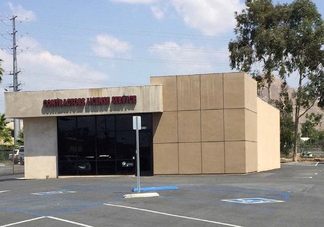
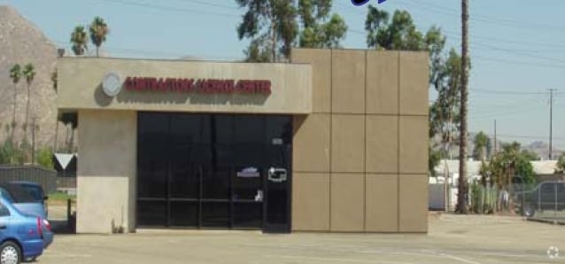
Property Record
1064 E La Cadena Dr, Riverside, CA 92507


Current Lease Availabilities
Property Detail
1064 E La Cadena Dr
Riverside-San Bernardino-Ontario, CA
.89 ACRES M/L IN POR LOT 2 AND LOT 3 MB 002/040 ORANGE GROWERS BANK ADD
210-020-003
Riverside
Officebuilding
California
C2
3
B and X Area of moderate flood hazard, usually the area between the limits of the 100-year and 500-year floods.
0.89 AC
2024
Riverside
2025
Inland Empire (California)
042209
NEARBY LISTINGS FOR SALE OR LEASE
DEMOGRAPHICS near 1064 E La Cadena Dr
1 mile
3 mile
5 mile
2024 Total Population
8,665
88,690
212,562
2029 Population
8,860
90,882
217,135
Pop Growth 2024-2029
+ 2.25%
+ 2.47%
+ 2.15%
Average Age
35
34
36
2024 Total Households
2,435
25,719
64,797
HH Growth 2024-2029
+ 1.89%
+ 2.08%
+ 1.87%
Median Household Inc
$92,028
$76,911
$84,968
Avg Household Size
3.50
3.00
3.00
2024 Avg HH Vehicles
3.00
2.00
2.00
Median Home Value
$466,902
$533,215
$596,103
Median Year Built
1970
1974
1975
Nearby Places
Map Layers
Map Styles
 Street
 Aerial
Transit
 Traffic
 Biking
Places
Listings with unknown addresses are not visible on the map
- Restaurants
- Banks
- Shops
- Fitness
- Groceries
PUBLIC TRANSPORTATION
COMMUTER RAIL
Riverside-Hunter Park/Ucr (Metrolink 91-Perris Valley Line - Metrolink Trains)
Drive
Walk
Distance
Riverside-Hunter Park/Ucr (Metrolink 91-Perris Valley Line - Metrolink Trains)
3 min
1.5 mi
Riverside-Downtown (91 Line - Southern California Regional Rail Authority (Metrolink), Inland Empire-Orange County Line - Southern California Regional Rail Authority (Metrolink), Riverside Line - Southern California Regional Rail Authority (Metrolink))
Drive
Walk
Distance
Riverside-Downtown (91 Line - Southern California Regional Rail Authority (Metrolink), Inland Empire-Orange County Line - Southern California Regional Rail Authority (Metrolink), Riverside Line - Southern California Regional Rail Authority (Metrolink))
7 min
3.2 mi
AIRPORT
Ontario International
Drive
Walk
Distance
Ontario International
25 min
18.1 mi
Freight Ports
Port of Long Beach
Drive
Walk
Distance
Port of Long Beach
75 min
59.0 mi
Nearby Properties
Address
Land Use
TOTAL SIZE
Lot Size
Zoning
Address
Land Use
TOTAL SIZE
Lot Size
Zoning
1,186,950 SF
54.77 AC
Address
Land Use
TOTAL SIZE
Lot Size
Zoning
1,025,132 SF
46.44 AC
Address
Land Use
TOTAL SIZE
Lot Size
Zoning
1,000,177 SF
46 AC
Address
Land Use
TOTAL SIZE
Lot Size
Zoning
798,304 SF
42.64 AC
AMSP
Address
Land Use
TOTAL SIZE
Lot Size
Zoning
247,416 SF
10.17 AC
Address
Land Use
TOTAL SIZE
Lot Size
Zoning
1,009,120 SF
35.22 AC
Address
Land Use
TOTAL SIZE
Lot Size
Zoning
494,575 SF
25.33 AC
MP
Address
Land Use
TOTAL SIZE
Lot Size
Zoning
505,152 SF
28.88 AC
Address
Land Use
TOTAL SIZE
Lot Size
Zoning
599,735 SF
33.25 AC
AMSP
Address
Land Use
TOTAL SIZE
Lot Size
Zoning
369,842 SF
16.35 AC
Address
Land Use
TOTAL SIZE
Lot Size
Zoning
411,707 SF
19.34 AC
Address
Land Use
TOTAL SIZE
Lot Size
Zoning
350,278 SF
1.21 AC
Address
Land Use
TOTAL SIZE
Lot Size
Zoning
272,120 SF
13.05 AC
Address
Land Use
TOTAL SIZE
Lot Size
Zoning
447,190 SF
21.08 AC
Address
Land Use
TOTAL SIZE
Lot Size
Zoning
26,879 SF
16.27 AC
R3
Address
Land Use
TOTAL SIZE
Lot Size
Zoning
217,036 SF
1.66 AC
C2
Address
Land Use
TOTAL SIZE
Lot Size
Zoning
182,624 SF
16.07 AC
Address
Land Use
TOTAL SIZE
Lot Size
Zoning
424,904 SF
23.03 AC
Address
Land Use
TOTAL SIZE
Lot Size
Zoning
1,056,072 SF
51.85 AC
AMSP
Address
Land Use
TOTAL SIZE
Lot Size
Zoning
156,241 SF
2.55 AC
Address
Land Use
TOTAL SIZE
Lot Size
Zoning
55.22 AC
AMSP
Address
Land Use
TOTAL SIZE
Lot Size
Zoning
139,454 SF
0.97 AC
DSP
Address
Land Use
TOTAL SIZE
Lot Size
Zoning
750,700 SF
32.81 AC
AMSP
Address
Land Use
TOTAL SIZE
Lot Size
Zoning
36,010 SF
11.76 AC
R3
Address
Land Use
TOTAL SIZE
Lot Size
Zoning
210,004 SF
11.68 AC
Address
Land Use
TOTAL SIZE
Lot Size
Zoning
87,600 SF
0.39 AC
The World's #1 Commercial Real Estate Marketplace
Connect with us
© 2026 CoStar Group
The information above has been obtained from sources believed reliable. While we do not doubt its accuracy we have not verified it and make no guarantee, warranty or representation about it. It is your responsibility to independently confirm its accuracy and completeness. Any projections, opinions, assumptions, or estimates used are for example only and do not represent the current or future performance of the property. The value of this transaction to you depends on tax and other factors which should be evaluated by your tax, financial, and legal advisors. You and your advisors should conduct a careful, independent investigation of the property to determine to your satisfaction the suitability of the property for your needs.