Property Record
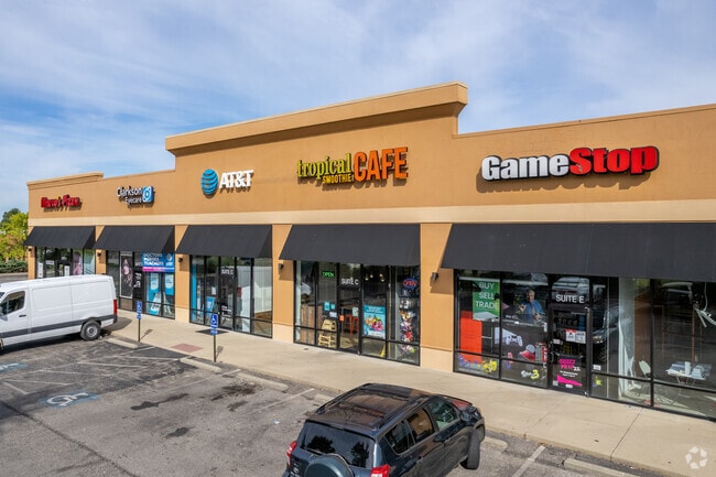
1064 State Route 28, Milford, OH 45150


NEARBY LISTINGS FOR SALE OR LEASE
Property Detail
1064 State Route 28
Stripcommercialcenter
Clermont
X
Ohio
39025C0130G
1.25 AC
2024
Milford/Wards Corner
2024
Cincinnati/Dayton
040403
Cincinnati, OH-KY-IN
12,000 SF
18-25-16D-278
DEMOGRAPHICS near 1064 State Route 28
1 Mile
3 Mile
5 Mile
2024 Total Population
7,318
42,896
74,856
2029 Population
7,480
43,904
76,277
Pop Growth 2024-2029
+ 2.21%
+ 2.35%
+ 1.90%
Average Age
41
41
41
2024 Total Households
2,981
16,360
28,229
HH Growth 2024-2029
+ 2.15%
+ 2.33%
+ 1.93%
Median Household Inc
$67,589
$83,048
$88,371
Avg Household Size
2.40
2.60
2.60
2024 Avg HH Vehicles
2.00
2.00
2.00
Median Home Value
$229,437
$238,576
$259,680
Median Year Built
1984
1983
1983
Nearby Places
Map Layers
Map Styles
 Street
 Aerial
- Restaurants
- Banks
- Shops
- Fitness
- Groceries
PUBLIC TRANSPORTATION
AIRPORT
Cincinnati/Northern Kentucky International
DRIVE
WALK
Distance
Cincinnati/Northern Kentucky International
50 min
33.8 mi
SALE & LEASE HISTORY
LISTING DATE
SALE/LEASE

Sep 04, 2025
For Lease
Oct 09, 2024
For Sale
Mar 12, 2021
For Lease
Feb 11, 2019
For Lease
Aug 17, 2020
For Lease
Nearby Properties
Address
Land Use
TOTAL SIZE
Lot Size
Zoning
Address
Land Use
TOTAL SIZE
Lot Size
Zoning
145,346 SF
108.11 AC
Address
Land Use
TOTAL SIZE
Lot Size
Zoning
315,096 SF
9.48 AC
Address
Land Use
TOTAL SIZE
Lot Size
Zoning
2,555 SF
23.68 AC
Address
Land Use
TOTAL SIZE
Lot Size
Zoning
43,511 SF
12.36 AC
Address
Land Use
TOTAL SIZE
Lot Size
Zoning
6,432 SF
16.37 AC
Address
Land Use
TOTAL SIZE
Lot Size
Zoning
220,050 SF
33 AC
Address
Land Use
TOTAL SIZE
Lot Size
Zoning
37,328 SF
9.35 AC
Address
Land Use
TOTAL SIZE
Lot Size
Zoning
6.76 AC
Address
Land Use
TOTAL SIZE
Lot Size
Zoning
20,432 SF
20.32 AC
Address
Land Use
TOTAL SIZE
Lot Size
Zoning
12.61 AC
Address
Land Use
TOTAL SIZE
Lot Size
Zoning
210,444 SF
29.04 AC
Address
Land Use
TOTAL SIZE
Lot Size
Zoning
3,042 SF
24.24 AC
Address
Land Use
TOTAL SIZE
Lot Size
Zoning
53,033 SF
17.48 AC
Address
Land Use
TOTAL SIZE
Lot Size
Zoning
23.24 AC
Address
Land Use
TOTAL SIZE
Lot Size
Zoning
200,000 SF
41.92 AC
Address
Land Use
TOTAL SIZE
Lot Size
Zoning
53,033 SF
32.99 AC
Address
Land Use
TOTAL SIZE
Lot Size
Zoning
31,200 SF
3.92 AC
Address
Land Use
TOTAL SIZE
Lot Size
Zoning
27.51 AC
Address
Land Use
TOTAL SIZE
Lot Size
Zoning
Address
Land Use
TOTAL SIZE
Lot Size
Zoning
74,252 SF
20.47 AC
Address
Land Use
TOTAL SIZE
Lot Size
Zoning
7,000 SF
0.18 AC
M1
Address
Land Use
TOTAL SIZE
Lot Size
Zoning
14,400 SF
41.92 AC
Address
Land Use
TOTAL SIZE
Lot Size
Zoning
50,720 SF
6.29 AC
Address
Land Use
TOTAL SIZE
Lot Size
Zoning
86,550 SF
7.13 AC
Address
Land Use
TOTAL SIZE
Lot Size
Zoning
1,748 SF
9.23 AC
Address
Land Use
TOTAL SIZE
Lot Size
Zoning
7,192 SF
19.87 AC
Address
Land Use
TOTAL SIZE
Lot Size
Zoning
3,932 SF
42.43 AC
Address
Land Use
TOTAL SIZE
Lot Size
Zoning
7,376 SF
6.01 AC
Address
Land Use
TOTAL SIZE
Lot Size
Zoning
110,569 SF
7.88 AC
Address
Land Use
TOTAL SIZE
Lot Size
Zoning
15,065 SF
1.62 AC
The World's #1 Commercial Real Estate Marketplace
Connect with us
© 2026 CoStar Group
The information above has been obtained from sources believed reliable. While we do not doubt its accuracy we have not verified it and make no guarantee, warranty or representation about it. It is your responsibility to independently confirm its accuracy and completeness. Any projections, opinions, assumptions, or estimates used are for example only and do not represent the current or future performance of the property. The value of this transaction to you depends on tax and other factors which should be evaluated by your tax, financial, and legal advisors. You and your advisors should conduct a careful, independent investigation of the property to determine to your satisfaction the suitability of the property for your needs.