Property Record
1065 E Beal Ave, Bucyrus, OH 44820
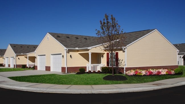
Property Detail
1065 E Beal Ave
Bucyrus, OH
536PT BK 937 PG 1865 PB PG
08-0014603.000
Crawford
Apartmenthouse5plusunits
Ohio
B and X Area of moderate flood hazard, usually the area between the limits of the 100-year and 500-year floods.
937
2025
3.65 AC
2025
Ohio North Area
974600
Other Market Areas
NEARBY LISTINGS FOR SALE OR LEASE
-
-
View all Bucyrus listings for sale on LoopNet.com
DEMOGRAPHICS near 1065 E Beal Ave
1 mile
3 mile
5 mile
2025 Total Population
2,857
12,748
14,526
2030 Population
2,852
12,726
14,487
Pop Growth 2025-2030
(0.18%)
(0.17%)
(0.27%)
Average Age
45
43
43
2025 Total Households
1,326
5,663
6,382
HH Growth 2025-2030
(0.30%)
(0.25%)
(0.31%)
Median Household Inc
$56,030
$53,663
$54,988
Avg Household Size
2.10
2.20
2.20
2025 Avg HH Vehicles
2.00
2.00
2.00
Median Home Value
$143,698
$134,558
$141,173
Median Year Built
1964
1959
1960
Nearby Places
Map Layers
Map Styles
 Street
 Aerial
Layers
 Traffic
 Biking
Places
Listings with unknown addresses are not visible on the map
- Restaurants
- Banks
- Shops
- Fitness
- Groceries
Nearby Properties
Address
Land Use
TOTAL SIZE
Lot Size
Zoning
Address
Land Use
TOTAL SIZE
Lot Size
Zoning
1.46 AC
Address
Land Use
TOTAL SIZE
Lot Size
Zoning
7,092 SF
16.97 AC
Address
Land Use
TOTAL SIZE
Lot Size
Zoning
49,328 SF
7.08 AC
Address
Land Use
TOTAL SIZE
Lot Size
Zoning
1.20 AC
Address
Land Use
TOTAL SIZE
Lot Size
Zoning
1,968 SF
70.19 AC
Address
Land Use
TOTAL SIZE
Lot Size
Zoning
Address
Land Use
TOTAL SIZE
Lot Size
Zoning
80,304 SF
22.72 AC
Address
Land Use
TOTAL SIZE
Lot Size
Zoning
80,364 SF
3.85 AC
Address
Land Use
TOTAL SIZE
Lot Size
Zoning
10.03 AC
Address
Land Use
TOTAL SIZE
Lot Size
Zoning
6,996 SF
7.14 AC
Address
Land Use
TOTAL SIZE
Lot Size
Zoning
20.16 AC
Address
Land Use
TOTAL SIZE
Lot Size
Zoning
4.72 AC
Address
Land Use
TOTAL SIZE
Lot Size
Zoning
3.73 AC
Address
Land Use
TOTAL SIZE
Lot Size
Zoning
4.39 AC
Address
Land Use
TOTAL SIZE
Lot Size
Zoning
34,745 SF
0.07 AC
Address
Land Use
TOTAL SIZE
Lot Size
Zoning
4,500 SF
7.18 AC
Address
Land Use
TOTAL SIZE
Lot Size
Zoning
63,945 SF
7.59 AC
Address
Land Use
TOTAL SIZE
Lot Size
Zoning
19,017 SF
2.93 AC
Address
Land Use
TOTAL SIZE
Lot Size
Zoning
10,016 SF
14.41 AC
Address
Land Use
TOTAL SIZE
Lot Size
Zoning
63.50 AC
Address
Land Use
TOTAL SIZE
Lot Size
Zoning
36.52 AC
Address
Land Use
TOTAL SIZE
Lot Size
Zoning
20,162 SF
0.35 AC
Address
Land Use
TOTAL SIZE
Lot Size
Zoning
13,440 SF
0.33 AC
Address
Land Use
TOTAL SIZE
Lot Size
Zoning
2,165 SF
7.22 AC
Address
Land Use
TOTAL SIZE
Lot Size
Zoning
18.45 AC
Address
Land Use
TOTAL SIZE
Lot Size
Zoning
0.25 AC
Address
Land Use
TOTAL SIZE
Lot Size
Zoning
20,656 SF
3.93 AC
Address
Land Use
TOTAL SIZE
Lot Size
Zoning
3.12 AC
Address
Land Use
TOTAL SIZE
Lot Size
Zoning
61,600 SF
14.12 AC
Address
Land Use
TOTAL SIZE
Lot Size
Zoning
17,032 SF
5.33 AC
The World's #1 Commercial Real Estate Marketplace
Connect with us
© 2026 CoStar Group
The information above has been obtained from sources believed reliable. While we do not doubt its accuracy we have not verified it and make no guarantee, warranty or representation about it. It is your responsibility to independently confirm its accuracy and completeness. Any projections, opinions, assumptions, or estimates used are for example only and do not represent the current or future performance of the property. The value of this transaction to you depends on tax and other factors which should be evaluated by your tax, financial, and legal advisors. You and your advisors should conduct a careful, independent investigation of the property to determine to your satisfaction the suitability of the property for your needs.