Property Record
1065 Pray Blvd, Waterville, OH 43566


NEARBY LISTINGS FOR SALE OR LEASE
Property Detail
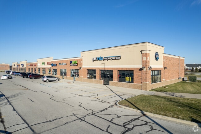
1065 Pray Blvd
Toledo, OH
Commerce Village At Waterv Ille Landing
96-61240
COMMERCE VILLAGE AT WATERV ILLE LANDING PLAT ONELOT 1 (SEE 96-61260
Regionalshoppingcenterormallwithanchorstore
Lucas
AE
Ohio
39173C0015D
1
0
3.13 AC
2025
South/Southwest
008905
Toledo
28,760 SF
DEMOGRAPHICS near 1065 Pray Blvd
1 mile
3 mile
5 mile
2024 Total Population
3,664
14,631
35,887
2029 Population
3,745
14,601
35,763
Pop Growth 2024-2029
+ 2.21%
(0.21%)
(0.35%)
Average Age
40
41
42
2024 Total Households
1,310
5,468
13,414
HH Growth 2024-2029
+ 2.06%
(0.44%)
(0.56%)
Median Household Inc
$103,862
$101,032
$108,537
Avg Household Size
2.70
2.60
2.60
2024 Avg HH Vehicles
2.00
2.00
2.00
Median Home Value
$248,462
$261,210
$286,518
Median Year Built
2000
1994
1999
Nearby Places
Map Layers
Map Styles
 Street
 Aerial
Transit
 Traffic
 Biking
Places
Listings with unknown addresses are not visible on the map
- Restaurants
- Banks
- Shops
- Fitness
- Groceries
PUBLIC TRANSPORTATION
AIRPORT
Eugene F Kranz Toledo Express
Drive
Walk
Distance
Eugene F Kranz Toledo Express
20 min
9.0 mi
SALE & LEASE HISTORY
LISTING DATE
SALE/LEASE

Oct 13, 2017
For Lease
Feb 11, 2021
For Lease
Nearby Properties
Address
Land Use
TOTAL SIZE
Lot Size
Zoning
Address
Land Use
TOTAL SIZE
Lot Size
Zoning
110,484 SF
8.35 AC
NOTZONED
Address
Land Use
TOTAL SIZE
Lot Size
Zoning
193,333 SF
14.84 AC
NOTZONED
Address
Land Use
TOTAL SIZE
Lot Size
Zoning
186,336 SF
14.06 AC
NOTZONED
Address
Land Use
TOTAL SIZE
Lot Size
Zoning
227,690 SF
36.62 AC
23-S1
Address
Land Use
TOTAL SIZE
Lot Size
Zoning
15.26 AC
NOTZONED
Address
Land Use
TOTAL SIZE
Lot Size
Zoning
108,253 SF
83.59 AC
22-A
Address
Land Use
TOTAL SIZE
Lot Size
Zoning
87,021 SF
20 AC
23-S1
Address
Land Use
TOTAL SIZE
Lot Size
Zoning
69,139 SF
22.29 AC
39-R1
Address
Land Use
TOTAL SIZE
Lot Size
Zoning
76,002 SF
3.48 AC
NOTZONED
Address
Land Use
TOTAL SIZE
Lot Size
Zoning
73,656 SF
3.33 AC
NOTZONED
Address
Land Use
TOTAL SIZE
Lot Size
Zoning
289,049 SF
43.63 AC
23-MX
Address
Land Use
TOTAL SIZE
Lot Size
Zoning
106,703 SF
7 AC
22-RA
Address
Land Use
TOTAL SIZE
Lot Size
Zoning
535,433 SF
74.48 AC
17-MX
Address
Land Use
TOTAL SIZE
Lot Size
Zoning
387,456 SF
37.64 AC
22-M2
Address
Land Use
TOTAL SIZE
Lot Size
Zoning
72,061 SF
21.21 AC
23-S1
Address
Land Use
TOTAL SIZE
Lot Size
Zoning
51,260 SF
8 AC
17-C1
Address
Land Use
TOTAL SIZE
Lot Size
Zoning
Address
Land Use
TOTAL SIZE
Lot Size
Zoning
50,400 SF
124.25 AC
39-SUP
Address
Land Use
TOTAL SIZE
Lot Size
Zoning
45,176 SF
3.46 AC
39-M1
Address
Land Use
TOTAL SIZE
Lot Size
Zoning
4.91 AC
39-M1
Address
Land Use
TOTAL SIZE
Lot Size
Zoning
31,790 SF
9.21 AC
NOTZONED
Address
Land Use
TOTAL SIZE
Lot Size
Zoning
14,540 SF
3.76 AC
39-C1
Address
Land Use
TOTAL SIZE
Lot Size
Zoning
35,196 SF
4.52 AC
39-R3
Address
Land Use
TOTAL SIZE
Lot Size
Zoning
87,356 SF
15.39 AC
39-SUP
Address
Land Use
TOTAL SIZE
Lot Size
Zoning
39,981 SF
5.50 AC
39-SUP
Address
Land Use
TOTAL SIZE
Lot Size
Zoning
63,038 SF
4.74 AC
17-RA
Address
Land Use
TOTAL SIZE
Lot Size
Zoning
Address
Land Use
TOTAL SIZE
Lot Size
Zoning
7.45 AC
39-M1
Address
Land Use
TOTAL SIZE
Lot Size
Zoning
3 AC
NOTZONED
Address
Land Use
TOTAL SIZE
Lot Size
Zoning
65,820 SF
4.91 AC
39-M1
The World's #1 Commercial Real Estate Marketplace
Connect with us
© 2026 CoStar Group
The information above has been obtained from sources believed reliable. While we do not doubt its accuracy we have not verified it and make no guarantee, warranty or representation about it. It is your responsibility to independently confirm its accuracy and completeness. Any projections, opinions, assumptions, or estimates used are for example only and do not represent the current or future performance of the property. The value of this transaction to you depends on tax and other factors which should be evaluated by your tax, financial, and legal advisors. You and your advisors should conduct a careful, independent investigation of the property to determine to your satisfaction the suitability of the property for your needs.