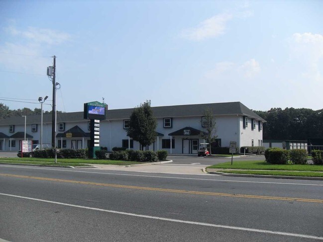
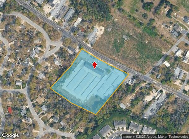
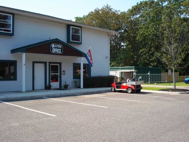
Property Record
1065 Route 47 S, Rio Grande, NJ 08242

NEARBY LISTINGS FOR SALE OR LEASE
Property Detail
1065 Route 47 S
Atlantic City-Hammonton, NJ
L2.14,2.15,2.16
06-01431-01-00002
Cape May
Warehouse
New Jersey
X
2
34009C0219F
5.90 AC
2024
South Shore/Vineland
2025
Other Market Areas
022102
DEMOGRAPHICS near 1065 Route 47 S
1 Mile
3 Mile
5 Mile
2024 Total Population
2,078
11,667
40,168
2029 Population
1,796
10,312
38,956
Pop Growth 2024-2029
(13.57%)
(11.61%)
(3.02%)
Average Age
43
42
46
2024 Total Households
788
4,408
16,893
HH Growth 2024-2029
(15.99%)
(13.59%)
(3.72%)
Median Household Inc
$84,030
$72,866
$68,635
Avg Household Size
2.40
2.40
2.20
2024 Avg HH Vehicles
2.00
2.00
2.00
Median Home Value
$274,999
$242,847
$287,992
Median Year Built
1988
1977
1976
Nearby Places
Map Layers
Map Styles
 Street
 Aerial
- Restaurants
- Banks
- Shops
- Fitness
- Groceries
PUBLIC TRANSPORTATION
AIRPORT
Atlantic City International
DRIVE
WALK
Distance
Atlantic City International
71 min
42.1 mi
SALE & LEASE HISTORY
LISTING DATE
SALE/LEASE

Sep 25, 2016
For Lease
Nearby Properties
Address
Land Use
TOTAL SIZE
Lot Size
Zoning
Address
Land Use
TOTAL SIZE
Lot Size
Zoning
66.50 AC
Address
Land Use
TOTAL SIZE
Lot Size
Zoning
32.39 AC
TC
Address
Land Use
TOTAL SIZE
Lot Size
Zoning
1,316 SF
16.41 AC
TR
Address
Land Use
TOTAL SIZE
Lot Size
Zoning
19.18 AC
TC
Address
Land Use
TOTAL SIZE
Lot Size
Zoning
12.73 AC
TC
Address
Land Use
TOTAL SIZE
Lot Size
Zoning
17.56 AC
TC
Address
Land Use
TOTAL SIZE
Lot Size
Zoning
1,944 SF
87.10 AC
Address
Land Use
TOTAL SIZE
Lot Size
Zoning
85.92 AC
Address
Land Use
TOTAL SIZE
Lot Size
Zoning
5.67 AC
TC
Address
Land Use
TOTAL SIZE
Lot Size
Zoning
3.71 AC
TC
Address
Land Use
TOTAL SIZE
Lot Size
Zoning
15.25 AC
TC
Address
Land Use
TOTAL SIZE
Lot Size
Zoning
73.03 AC
R-3
Address
Land Use
TOTAL SIZE
Lot Size
Zoning
5.71 AC
TB
Address
Land Use
TOTAL SIZE
Lot Size
Zoning
4.17 AC
TC
Address
Land Use
TOTAL SIZE
Lot Size
Zoning
3.71 AC
GB
Address
Land Use
TOTAL SIZE
Lot Size
Zoning
5.94 AC
TC
Address
Land Use
TOTAL SIZE
Lot Size
Zoning
Address
Land Use
TOTAL SIZE
Lot Size
Zoning
4.99 AC
TC
Address
Land Use
TOTAL SIZE
Lot Size
Zoning
85.15 AC
RC
Address
Land Use
TOTAL SIZE
Lot Size
Zoning
43.80 AC
TRRC
Address
Land Use
TOTAL SIZE
Lot Size
Zoning
204.70 AC
Address
Land Use
TOTAL SIZE
Lot Size
Zoning
1.66 AC
TC
Address
Land Use
TOTAL SIZE
Lot Size
Zoning
68.95 AC
VCRC
Address
Land Use
TOTAL SIZE
Lot Size
Zoning
800 SF
19.09 AC
R-3
Address
Land Use
TOTAL SIZE
Lot Size
Zoning
15.90 AC
TC
Address
Land Use
TOTAL SIZE
Lot Size
Zoning
26.87 AC
Address
Land Use
TOTAL SIZE
Lot Size
Zoning
15.25 AC
TC
Address
Land Use
TOTAL SIZE
Lot Size
Zoning
2.71 AC
TC
Address
Land Use
TOTAL SIZE
Lot Size
Zoning
3.51 AC
TB
The World's #1 Commercial Real Estate Marketplace
Connect with us
© 2026 CoStar Group
The information above has been obtained from sources believed reliable. While we do not doubt its accuracy we have not verified it and make no guarantee, warranty or representation about it. It is your responsibility to independently confirm its accuracy and completeness. Any projections, opinions, assumptions, or estimates used are for example only and do not represent the current or future performance of the property. The value of this transaction to you depends on tax and other factors which should be evaluated by your tax, financial, and legal advisors. You and your advisors should conduct a careful, independent investigation of the property to determine to your satisfaction the suitability of the property for your needs.