Property Record
1065 S Main St, Las Cruces, NM 88005


NEARBY LISTINGS FOR SALE OR LEASE
Property Detail
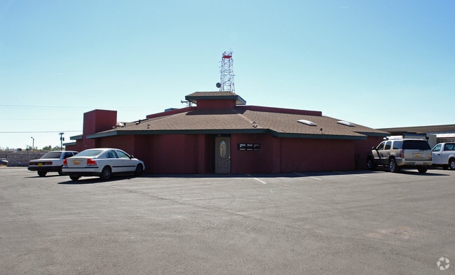
1065 S Main St
Las Cruces, NM
El Paseo Center
02-07353
SUBD: EL PASEO CENTER 657 LOT: 1 BLOCK: 3 S: 19 T: 23S R: 2E
Commercialacreage
Dona Ana
AE
New Mexico
35013C1092G
1
2024
1.28 AC
2025
Downtown Las Cruces
000600
Other Market Areas
20,810 SF
DEMOGRAPHICS near 1065 S Main St
1 Mile
3 Mile
5 Mile
2024 Total Population
7,446
76,039
116,101
2029 Population
7,829
79,903
122,141
Pop Growth 2024-2029
+ 5.14%
+ 5.08%
+ 5.20%
Average Age
38
37
38
2024 Total Households
3,447
31,156
47,350
HH Growth 2024-2029
+ 5.16%
+ 5.28%
+ 5.38%
Median Household Inc
$25,681
$36,749
$43,803
Avg Household Size
2.10
2.30
2.30
2024 Avg HH Vehicles
1.00
2.00
2.00
Median Home Value
$143,191
$159,140
$194,344
Median Year Built
1970
1979
1985
Nearby Places
Map Layers
Map Styles
 Street
 Aerial
- Restaurants
- Banks
- Shops
- Fitness
- Groceries
SALE & LEASE HISTORY
LISTING DATE
SALE/LEASE

May 10, 2018
For Lease
Nearby Properties
Address
Land Use
TOTAL SIZE
Lot Size
Zoning
Address
Land Use
TOTAL SIZE
Lot Size
Zoning
198,290 SF
33.76 AC
R4
Address
Land Use
TOTAL SIZE
Lot Size
Zoning
413,000 SF
R4
Address
Land Use
TOTAL SIZE
Lot Size
Zoning
77,691 SF
Address
Land Use
TOTAL SIZE
Lot Size
Zoning
106,866 SF
10.61 AC
R1
Address
Land Use
TOTAL SIZE
Lot Size
Zoning
240,030 SF
14.74 AC
R4
Address
Land Use
TOTAL SIZE
Lot Size
Zoning
206,137 SF
9.96 AC
R1
Address
Land Use
TOTAL SIZE
Lot Size
Zoning
49 AC
C1
Address
Land Use
TOTAL SIZE
Lot Size
Zoning
135,605 SF
6 AC
PUD
Address
Land Use
TOTAL SIZE
Lot Size
Zoning
207,825 SF
25.73 AC
A2
Address
Land Use
TOTAL SIZE
Lot Size
Zoning
213,046 SF
33.55 AC
R1
Address
Land Use
TOTAL SIZE
Lot Size
Zoning
98,015 SF
7.85 AC
A1
Address
Land Use
TOTAL SIZE
Lot Size
Zoning
394,043 SF
26.74 AC
C2
Address
Land Use
TOTAL SIZE
Lot Size
Zoning
139,122 SF
6.12 AC
C2
Address
Land Use
TOTAL SIZE
Lot Size
Zoning
463,811 SF
36.43 AC
C2
Address
Land Use
TOTAL SIZE
Lot Size
Zoning
52,991 SF
5.95 AC
C2
Address
Land Use
TOTAL SIZE
Lot Size
Zoning
49,295 SF
6.29 AC
R3
Address
Land Use
TOTAL SIZE
Lot Size
Zoning
72,015 SF
9.84 AC
ER4
Address
Land Use
TOTAL SIZE
Lot Size
Zoning
65,535 SF
5.64 AC
R1
Address
Land Use
TOTAL SIZE
Lot Size
Zoning
242,177 SF
21.36 AC
M1
Address
Land Use
TOTAL SIZE
Lot Size
Zoning
27,528 SF
4.65 AC
R1
Address
Land Use
TOTAL SIZE
Lot Size
Zoning
74,724 SF
8 AC
PUD
Address
Land Use
TOTAL SIZE
Lot Size
Zoning
42,295 SF
7.45 AC
C2
Address
Land Use
TOTAL SIZE
Lot Size
Zoning
76,950 SF
3.95 AC
Address
Land Use
TOTAL SIZE
Lot Size
Zoning
79,362 SF
5.90 AC
C2
Address
Land Use
TOTAL SIZE
Lot Size
Zoning
74,625 SF
6.40 AC
C2
Address
Land Use
TOTAL SIZE
Lot Size
Zoning
121,855 SF
12.59 AC
C2
Address
Land Use
TOTAL SIZE
Lot Size
Zoning
69,890 SF
Address
Land Use
TOTAL SIZE
Lot Size
Zoning
17,812 SF
2.65 AC
CBD
Address
Land Use
TOTAL SIZE
Lot Size
Zoning
77,180 SF
2.80 AC
R4
The World's #1 Commercial Real Estate Marketplace
Connect with us
© 2025 CoStar Group
The information above has been obtained from sources believed reliable. While we do not doubt its accuracy we have not verified it and make no guarantee, warranty or representation about it. It is your responsibility to independently confirm its accuracy and completeness. Any projections, opinions, assumptions, or estimates used are for example only and do not represent the current or future performance of the property. The value of this transaction to you depends on tax and other factors which should be evaluated by your tax, financial, and legal advisors. You and your advisors should conduct a careful, independent investigation of the property to determine to your satisfaction the suitability of the property for your needs.