Property Record
10661 Interstate 10 E, Schertz, TX 78154

Property Detail
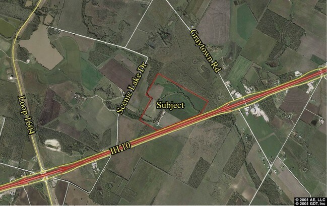
10661 Interstate 10 E
San Antonio-New Braunfels, TX
NCB 16564 P-15 (DEANNEXED 6/19/86) REFER TO: 16564-000-0152
16564-000-0153
BEXAR
Farms
Texas
A Areas with a 1% annual chance of flooding and a 26% chance of flooding over the life of a 30-year mortgage.
153
2024
93.10 AC
2025
Northeast
131601
San Antonio
NEARBY LISTINGS FOR SALE OR LEASE
DEMOGRAPHICS near 10661 Interstate 10 E
1 mile
3 mile
5 mile
2025 Total Population
5,709
56,956
141,798
2030 Population
6,261
61,534
150,542
Pop Growth 2025-2030
+ 9.67%
+ 8.04%
+ 6.17%
Average Age
34
35
36
2025 Total Households
1,835
18,380
47,047
HH Growth 2025-2030
+ 9.75%
+ 8.18%
+ 6.26%
Median Household Inc
$95,703
$83,889
$74,045
Avg Household Size
3.10
3.10
3.00
2025 Avg HH Vehicles
2.00
2.00
2.00
Median Home Value
$272,609
$259,670
$240,151
Median Year Built
2010
2006
2000
Nearby Places
Map Layers
Map Styles
 Street
 Aerial
Transit
 Traffic
 Biking
Places
Listings with unknown addresses are not visible on the map
- Restaurants
- Banks
- Shops
- Fitness
- Groceries
PUBLIC TRANSPORTATION
AIRPORT
San Antonio International
Drive
Walk
Distance
San Antonio International
27 min
19.4 mi
Freight Ports
Calhoun Port
Drive
Walk
Distance
Calhoun Port
167 min
139.0 mi
Nearby Properties
Address
Land Use
TOTAL SIZE
Lot Size
Zoning
Address
Land Use
TOTAL SIZE
Lot Size
Zoning
116,536 SF
13.84 AC
Address
Land Use
TOTAL SIZE
Lot Size
Zoning
97,064 SF
20 AC
Address
Land Use
TOTAL SIZE
Lot Size
Zoning
28.60 AC
Address
Land Use
TOTAL SIZE
Lot Size
Zoning
232,554 SF
13.19 AC
Address
Land Use
TOTAL SIZE
Lot Size
Zoning
35.72 AC
Address
Land Use
TOTAL SIZE
Lot Size
Zoning
336,913 SF
17.28 AC
Address
Land Use
TOTAL SIZE
Lot Size
Zoning
83,178 SF
22.50 AC
Address
Land Use
TOTAL SIZE
Lot Size
Zoning
67,642 SF
22.18 AC
Address
Land Use
TOTAL SIZE
Lot Size
Zoning
140.20 AC
Address
Land Use
TOTAL SIZE
Lot Size
Zoning
4,621 SF
43.39 AC
Address
Land Use
TOTAL SIZE
Lot Size
Zoning
76,900 SF
21.81 AC
Address
Land Use
TOTAL SIZE
Lot Size
Zoning
221.80 AC
Address
Land Use
TOTAL SIZE
Lot Size
Zoning
46,076 SF
16.51 AC
Address
Land Use
TOTAL SIZE
Lot Size
Zoning
92.04 AC
Address
Land Use
TOTAL SIZE
Lot Size
Zoning
1,608 SF
216.29 AC
Address
Land Use
TOTAL SIZE
Lot Size
Zoning
784 SF
234.55 AC
Address
Land Use
TOTAL SIZE
Lot Size
Zoning
80,016 SF
5.64 AC
Address
Land Use
TOTAL SIZE
Lot Size
Zoning
29,876 SF
28.83 AC
Address
Land Use
TOTAL SIZE
Lot Size
Zoning
104,121 SF
8.96 AC
Address
Land Use
TOTAL SIZE
Lot Size
Zoning
102.05 AC
Address
Land Use
TOTAL SIZE
Lot Size
Zoning
92,448 SF
3.27 AC
Address
Land Use
TOTAL SIZE
Lot Size
Zoning
1,568 SF
115 AC
Address
Land Use
TOTAL SIZE
Lot Size
Zoning
1,352 SF
92.30 AC
Address
Land Use
TOTAL SIZE
Lot Size
Zoning
63.79 AC
Address
Land Use
TOTAL SIZE
Lot Size
Zoning
38,747 SF
1.45 AC
Address
Land Use
TOTAL SIZE
Lot Size
Zoning
1,246 SF
218.03 AC
Address
Land Use
TOTAL SIZE
Lot Size
Zoning
52,000 SF
45.52 AC
Address
Land Use
TOTAL SIZE
Lot Size
Zoning
8,220 SF
115.41 AC
Address
Land Use
TOTAL SIZE
Lot Size
Zoning
Address
Land Use
TOTAL SIZE
Lot Size
Zoning
24.45 AC
The World's #1 Commercial Real Estate Marketplace
Connect with us
© 2026 CoStar Group
The information above has been obtained from sources believed reliable. While we do not doubt its accuracy we have not verified it and make no guarantee, warranty or representation about it. It is your responsibility to independently confirm its accuracy and completeness. Any projections, opinions, assumptions, or estimates used are for example only and do not represent the current or future performance of the property. The value of this transaction to you depends on tax and other factors which should be evaluated by your tax, financial, and legal advisors. You and your advisors should conduct a careful, independent investigation of the property to determine to your satisfaction the suitability of the property for your needs.