Property Record
10662 Sw County Road 769, Arcadia, FL 34269
NEARBY LISTINGS FOR SALE OR LEASE
Property Detail
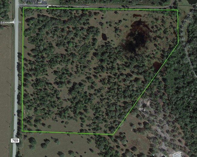
10662 Sw County Road 769
Arcadia, FL
Peace River Est East Unit One
21-39-23-0000-0116-0000
BEG SW COR TH N 01D05M50S E 33.01 FT TO N R/W SW PEACE RIVER ST TH S 89D36M44S W ALG R/W 185.18 FT TH N 63D32M11S W 30.44 FT TO ELY R/W KINGS HWY TH N 26D12M29S E ALG R/W 853.94 FT TO PC OF CURVE TO LEFT (R=17238.73 FT & C A=03D 27M37S) TH ALG ARC OF
Warehouse
DeSoto
A
Florida
12027C0259D
8 AC
2024
Florida Central South Area
2024
Other Market Areas
010405
DEMOGRAPHICS near 10662 Sw County Road 769
1 Mile
3 Mile
5 Mile
2024 Total Population
333
7,635
31,347
2029 Population
371
8,785
36,955
Pop Growth 2024-2029
+ 11.41%
+ 15.06%
+ 17.89%
Average Age
49
54
52
2024 Total Households
139
3,516
14,119
HH Growth 2024-2029
+ 12.23%
+ 15.44%
+ 18.27%
Median Household Inc
$65,000
$57,033
$61,820
Avg Household Size
2.40
2.10
2.20
2024 Avg HH Vehicles
2.00
2.00
2.00
Median Home Value
$195,160
$245,479
$247,325
Median Year Built
1988
1993
1995
Nearby Places
Map Layers
Map Styles
 Street
 Aerial
- Restaurants
- Banks
- Shops
- Fitness
- Groceries
PUBLIC TRANSPORTATION
AIRPORT
Punta Gorda
DRIVE
WALK
Distance
Punta Gorda
21 min
13.3 mi
Freight Ports
Port Manatee
DRIVE
WALK
Distance
Port Manatee
81 min
67.8 mi
SALE & LEASE HISTORY
LISTING DATE
SALE/LEASE

Dec 11, 2019
For Sale
Nearby Properties
Address
Land Use
TOTAL SIZE
Lot Size
Zoning
Address
Land Use
TOTAL SIZE
Lot Size
Zoning
653.75 AC
A-10
Address
Land Use
TOTAL SIZE
Lot Size
Zoning
41,148 SF
155.85 AC
RSF-3
Address
Land Use
TOTAL SIZE
Lot Size
Zoning
173.33 AC
P/I
Address
Land Use
TOTAL SIZE
Lot Size
Zoning
594.36 AC
A-10
Address
Land Use
TOTAL SIZE
Lot Size
Zoning
153.66 AC
P/I
Address
Land Use
TOTAL SIZE
Lot Size
Zoning
1,836 SF
17.80 AC
P/I
Address
Land Use
TOTAL SIZE
Lot Size
Zoning
8,044 SF
29.55 AC
TTRVC
Address
Land Use
TOTAL SIZE
Lot Size
Zoning
9,908 SF
40 AC
RVC
Address
Land Use
TOTAL SIZE
Lot Size
Zoning
172.19 AC
PUD
Address
Land Use
TOTAL SIZE
Lot Size
Zoning
509 AC
A-5
Address
Land Use
TOTAL SIZE
Lot Size
Zoning
55,310 SF
3.20 AC
CG
Address
Land Use
TOTAL SIZE
Lot Size
Zoning
651.43 AC
A-10
Address
Land Use
TOTAL SIZE
Lot Size
Zoning
3,248 SF
21.20 AC
MHP
Address
Land Use
TOTAL SIZE
Lot Size
Zoning
649.60 AC
A-10
Address
Land Use
TOTAL SIZE
Lot Size
Zoning
623.08 AC
A-10
Address
Land Use
TOTAL SIZE
Lot Size
Zoning
14,863 SF
12.50 AC
PD
Address
Land Use
TOTAL SIZE
Lot Size
Zoning
30,720 SF
2.89 AC
CG
Address
Land Use
TOTAL SIZE
Lot Size
Zoning
31.61 AC
RVC
Address
Land Use
TOTAL SIZE
Lot Size
Zoning
110.53 AC
RMF-6
Address
Land Use
TOTAL SIZE
Lot Size
Zoning
499.70 AC
A-5
Address
Land Use
TOTAL SIZE
Lot Size
Zoning
65.31 AC
P/I
Address
Land Use
TOTAL SIZE
Lot Size
Zoning
501.85 AC
A-5
Address
Land Use
TOTAL SIZE
Lot Size
Zoning
23,142 SF
5 AC
A-5
Address
Land Use
TOTAL SIZE
Lot Size
Zoning
480 AC
A-5
Address
Land Use
TOTAL SIZE
Lot Size
Zoning
33.42 AC
PUD
Address
Land Use
TOTAL SIZE
Lot Size
Zoning
2,689 SF
398.23 AC
A-10
Address
Land Use
TOTAL SIZE
Lot Size
Zoning
227.49 AC
A-10
Address
Land Use
TOTAL SIZE
Lot Size
Zoning
7,732 SF
9.74 AC
A-10
Address
Land Use
TOTAL SIZE
Lot Size
Zoning
18.83 AC
RVC
Address
Land Use
TOTAL SIZE
Lot Size
Zoning
1,537 SF
10.97 AC
RVC
The World's #1 Commercial Real Estate Marketplace
Connect with us
© 2025 CoStar Group
The information above has been obtained from sources believed reliable. While we do not doubt its accuracy we have not verified it and make no guarantee, warranty or representation about it. It is your responsibility to independently confirm its accuracy and completeness. Any projections, opinions, assumptions, or estimates used are for example only and do not represent the current or future performance of the property. The value of this transaction to you depends on tax and other factors which should be evaluated by your tax, financial, and legal advisors. You and your advisors should conduct a careful, independent investigation of the property to determine to your satisfaction the suitability of the property for your needs.