Property Record
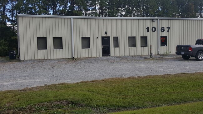
1067 Brompton Ln, Greenville, NC 27834


Property Detail
1067 Brompton Ln
048387
OXFORD PARK
Warehouse
Pitt
GC
North Carolina
B and X Area of moderate flood hazard, usually the area between the limits of the 100-year and 500-year floods.
11
2025
2.30 AC
2025
Southwest Greenville
001602
Other Market Areas
25,000 SF
Greenville, NC
NEARBY LISTINGS FOR SALE OR LEASE
DEMOGRAPHICS near 1067 Brompton Ln
1 mile
3 mile
5 mile
2025 Total Population
2,335
32,079
86,876
2030 Population
2,423
32,874
89,764
Pop Growth 2025-2030
+ 3.77%
+ 2.48%
+ 3.32%
Average Age
37
36
36
2025 Total Households
919
13,741
35,613
HH Growth 2025-2030
+ 4.03%
+ 2.60%
+ 3.68%
Median Household Inc
$80,183
$66,236
$60,703
Avg Household Size
2.50
2.30
2.20
2025 Avg HH Vehicles
2.00
2.00
2.00
Median Home Value
$223,408
$231,231
$244,427
Median Year Built
2002
1999
1996
Nearby Places
Map Layers
Map Styles
 Street
 Aerial
Layers
 Traffic
 Biking
Places
Listings with unknown addresses are not visible on the map
- Restaurants
- Banks
- Shops
- Fitness
- Groceries
PUBLIC TRANSPORTATION
AIRPORT
Pitt-Greenville
Drive
Walk
Distance
Pitt-Greenville
16 min
11.1 mi
Freight Ports
Port of Morehead City
Drive
Walk
Distance
Port of Morehead City
132 min
87.5 mi
SALE & LEASE HISTORY
LISTING DATE
SALE/LEASE

Sep 25, 2016
For Lease
Oct 25, 2019
For Lease
Dec 11, 2017
For Lease
Nearby Properties
Address
Land Use
TOTAL SIZE
Lot Size
Zoning
Address
Land Use
TOTAL SIZE
Lot Size
Zoning
251,145 SF
84.25 AC
RA20
Address
Land Use
TOTAL SIZE
Lot Size
Zoning
142,831 SF
13.61 AC
MO
Address
Land Use
TOTAL SIZE
Lot Size
Zoning
18,932 SF
11.51 AC
MR
Address
Land Use
TOTAL SIZE
Lot Size
Zoning
90,108 SF
11.27 AC
OI
Address
Land Use
TOTAL SIZE
Lot Size
Zoning
162,126 SF
30 AC
OI
Address
Land Use
TOTAL SIZE
Lot Size
Zoning
23,772 SF
8.75 AC
MR
Address
Land Use
TOTAL SIZE
Lot Size
Zoning
94,176 SF
23.12 AC
R6
Address
Land Use
TOTAL SIZE
Lot Size
Zoning
97,638 SF
28.62 AC
R9S
Address
Land Use
TOTAL SIZE
Lot Size
Zoning
77,707 SF
6.37 AC
MS
Address
Land Use
TOTAL SIZE
Lot Size
Zoning
64,547 SF
28.84 AC
MO
Address
Land Use
TOTAL SIZE
Lot Size
Zoning
26,958 SF
7.67 AC
MR
Address
Land Use
TOTAL SIZE
Lot Size
Zoning
84,649 SF
44.78 AC
AR
Address
Land Use
TOTAL SIZE
Lot Size
Zoning
30,714 SF
7.79 AC
MR
Address
Land Use
TOTAL SIZE
Lot Size
Zoning
56,748 SF
1.72 AC
OI
Address
Land Use
TOTAL SIZE
Lot Size
Zoning
27,466 SF
7.57 AC
MR
Address
Land Use
TOTAL SIZE
Lot Size
Zoning
129,749 SF
13.56 AC
MCG
Address
Land Use
TOTAL SIZE
Lot Size
Zoning
54,430 SF
39.09 AC
RA20
Address
Land Use
TOTAL SIZE
Lot Size
Zoning
45,471 SF
10.69 AC
MO
Address
Land Use
TOTAL SIZE
Lot Size
Zoning
9,864 SF
19 AC
R6A
Address
Land Use
TOTAL SIZE
Lot Size
Zoning
8,736 SF
6.91 AC
MR
Address
Land Use
TOTAL SIZE
Lot Size
Zoning
31,820 SF
4.61 AC
MR
Address
Land Use
TOTAL SIZE
Lot Size
Zoning
45,180 SF
7.16 AC
MO
Address
Land Use
TOTAL SIZE
Lot Size
Zoning
5,370 SF
8.19 AC
R6
Address
Land Use
TOTAL SIZE
Lot Size
Zoning
42,124 SF
22.38 AC
OI
Address
Land Use
TOTAL SIZE
Lot Size
Zoning
8,736 SF
6.15 AC
MR
Address
Land Use
TOTAL SIZE
Lot Size
Zoning
55,020 SF
5.07 AC
CG
Address
Land Use
TOTAL SIZE
Lot Size
Zoning
137,320 SF
13.58 AC
GB
Address
Land Use
TOTAL SIZE
Lot Size
Zoning
6,872 SF
8.14 AC
R6
Address
Land Use
TOTAL SIZE
Lot Size
Zoning
20,292 SF
12.40 AC
OR
Address
Land Use
TOTAL SIZE
Lot Size
Zoning
76,393 SF
12.62 AC
CH
The World's #1 Commercial Real Estate Marketplace
Connect with us
© 2026 CoStar Group
The information above has been obtained from sources believed reliable. While we do not doubt its accuracy we have not verified it and make no guarantee, warranty or representation about it. It is your responsibility to independently confirm its accuracy and completeness. Any projections, opinions, assumptions, or estimates used are for example only and do not represent the current or future performance of the property. The value of this transaction to you depends on tax and other factors which should be evaluated by your tax, financial, and legal advisors. You and your advisors should conduct a careful, independent investigation of the property to determine to your satisfaction the suitability of the property for your needs.