Property Record
1067 E Kaniksu St, Apache Junction, AZ 85119
Property Detail
1067 E Kaniksu St
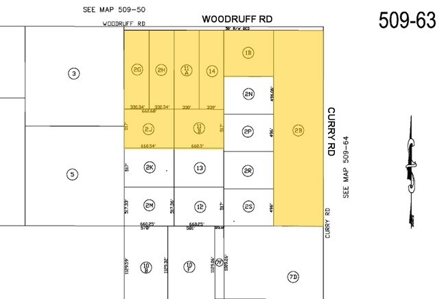
509-63-001B
E1/2 E1/2 NE OF SEC 35-5S-7E 39.25 AC
Residentialacreage
Pinal
GR
Arizona
B and X Area of moderate flood hazard, usually the area between the limits of the 100-year and 500-year floods.
9.24 AC
2024
Pinal County
2025
Phoenix
001100
Phoenix-Mesa-Chandler, AZ
NEARBY LISTINGS FOR SALE OR LEASE
DEMOGRAPHICS near 1067 E Kaniksu St
1 mile
3 mile
5 mile
2025 Total Population
833
1,873
15,387
2030 Population
977
2,195
18,389
Pop Growth 2025-2030
+ 17.29%
+ 17.19%
+ 19.51%
Average Age
41
41
38
2025 Total Households
288
640
4,996
HH Growth 2025-2030
+ 17.36%
+ 17.19%
+ 19.12%
Median Household Inc
$80,156
$79,715
$74,892
Avg Household Size
2.70
2.70
3.00
2025 Avg HH Vehicles
2.00
2.00
2.00
Median Home Value
$472,825
$462,886
$318,227
Median Year Built
2002
2002
2003
Nearby Places
Map Layers
Map Styles
 Street
 Aerial
Transit
 Traffic
 Biking
Places
Listings with unknown addresses are not visible on the map
- Restaurants
- Banks
- Shops
- Fitness
- Groceries
PUBLIC TRANSPORTATION
AIRPORT
Phoenix-Mesa Gateway
Drive
Walk
Distance
Phoenix-Mesa Gateway
35 min
19.5 mi
Phoenix Sky Harbor International
Drive
Walk
Distance
Phoenix Sky Harbor International
49 min
31.7 mi
Freight Ports
Port of San Diego
Drive
Walk
Distance
Port of San Diego
440 min
392.0 mi
Nearby Properties
Address
Land Use
TOTAL SIZE
Lot Size
Zoning
Address
Land Use
TOTAL SIZE
Lot Size
Zoning
117,169 SF
13.27 AC
Address
Land Use
TOTAL SIZE
Lot Size
Zoning
Address
Land Use
TOTAL SIZE
Lot Size
Zoning
69,692 SF
7.26 AC
Address
Land Use
TOTAL SIZE
Lot Size
Zoning
11,686 SF
40 AC
Address
Land Use
TOTAL SIZE
Lot Size
Zoning
30,477 SF
3.91 AC
UNDESIGNAT
Address
Land Use
TOTAL SIZE
Lot Size
Zoning
3,516 SF
18.82 AC
UNDESIGNAT
Address
Land Use
TOTAL SIZE
Lot Size
Zoning
15,866 SF
2.40 AC
UNDESIGNAT
Address
Land Use
TOTAL SIZE
Lot Size
Zoning
15,143 SF
1.69 AC
UNDESIGNAT
Address
Land Use
TOTAL SIZE
Lot Size
Zoning
14,000 SF
1.76 AC
Address
Land Use
TOTAL SIZE
Lot Size
Zoning
110.61 AC
Address
Land Use
TOTAL SIZE
Lot Size
Zoning
23,716 SF
5 AC
Address
Land Use
TOTAL SIZE
Lot Size
Zoning
13,838 SF
2.25 AC
UNDESIGNAT
Address
Land Use
TOTAL SIZE
Lot Size
Zoning
7,680 SF
1.50 AC
UNDESIGNAT
Address
Land Use
TOTAL SIZE
Lot Size
Zoning
3,180 SF
17.50 AC
Address
Land Use
TOTAL SIZE
Lot Size
Zoning
5,338 SF
12.37 AC
CB1
Address
Land Use
TOTAL SIZE
Lot Size
Zoning
4,527 SF
8.22 AC
UNDESIGNAT
Address
Land Use
TOTAL SIZE
Lot Size
Zoning
150 SF
9.39 AC
UNDESIGNAT
Address
Land Use
TOTAL SIZE
Lot Size
Zoning
14,760 SF
1.62 AC
UNDESIGNAT
Address
Land Use
TOTAL SIZE
Lot Size
Zoning
47,739 SF
2.93 AC
Address
Land Use
TOTAL SIZE
Lot Size
Zoning
6,144 SF
1.13 AC
Address
Land Use
TOTAL SIZE
Lot Size
Zoning
7,279 SF
4.81 AC
CR1
Address
Land Use
TOTAL SIZE
Lot Size
Zoning
101,135 SF
13.20 AC
Address
Land Use
TOTAL SIZE
Lot Size
Zoning
14,237 SF
0.31 AC
UNDESIGNAT
Address
Land Use
TOTAL SIZE
Lot Size
Zoning
11,767 SF
4.77 AC
Address
Land Use
TOTAL SIZE
Lot Size
Zoning
4,081 SF
0.81 AC
Address
Land Use
TOTAL SIZE
Lot Size
Zoning
3,865 SF
10 AC
UNDESIGNAT
Address
Land Use
TOTAL SIZE
Lot Size
Zoning
14,136 SF
9.77 AC
Address
Land Use
TOTAL SIZE
Lot Size
Zoning
9,198 SF
1.44 AC
UNDESIGNAT
The World's #1 Commercial Real Estate Marketplace
Connect with us
© 2026 CoStar Group
The information above has been obtained from sources believed reliable. While we do not doubt its accuracy we have not verified it and make no guarantee, warranty or representation about it. It is your responsibility to independently confirm its accuracy and completeness. Any projections, opinions, assumptions, or estimates used are for example only and do not represent the current or future performance of the property. The value of this transaction to you depends on tax and other factors which should be evaluated by your tax, financial, and legal advisors. You and your advisors should conduct a careful, independent investigation of the property to determine to your satisfaction the suitability of the property for your needs.