Property Record
1067 N Warson Rd, Saint Louis, MO 63132
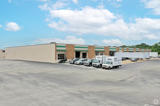

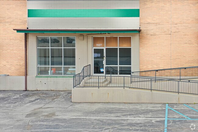
Property Detail
1067 N Warson Rd
16M-22-0089
W LN WARSON RD 436.25 FEET N OF S SEC LN
Warehouse
Saint Louis
82LI
Missouri
B and X Area of moderate flood hazard, usually the area between the limits of the 100-year and 500-year floods.
17.21 AC
2024
Innerbelt W of 170
2025
St. Louis
215600
St. Louis, MO-IL
318,031 SF
NEARBY LISTINGS FOR SALE OR LEASE
DEMOGRAPHICS near 1067 N Warson Rd
1 mile
3 mile
5 mile
2025 Total Population
8,801
75,151
220,675
2030 Population
8,784
74,645
219,555
Pop Growth 2025-2030
(0.19%)
(0.67%)
(0.51%)
Average Age
40
42
41
2025 Total Households
3,941
32,471
95,024
HH Growth 2025-2030
(0.36%)
(0.70%)
(0.53%)
Median Household Inc
$79,087
$79,497
$84,069
Avg Household Size
2.20
2.20
2.20
2025 Avg HH Vehicles
2.00
2.00
2.00
Median Home Value
$321,384
$266,448
$276,908
Median Year Built
1971
1962
1962
Nearby Places
Map Layers
Map Styles
 Street
 Aerial
Layers
 Traffic
 Biking
Places
Listings with unknown addresses are not visible on the map
- Restaurants
- Banks
- Shops
- Fitness
- Groceries
PUBLIC TRANSPORTATION
COMMUTER RAIL
Clayton (Shrewsbury-Lansdowne I-44 Emerson Park - St. Louis MetroLink (MetroLink))
Drive
Walk
Distance
Clayton (Shrewsbury-Lansdowne I-44 Emerson Park - St. Louis MetroLink (MetroLink))
9 min
4.8 mi
Forsyth (Shrewsbury-Lansdowne I-44 Emerson Park - St. Louis MetroLink (MetroLink))
Drive
Walk
Distance
Forsyth (Shrewsbury-Lansdowne I-44 Emerson Park - St. Louis MetroLink (MetroLink))
12 min
6.2 mi
AIRPORT
St Louis Lambert International
Drive
Walk
Distance
St Louis Lambert International
15 min
8.9 mi
Freight Ports
Port Milwaukee
Drive
Walk
Distance
Port Milwaukee
437 min
383.4 mi
SALE & LEASE HISTORY
LISTING DATE
SALE/LEASE

Sep 24, 2019
For Lease
Nov 09, 2016
For Lease
Mar 01, 2024
For Lease
Dec 10, 2020
For Lease
Nearby Properties
Address
Land Use
TOTAL SIZE
Lot Size
Zoning
Address
Land Use
TOTAL SIZE
Lot Size
Zoning
1,053,686 SF
31.40 AC
43M-1
Address
Land Use
TOTAL SIZE
Lot Size
Zoning
52.13 AC
42PA
Address
Land Use
TOTAL SIZE
Lot Size
Zoning
201,879 SF
29.52 AC
82RO
Address
Land Use
TOTAL SIZE
Lot Size
Zoning
56.62 AC
82A
Address
Land Use
TOTAL SIZE
Lot Size
Zoning
1,280,539 SF
151.20 AC
H
Address
Land Use
TOTAL SIZE
Lot Size
Zoning
544,556 SF
95.75 AC
H
Address
Land Use
TOTAL SIZE
Lot Size
Zoning
292,543 SF
10.11 AC
CB
Address
Land Use
TOTAL SIZE
Lot Size
Zoning
337,354 SF
7.40 AC
82CB
Address
Land Use
TOTAL SIZE
Lot Size
Zoning
46,752 SF
3.67 AC
82CB
Address
Land Use
TOTAL SIZE
Lot Size
Zoning
234,421 SF
2.01 AC
82CB
Address
Land Use
TOTAL SIZE
Lot Size
Zoning
228,816 SF
1.70 AC
82CB
Address
Land Use
TOTAL SIZE
Lot Size
Zoning
10.57 AC
33C
Address
Land Use
TOTAL SIZE
Lot Size
Zoning
290,380 SF
9.97 AC
82CB
Address
Land Use
TOTAL SIZE
Lot Size
Zoning
134,716 SF
15.56 AC
33G
Address
Land Use
TOTAL SIZE
Lot Size
Zoning
297,247 SF
5.40 AC
82CB
Address
Land Use
TOTAL SIZE
Lot Size
Zoning
386,784 SF
6.50 AC
57HDR/O
Address
Land Use
TOTAL SIZE
Lot Size
Zoning
288,322 SF
19.72 AC
104PDM
Address
Land Use
TOTAL SIZE
Lot Size
Zoning
249,369 SF
6 AC
57HDR/O
Address
Land Use
TOTAL SIZE
Lot Size
Zoning
160,628 SF
1.47 AC
82R0
Address
Land Use
TOTAL SIZE
Lot Size
Zoning
57,010 SF
2.42 AC
57GC
Address
Land Use
TOTAL SIZE
Lot Size
Zoning
3,154 SF
38.36 AC
33C
Address
Land Use
TOTAL SIZE
Lot Size
Zoning
55.75 AC
33C
Address
Land Use
TOTAL SIZE
Lot Size
Zoning
193,158 SF
3.60 AC
82GC
Address
Land Use
TOTAL SIZE
Lot Size
Zoning
30 AC
82A
Address
Land Use
TOTAL SIZE
Lot Size
Zoning
181,103 SF
7.57 AC
82CB
Address
Land Use
TOTAL SIZE
Lot Size
Zoning
9,360 SF
30.94 AC
FP
Address
Land Use
TOTAL SIZE
Lot Size
Zoning
8,614 SF
61.03 AC
25R-1
Address
Land Use
TOTAL SIZE
Lot Size
Zoning
28.78 AC
82B
Address
Land Use
TOTAL SIZE
Lot Size
Zoning
172,059 SF
25.52 AC
R1
Address
Land Use
TOTAL SIZE
Lot Size
Zoning
2.89 AC
F
The World's #1 Commercial Real Estate Marketplace
Connect with us
© 2026 CoStar Group
The information above has been obtained from sources believed reliable. While we do not doubt its accuracy we have not verified it and make no guarantee, warranty or representation about it. It is your responsibility to independently confirm its accuracy and completeness. Any projections, opinions, assumptions, or estimates used are for example only and do not represent the current or future performance of the property. The value of this transaction to you depends on tax and other factors which should be evaluated by your tax, financial, and legal advisors. You and your advisors should conduct a careful, independent investigation of the property to determine to your satisfaction the suitability of the property for your needs.