Property Record
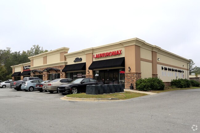
1067 W Oglethorpe Hwy, Hinesville, GA 31313


Property Detail
1067 W Oglethorpe Hwy
059C-019
B-2 HWY 84 (OFFICE SPACES)
Stripcommercialcenter
Liberty
C2
Georgia
B and X Area of moderate flood hazard, usually the area between the limits of the 100-year and 500-year floods.
1.10 AC
2025
Liberty County
2025
Savannah
010402
Hinesville, GA
10,160 SF
NEARBY LISTINGS FOR SALE OR LEASE
DEMOGRAPHICS near 1067 W Oglethorpe Hwy
1 mile
3 mile
5 mile
2025 Total Population
6,704
32,705
52,213
2030 Population
6,987
34,303
55,814
Pop Growth 2025-2030
+ 4.22%
+ 4.89%
+ 6.90%
Average Age
33
33
33
2025 Total Households
2,577
12,345
19,046
HH Growth 2025-2030
+ 4.38%
+ 5.11%
+ 7.05%
Median Household Inc
$57,820
$58,725
$59,829
Avg Household Size
2.60
2.60
2.60
2025 Avg HH Vehicles
2.00
2.00
2.00
Median Home Value
$174,562
$181,830
$190,886
Median Year Built
1990
1991
1992
Nearby Places
Map Layers
Map Styles
 Street
 Aerial
Transit
 Traffic
 Biking
Places
Listings with unknown addresses are not visible on the map
- Restaurants
- Banks
- Shops
- Fitness
- Groceries
SALE & LEASE HISTORY
LISTING DATE
SALE/LEASE

Nov 02, 2016
For Lease
Feb 10, 2021
For Lease
Nearby Properties
Address
Land Use
TOTAL SIZE
Lot Size
Zoning
Address
Land Use
TOTAL SIZE
Lot Size
Zoning
3,354 SF
58.90 AC
C3/R20
Address
Land Use
TOTAL SIZE
Lot Size
Zoning
2,352 SF
22.31 AC
ATR/MFR
Address
Land Use
TOTAL SIZE
Lot Size
Zoning
102,939 SF
2.53 AC
C1
Address
Land Use
TOTAL SIZE
Lot Size
Zoning
148,364 SF
18.53 AC
PUD
Address
Land Use
TOTAL SIZE
Lot Size
Zoning
60,432 SF
23.64 AC
R20
Address
Land Use
TOTAL SIZE
Lot Size
Zoning
41,670 SF
1.89 AC
C1
Address
Land Use
TOTAL SIZE
Lot Size
Zoning
100,765 SF
33.20 AC
C2
Address
Land Use
TOTAL SIZE
Lot Size
Zoning
90,886 SF
10.78 AC
C2
Address
Land Use
TOTAL SIZE
Lot Size
Zoning
11,944 SF
39.41 AC
LI
Address
Land Use
TOTAL SIZE
Lot Size
Zoning
1,884 SF
9.25 AC
C2
Address
Land Use
TOTAL SIZE
Lot Size
Zoning
81,366 SF
35.17 AC
R8
Address
Land Use
TOTAL SIZE
Lot Size
Zoning
81,366 SF
16.50 AC
R20
Address
Land Use
TOTAL SIZE
Lot Size
Zoning
39,252 SF
4.93 AC
MFR
Address
Land Use
TOTAL SIZE
Lot Size
Zoning
205,730 SF
21.03 AC
C3
Address
Land Use
TOTAL SIZE
Lot Size
Zoning
155,001 SF
10.56 AC
MFR
Address
Land Use
TOTAL SIZE
Lot Size
Zoning
71,899 SF
50.12 AC
LI
Address
Land Use
TOTAL SIZE
Lot Size
Zoning
83,217 SF
11.18 AC
C2
Address
Land Use
TOTAL SIZE
Lot Size
Zoning
57,980 SF
10.72 AC
C2
Address
Land Use
TOTAL SIZE
Lot Size
Zoning
53,103 SF
34.03 AC
I1
Address
Land Use
TOTAL SIZE
Lot Size
Zoning
110,150 SF
14.83 AC
C3
Address
Land Use
TOTAL SIZE
Lot Size
Zoning
139,565 SF
14.96 AC
C2
Address
Land Use
TOTAL SIZE
Lot Size
Zoning
14,274 SF
6.34 AC
MFR
Address
Land Use
TOTAL SIZE
Lot Size
Zoning
9,320 SF
6.74 AC
C2/C3
Address
Land Use
TOTAL SIZE
Lot Size
Zoning
27,627 SF
4.97 AC
C2
Address
Land Use
TOTAL SIZE
Lot Size
Zoning
12,261 SF
10.99 AC
C2
Address
Land Use
TOTAL SIZE
Lot Size
Zoning
42,572 SF
5.27 AC
C2
Address
Land Use
TOTAL SIZE
Lot Size
Zoning
34,334 SF
7.10 AC
C2
Address
Land Use
TOTAL SIZE
Lot Size
Zoning
24,144 SF
9.24 AC
C3
Address
Land Use
TOTAL SIZE
Lot Size
Zoning
42,110 SF
5.86 AC
C3
Address
Land Use
TOTAL SIZE
Lot Size
Zoning
34,484 SF
1.92 AC
C2
The World's #1 Commercial Real Estate Marketplace
Connect with us
© 2026 CoStar Group
The information above has been obtained from sources believed reliable. While we do not doubt its accuracy we have not verified it and make no guarantee, warranty or representation about it. It is your responsibility to independently confirm its accuracy and completeness. Any projections, opinions, assumptions, or estimates used are for example only and do not represent the current or future performance of the property. The value of this transaction to you depends on tax and other factors which should be evaluated by your tax, financial, and legal advisors. You and your advisors should conduct a careful, independent investigation of the property to determine to your satisfaction the suitability of the property for your needs.