Property Record
1068 N Farms Rd, Wallingford, CT 06492
NEARBY LISTINGS FOR SALE OR LEASE
Property Detail
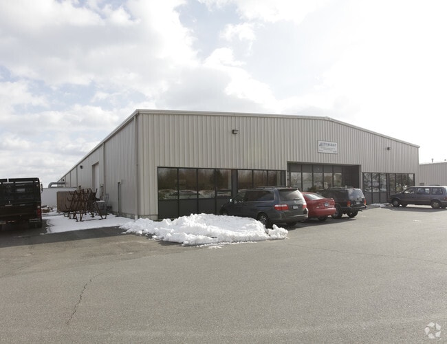
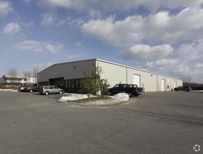
1068 N Farms Rd
WALL-000027-000000-000042-000001
North Farms
Industrialcondominium
New Haven
X
Connecticut
09009C0307J
42-1
2025
Wallingford
2025
Westchester/So Connecticut
175800
New Haven-Milford, CT
22,910 SF
DEMOGRAPHICS near 1068 N Farms Rd
1 Mile
3 Mile
5 Mile
2024 Total Population
2,121
39,490
104,119
2029 Population
2,114
39,375
103,642
Pop Growth 2024-2029
(0.33%)
(0.29%)
(0.46%)
Average Age
45
41
41
2024 Total Households
766
15,729
41,751
HH Growth 2024-2029
(0.39%)
(0.41%)
(0.52%)
Median Household Inc
$114,197
$75,980
$74,647
Avg Household Size
2.60
2.40
2.40
2024 Avg HH Vehicles
2.00
2.00
2.00
Median Home Value
$262,360
$236,496
$242,984
Median Year Built
1981
1964
1963
Nearby Places
Map Layers
Map Styles
 Street
 Aerial
- Restaurants
- Banks
- Shops
- Fitness
- Groceries
PUBLIC TRANSPORTATION
COMMUTER RAIL
DRIVE
WALK
Distance
8 min
4.1 mi
DRIVE
WALK
Distance
9 min
4.2 mi
AIRPORT
Tweed/New Haven
DRIVE
WALK
Distance
Tweed/New Haven
33 min
20.0 mi
Bradley International
DRIVE
WALK
Distance
Bradley International
52 min
36.5 mi
Freight Ports
Port of New Haven
DRIVE
WALK
Distance
Port of New Haven
28 min
18.9 mi
Nearby Properties
Address
Land Use
TOTAL SIZE
Lot Size
Zoning
Address
Land Use
TOTAL SIZE
Lot Size
Zoning
276,631 SF
27.60 AC
R-1
Address
Land Use
TOTAL SIZE
Lot Size
Zoning
267,249 SF
27.55 AC
R-1
Address
Land Use
TOTAL SIZE
Lot Size
Zoning
10.38 AC
M-1
Address
Land Use
TOTAL SIZE
Lot Size
Zoning
329,296 SF
35.55 AC
IX
Address
Land Use
TOTAL SIZE
Lot Size
Zoning
291,405 SF
104.81 AC
WI
Address
Land Use
TOTAL SIZE
Lot Size
Zoning
119,598 SF
18.43 AC
RF40
Address
Land Use
TOTAL SIZE
Lot Size
Zoning
23,920 SF
137.43 AC
R18
Address
Land Use
TOTAL SIZE
Lot Size
Zoning
11.02 AC
S-R
Address
Land Use
TOTAL SIZE
Lot Size
Zoning
172,027 SF
18.04 AC
RF40
Address
Land Use
TOTAL SIZE
Lot Size
Zoning
3,952 SF
21.76 AC
R-1
Address
Land Use
TOTAL SIZE
Lot Size
Zoning
26.45 AC
RF40
Address
Land Use
TOTAL SIZE
Lot Size
Zoning
153,180 SF
3.07 AC
TODH
Address
Land Use
TOTAL SIZE
Lot Size
Zoning
187,914 SF
16.13 AC
IX
Address
Land Use
TOTAL SIZE
Lot Size
Zoning
1.67 AC
TODP
Address
Land Use
TOTAL SIZE
Lot Size
Zoning
123,730 SF
40.31 AC
R18
Address
Land Use
TOTAL SIZE
Lot Size
Zoning
203,692 SF
21.22 AC
IX
Address
Land Use
TOTAL SIZE
Lot Size
Zoning
22,284 SF
128.20 AC
RU40
Address
Land Use
TOTAL SIZE
Lot Size
Zoning
18.70 AC
RF40
Address
Land Use
TOTAL SIZE
Lot Size
Zoning
166,724 SF
21.79 AC
M-2
Address
Land Use
TOTAL SIZE
Lot Size
Zoning
9.75 AC
RF40
Address
Land Use
TOTAL SIZE
Lot Size
Zoning
598.20 AC
R-R
Address
Land Use
TOTAL SIZE
Lot Size
Zoning
84,919 SF
7.53 AC
C-1
Address
Land Use
TOTAL SIZE
Lot Size
Zoning
48,942 SF
6.74 AC
RF40
Address
Land Use
TOTAL SIZE
Lot Size
Zoning
19.47 AC
RF40
Address
Land Use
TOTAL SIZE
Lot Size
Zoning
34,021 SF
R18
Address
Land Use
TOTAL SIZE
Lot Size
Zoning
81,496 SF
5.96 AC
WI
Address
Land Use
TOTAL SIZE
Lot Size
Zoning
71,501 SF
6.84 AC
R18
Address
Land Use
TOTAL SIZE
Lot Size
Zoning
47,000 SF
R18
Address
Land Use
TOTAL SIZE
Lot Size
Zoning
94,044 SF
5.48 AC
WI
Address
Land Use
TOTAL SIZE
Lot Size
Zoning
20,330 SF
174.02 AC
WI
The World's #1 Commercial Real Estate Marketplace
Connect with us
© 2025 CoStar Group
The information above has been obtained from sources believed reliable. While we do not doubt its accuracy we have not verified it and make no guarantee, warranty or representation about it. It is your responsibility to independently confirm its accuracy and completeness. Any projections, opinions, assumptions, or estimates used are for example only and do not represent the current or future performance of the property. The value of this transaction to you depends on tax and other factors which should be evaluated by your tax, financial, and legal advisors. You and your advisors should conduct a careful, independent investigation of the property to determine to your satisfaction the suitability of the property for your needs.