Property Record
10680 Knott Ave, Stanton, CA 90680


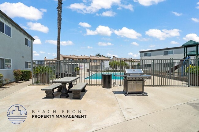

Property Detail
10680 Knott Ave
079-771-39
S TWP 4 RGE 11 SEC 23 SEC 23 T 4 R 11 S 137 FT N 467 FT SW1/4 NW1/4
Multifamilydwelling
Orange
C and X Area of minimal flood hazard, usually depicted on FIRMs as above the 500-year flood level.
California
2024
1.82 AC
2025
Stanton
087801
Orange County (California)
27,135 SF
Anaheim-Santa Ana-Irvine, CA
NEARBY LISTINGS FOR SALE OR LEASE
DEMOGRAPHICS near 10680 Knott Ave
1 mile
3 mile
5 mile
2024 Total Population
30,594
250,216
642,093
2029 Population
30,529
249,969
640,978
Pop Growth 2024-2029
(0.21%)
(0.10%)
(0.17%)
Average Age
41
40
40
2024 Total Households
9,440
75,422
192,808
HH Growth 2024-2029
(0.39%)
(0.22%)
(0.34%)
Median Household Inc
$92,758
$94,058
$94,123
Avg Household Size
3.10
3.20
3.20
2024 Avg HH Vehicles
2.00
2.00
2.00
Median Home Value
$688,150
$771,673
$788,943
Median Year Built
1971
1967
1967
Nearby Places
Map Layers
Map Styles
 Street
 Aerial
Transit
 Traffic
 Biking
Places
Listings with unknown addresses are not visible on the map
- Restaurants
- Banks
- Shops
- Fitness
- Groceries
PUBLIC TRANSPORTATION
COMMUTER RAIL
Buena Park (91 Line - Southern California Regional Rail Authority (Metrolink), Orange County Line - Southern California Regional Rail Authority (Metrolink))
Drive
Walk
Distance
Buena Park (91 Line - Southern California Regional Rail Authority (Metrolink), Orange County Line - Southern California Regional Rail Authority (Metrolink))
13 min
6.5 mi
Drive
Walk
Distance
15 min
8.3 mi
AIRPORT
Long Beach (Daugherty Field)
Drive
Walk
Distance
Long Beach (Daugherty Field)
17 min
10.5 mi
John Wayne/Orange County
Drive
Walk
Distance
John Wayne/Orange County
22 min
14.2 mi
Los Angeles International
Drive
Walk
Distance
Los Angeles International
41 min
29.3 mi
Nearby Properties
Address
Land Use
TOTAL SIZE
Lot Size
Zoning
Address
Land Use
TOTAL SIZE
Lot Size
Zoning
57.25 AC
Address
Land Use
TOTAL SIZE
Lot Size
Zoning
316,420 SF
11.72 AC
Address
Land Use
TOTAL SIZE
Lot Size
Zoning
22.31 AC
Address
Land Use
TOTAL SIZE
Lot Size
Zoning
46.74 AC
Address
Land Use
TOTAL SIZE
Lot Size
Zoning
13.97 AC
Address
Land Use
TOTAL SIZE
Lot Size
Zoning
210,000 SF
9.18 AC
PC3
Address
Land Use
TOTAL SIZE
Lot Size
Zoning
Address
Land Use
TOTAL SIZE
Lot Size
Zoning
26,960 SF
64.86 AC
Address
Land Use
TOTAL SIZE
Lot Size
Zoning
Address
Land Use
TOTAL SIZE
Lot Size
Zoning
199,534 SF
12.89 AC
Address
Land Use
TOTAL SIZE
Lot Size
Zoning
3.12 AC
Address
Land Use
TOTAL SIZE
Lot Size
Zoning
196,168 SF
8.27 AC
Address
Land Use
TOTAL SIZE
Lot Size
Zoning
8.09 AC
Address
Land Use
TOTAL SIZE
Lot Size
Zoning
2.55 AC
Address
Land Use
TOTAL SIZE
Lot Size
Zoning
10.67 AC
Address
Land Use
TOTAL SIZE
Lot Size
Zoning
Address
Land Use
TOTAL SIZE
Lot Size
Zoning
Address
Land Use
TOTAL SIZE
Lot Size
Zoning
125,270 SF
4.04 AC
Address
Land Use
TOTAL SIZE
Lot Size
Zoning
24.99 AC
Address
Land Use
TOTAL SIZE
Lot Size
Zoning
11.49 AC
Address
Land Use
TOTAL SIZE
Lot Size
Zoning
15.08 AC
Address
Land Use
TOTAL SIZE
Lot Size
Zoning
29,749 SF
1.69 AC
Address
Land Use
TOTAL SIZE
Lot Size
Zoning
8.51 AC
Address
Land Use
TOTAL SIZE
Lot Size
Zoning
Address
Land Use
TOTAL SIZE
Lot Size
Zoning
105,069 SF
5.19 AC
Address
Land Use
TOTAL SIZE
Lot Size
Zoning
2,663 SF
1.43 AC
Address
Land Use
TOTAL SIZE
Lot Size
Zoning
Address
Land Use
TOTAL SIZE
Lot Size
Zoning
17.50 AC
Address
Land Use
TOTAL SIZE
Lot Size
Zoning
83,600 SF
5.09 AC
R3
Address
Land Use
TOTAL SIZE
Lot Size
Zoning
18.40 AC
The World's #1 Commercial Real Estate Marketplace
Connect with us
© 2026 CoStar Group
The information above has been obtained from sources believed reliable. While we do not doubt its accuracy we have not verified it and make no guarantee, warranty or representation about it. It is your responsibility to independently confirm its accuracy and completeness. Any projections, opinions, assumptions, or estimates used are for example only and do not represent the current or future performance of the property. The value of this transaction to you depends on tax and other factors which should be evaluated by your tax, financial, and legal advisors. You and your advisors should conduct a careful, independent investigation of the property to determine to your satisfaction the suitability of the property for your needs.