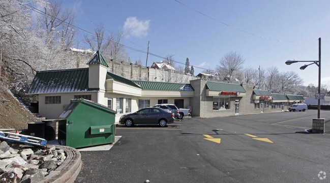
Property Record
10689 State Route 30, Irwin, PA 15642


NEARBY LISTINGS FOR SALE OR LEASE
Property Detail
10689 State Route 30
54-07-11-0-257
LOT BLDGS PT FIRE 286.99 X 135.84 X IR
Commercialofficeresidentialmixeduse
Westmoreland
X
Pennsylvania
42129C0378F
b
2025
0.90 AC
2025
Westmoreland County
803100
Pittsburgh
6,994 SF
Pittsburgh, PA
DEMOGRAPHICS near 10689 State Route 30
1 Mile
3 Mile
5 Mile
2024 Total Population
7,699
38,558
73,439
2029 Population
7,705
38,197
72,537
Pop Growth 2024-2029
+ 0.08%
(0.94%)
(1.23%)
Average Age
43
44
45
2024 Total Households
3,556
16,188
31,081
HH Growth 2024-2029
+ 0.34%
(0.84%)
(1.22%)
Median Household Inc
$60,910
$80,183
$77,061
Avg Household Size
2.10
2.30
2.30
2024 Avg HH Vehicles
2.00
2.00
2.00
Median Home Value
$175,630
$199,586
$195,574
Median Year Built
1960
1967
1966
Nearby Places
Map Layers
Map Styles
 Street
 Aerial
- Restaurants
- Banks
- Shops
- Fitness
- Groceries
PUBLIC TRANSPORTATION
AIRPORT
Arnold Palmer Regional
DRIVE
WALK
Distance
Arnold Palmer Regional
36 min
19.9 mi
Pittsburgh International
DRIVE
WALK
Distance
Pittsburgh International
58 min
36.2 mi
Freight Ports
Port of Baltimore
DRIVE
WALK
Distance
Port of Baltimore
263 min
225.6 mi
SALE & LEASE HISTORY
LISTING DATE
SALE/LEASE

Mar 23, 2022
For Lease
Mar 01, 2017
For Lease
Aug 08, 2019
For Lease
Nearby Properties
Address
Land Use
TOTAL SIZE
Lot Size
Zoning
Address
Land Use
TOTAL SIZE
Lot Size
Zoning
47.90 AC
Address
Land Use
TOTAL SIZE
Lot Size
Zoning
12,794 SF
22.60 AC
Address
Land Use
TOTAL SIZE
Lot Size
Zoning
49.80 AC
Address
Land Use
TOTAL SIZE
Lot Size
Zoning
13.80 AC
Address
Land Use
TOTAL SIZE
Lot Size
Zoning
124,512 SF
4.27 AC
Address
Land Use
TOTAL SIZE
Lot Size
Zoning
114,830 SF
12.92 AC
Address
Land Use
TOTAL SIZE
Lot Size
Zoning
122,158 SF
9.11 AC
Address
Land Use
TOTAL SIZE
Lot Size
Zoning
14.80 AC
Address
Land Use
TOTAL SIZE
Lot Size
Zoning
40,117 SF
3.90 AC
Address
Land Use
TOTAL SIZE
Lot Size
Zoning
0.96 AC
Address
Land Use
TOTAL SIZE
Lot Size
Zoning
19,852 SF
7.04 AC
Address
Land Use
TOTAL SIZE
Lot Size
Zoning
5.90 AC
Address
Land Use
TOTAL SIZE
Lot Size
Zoning
Address
Land Use
TOTAL SIZE
Lot Size
Zoning
22.92 AC
Address
Land Use
TOTAL SIZE
Lot Size
Zoning
87,654 SF
13.60 AC
Address
Land Use
TOTAL SIZE
Lot Size
Zoning
7.30 AC
Address
Land Use
TOTAL SIZE
Lot Size
Zoning
3.19 AC
Address
Land Use
TOTAL SIZE
Lot Size
Zoning
74,485 SF
5.72 AC
Address
Land Use
TOTAL SIZE
Lot Size
Zoning
3,306 SF
22.10 AC
Address
Land Use
TOTAL SIZE
Lot Size
Zoning
10.02 AC
Address
Land Use
TOTAL SIZE
Lot Size
Zoning
7.22 AC
Address
Land Use
TOTAL SIZE
Lot Size
Zoning
15.83 AC
Address
Land Use
TOTAL SIZE
Lot Size
Zoning
26.79 AC
Address
Land Use
TOTAL SIZE
Lot Size
Zoning
6.10 AC
Address
Land Use
TOTAL SIZE
Lot Size
Zoning
37,285 SF
2.38 AC
Address
Land Use
TOTAL SIZE
Lot Size
Zoning
38,828 SF
4.90 AC
Address
Land Use
TOTAL SIZE
Lot Size
Zoning
52,259 SF
31.50 AC
Address
Land Use
TOTAL SIZE
Lot Size
Zoning
4.30 AC
Address
Land Use
TOTAL SIZE
Lot Size
Zoning
28,774 SF
3.34 AC
Address
Land Use
TOTAL SIZE
Lot Size
Zoning
40,400 SF
7.46 AC
The World's #1 Commercial Real Estate Marketplace
Connect with us
© 2026 CoStar Group
The information above has been obtained from sources believed reliable. While we do not doubt its accuracy we have not verified it and make no guarantee, warranty or representation about it. It is your responsibility to independently confirm its accuracy and completeness. Any projections, opinions, assumptions, or estimates used are for example only and do not represent the current or future performance of the property. The value of this transaction to you depends on tax and other factors which should be evaluated by your tax, financial, and legal advisors. You and your advisors should conduct a careful, independent investigation of the property to determine to your satisfaction the suitability of the property for your needs.